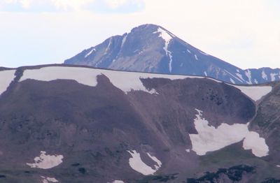
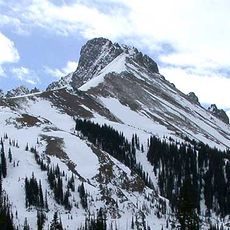
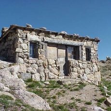
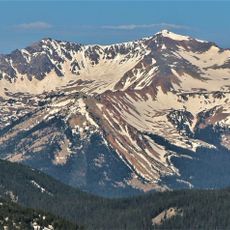
Mount Richthofen, Mountain summit in Rocky Mountain National Park, United States
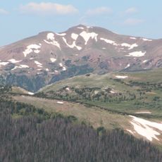
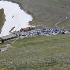
Mount Richthofen is a mountain in the Never Summer Mountains, part of the Rocky Mountains, standing at approximately 12,945 feet. The peak lies along the Continental Divide between Rocky Mountain National Park and Routt National Forest.
The mountain was named after German geologist Baron Ferdinand von Richthofen following exploration by Clarence King's survey team in 1870. William S. Cooper accomplished the first recorded ascent in 1908, initiating mountaineering activities in this section of Colorado.
William S. Cooper completed the first recorded climb of Mount Richthofen in 1908, marking the beginning of mountaineering activities in this section of Colorado.
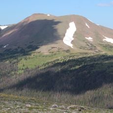
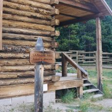
Access from Lake Agnes involves a Class 3 scramble across steep scree slopes that demands careful foot placement and climbing experience. The terrain is demanding and best suited for hikers comfortable with rock travel and exposure.
The peak stands at the boundary between Rocky Mountain National Park Wilderness and Routt National Forest, marking where three Colorado counties meet. This location makes it a geographically significant reference point in the region.
Location: Colorado
GPS coordinates: 40.46943,-105.89501
Latest update: December 11, 2025 11:06
Trail Ridge Road
9.4 km
Alpine Visitor Center
12.3 km
State Forest State Park
10.8 km
Milner Pass
9 km
Nokhu Crags
1.8 km
Mount Ida
14.6 km
Holzwarth Historic District
11.2 km
Specimen Mountain
7.8 km
Iron Mountain
5.5 kmBraddock Peak
1.9 km
Fall River Pump House and Catchment Basin
13 km
Willow Park Patrol Cabin
14.2 km
Timberline Cabin
13.2 km
Timber Creek Campground Comfort Stations
10.6 km
Fall River Pass Ranger Station
12.3 km
Willow Park Stable
14.3 km
Milner Pass Road Camp Mess Hall and House
8.9 km
Fleshut Cabin
11.4 km
Timber Creek Campground Comfort Station No. 247
10.8 km
Timber Creek Campground Comfort Station No. 245
10.7 km
Timber Creek Campground Comfort Station No. 246
10.7 km
Fall River Pass Historic District
12.3 km
Alpine Ridge Trail
12.5 km
La Poudre Pass Ranger Station
5.9 km
Gore Range Overlook
11.5 km
Timber Creek Campground
10.8 km
Alpine Visitor Center Viewpoint
12.4 km
Mount Stratus
8.9 kmVisited this place? Tap the stars to rate it and share your experience / photos with the community! Try now! You can cancel it anytime.
Discover hidden gems everywhere you go!
From secret cafés to breathtaking viewpoints, skip the crowded tourist spots and find places that match your style. Our app makes it easy with voice search, smart filtering, route optimization, and insider tips from travelers worldwide. Download now for the complete mobile experience.
A unique approach to discovering new places❞
— Le Figaro
All the places worth exploring❞
— France Info
A tailor-made excursion in just a few clicks❞
— 20 Minutes