Enable Location

We need your location to show you interesting places around you

Discover nearby places

Find interesting locations and hidden gems around you

Precise directions

Get accurate directions and distances to places

Your location is never shared with other users. It's only used when you tap the location button.

Log in to your account

Start exploring — it's free

Trusted by 61,629 travelers worldwide

Continue with Google
Continue with Apple
or

We will send you a code to connect

By continuing, you accept our Terms and Conditions and our Privacy Policy

Check your inbox

We've sent a pincode in your inbox. Please enter the code below.

Bear Creek Regional Park and Nature Center

Bear Creek Regional Park and Nature Center, Regional park and nature center in Colorado Springs, United States

Description

Bear Creek Regional Park spans about 845 acres with different habitats including scrub oak, ponderosa pine forests, meadows, and areas with mountain streams. The park has multiple facilities such as tennis courts, soccer fields, an archery range, and designated off-leash dog areas.

History

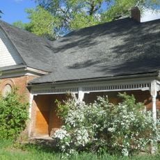
The site was a county poor farm from the late 1800s to the early 1980s, where residents grew food and lived in buildings on the grounds. This agricultural past left a mark on the land and continues to shape how the park is used today.

Culture

The nature center runs programs throughout the year where visitors can learn about the plants and animals that live in the park's different habitats. Staff members explain how local species adapt to the landscape and what role they play in the ecosystem.

Practical

The park is easy to reach and has trails for walking and hiking at different difficulty levels. Visitors should wear good shoes and be prepared for changing weather depending on the season.

Did you know?

A community garden on the grounds preserves a gardening tradition going back to 1900 and grows organic vegetables for local use. This garden connects the site's past as farmland with its present-day role in the community.

Location
GPS coordinates
38.82100,-104.86200
Latest update
December 12, 2025 07:53

AroundUs brings together thousands of curated places, local tips, and hidden gems, enriched daily by 60,000 contributors worldwide. Discover all places nearby (Colorado).

Around this place
Old Colorado City
United States of America

Old Colorado City

3 km
D&RGW 168
United States of America

D&RGW 168

3.3 km
Colorado Springs Pioneers Museum
United States of America

Colorado Springs Pioneers Museum

3.6 km
Pikes Peak Center
United States of America

Pikes Peak Center

3.2 km
Wells Fargo Tower
United States of America

Wells Fargo Tower

3.4 km
St. Mary's Cathedral
United States of America

St. Mary's Cathedral

3.5 km
United States of America

South Cheyenne Canon

3.5 km
Ghost Town Museum
United States of America

Ghost Town Museum

2.2 km
Midland Terminal Railroad Roundhouse
United States of America

Midland Terminal Railroad Roundhouse

2.1 km
Alamo Hotel
United States of America

Alamo Hotel

3.5 km
Pikes Peak or Bust Rodeo
United States of America

Pikes Peak or Bust Rodeo

1.1 km
McAllister House
United States of America

McAllister House

3.9 km
El Pomar Estate
United States of America

El Pomar Estate

3.7 km
FirstBank Building
United States of America

FirstBank Building

3.5 km
Colorado Springs Day Nursery
United States of America

Colorado Springs Day Nursery

3.4 km
Pauline Chapel
United States of America

Pauline Chapel

3.3 km
DeGraff Building
United States of America

DeGraff Building

3.7 km
Colorado Springs Public Library-Carnegie Building
United States of America

Colorado Springs Public Library-Carnegie Building

3.5 km
Old Colorado City Branch Carnegie Library
United States of America

Old Colorado City Branch Carnegie Library

3 km
Emmanuel Presbyterian Church
United States of America

Emmanuel Presbyterian Church

3.8 km
United States Olympic & Paralympic Museum
United States of America

United States Olympic & Paralympic Museum

3 km
Stockbridge House
United States of America

Stockbridge House

3.3 km
John Wolfe House
United States of America

John Wolfe House

2.9 km
YWCA Building
United States of America

YWCA Building

3.9 km
Maytag Aircraft Building
United States of America

Maytag Aircraft Building

3.2 km
Second Midland School
United States of America

Second Midland School

2.3 km
Giddings Building
United States of America

Giddings Building

2.9 km
City Hall of Old Colorado City
United States of America

City Hall of Old Colorado City

3.4 km
Show the full map
« Bear Creek Regional Park and Nature Center - Regional park and nature center in Colorado Springs, United States » is provided by Around Us (aroundus.com). Images and texts are derived from Wikimedia project under a Creative Commons license. You are allowed to copy, distribute, and modify copies of this page, under the conditions set by the license, as long as this note is clearly visible.

Discover hidden gems everywhere you go!

From secret cafés to breathtaking viewpoints, skip the crowded tourist spots and find places that match your style. Our app makes it easy with voice search, smart filtering, route optimization, and insider tips from travelers worldwide. Download now for the complete mobile experience.

Around Us App Screenshot

A unique approach to discovering new places

Le Figaro

All the places worth exploring

France Info

A tailor-made excursion in just a few clicks

20 Minutes

Around Us
Travel Guide & Maps
Download

Send to your phone

QR Code
1

Open the camera app on your mobile.

2

Point at the QR code with your camera. A notification will appear.

3

Tap the notification to open the link.