Chest opened
+${chestReward.xp} XP
Explorer
NOUVEAU ×${chestReward.collectible.quantity}
tapez pour fermer
Chest locked

Open chests in the app

Around Us is built for your phone — chests unlock when you walk, explore and capture nearby places.

Enable Location

We need your location to show you interesting places around you

Discover nearby places

Find interesting locations and hidden gems around you

Precise directions

Get accurate directions and distances to places

Your location is never shared with other users. It's only used when you tap the location button.

Log in to your account

Start exploring — it's free

Trusted by 72,878 travelers worldwide

Continue with Google
Continue with Apple
or

We will send you a code to connect

By continuing, you accept our Terms and Conditions and our Privacy Policy

Check your inbox

We've sent a pincode in your inbox. Please enter the code below.

Pikeview, Colorado
Discussion Reviews Photo
2.9k Popularity

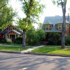
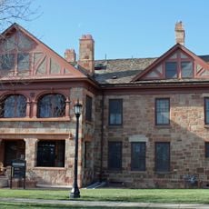
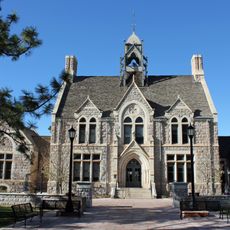
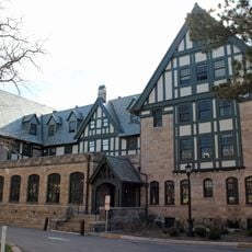
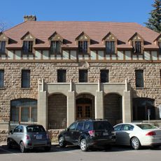
Pikeview, Colorado, Residential neighborhood in Colorado Springs, United States.

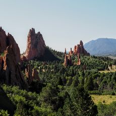
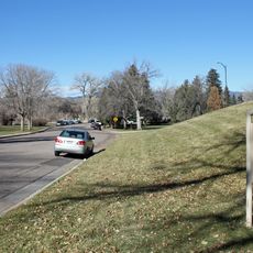
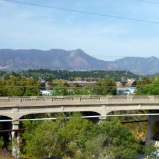
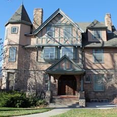
Pikeview is a residential neighborhood in northern Colorado Springs situated at the foot of mountains featuring limestone quarries. The area spans rolling terrain between Interstate 25 and Highway 24, forming a transition zone between urban development and mountain landscape.

The Denver and Rio Grande Western Railroad established a station in Pikeview in 1896, triggering coal mining operations that continued until 1957. This mining era shaped the area's early development and left lasting marks on the landscape.

The Greg Francis Bighorn Sheep Habitat, established in 2003, represents local efforts to transform former mining areas into natural wildlife spaces.

The neighborhood provides direct access to Interstate 25 and Highway 24 for quick trips to downtown and surrounding mountain attractions. Visitors should expect steep roads and changing elevations, especially when weather shifts in the mountain climate.

Limestone quarries operating since 1905 underwent extensive reclamation in the 1980s to restore the natural hillside landscape. This transformation demonstrates how an industrial site was converted back into functioning natural habitat.

The community of curious travelers

AroundUs brings together thousands of curated places, local tips, and hidden gems, enriched daily by 60,000 contributors worldwide.

Start exploring
Location
GPS coordinates
38.91527,-104.82220
Latest update
December 12, 2025 12:08
Around this place
Garden of the Gods
United States of America

Garden of the Gods

5.9 km
Focus on the Family
United States of America

Focus on the Family

6 km
Glen Eyrie
United States of America

Glen Eyrie

6 km
Flying W Ranch
United States of America

Flying W Ranch

4.4 km
Colorado Springs Fine Arts Center
United States of America

Colorado Springs Fine Arts Center

7.7 km
Monument Valley Park
United States of America

Monument Valley Park

7 km
Rock Ledge Ranch Historic Site
United States of America

Rock Ledge Ranch Historic Site

6.3 km
Old North End Historic District
United States of America

Old North End Historic District

6.4 km
Grace and St. Stephen's Episcopal Church
United States of America

Grace and St. Stephen's Episcopal Church

8 km
Edgeplain
United States of America

Edgeplain

7.3 km
Cutler Hall
United States of America

Cutler Hall

7.5 km
Lennox House
United States of America

Lennox House

7.5 km
Bemis Hall
United States of America

Bemis Hall

7.5 km
Fort Collins Municipal Railway No. 22
United States of America

Fort Collins Municipal Railway No. 22

5.4 km
Emmanuel Presbyterian Church
United States of America

Emmanuel Presbyterian Church

7.8 km
Stockbridge House
United States of America

Stockbridge House

8.2 km
Hagerman Mansion
United States of America

Hagerman Mansion

8 km
Palmer Hall
United States of America

Palmer Hall

7.4 km
Montgomery Hall, Colorado College
United States of America

Montgomery Hall, Colorado College

7.4 km
Shove Memorial Chapel
United States of America

Shove Memorial Chapel

7.5 km
City Hall of Old Colorado City
United States of America

City Hall of Old Colorado City

8.2 km
Burgess House
United States of America

Burgess House

7.8 km
Cottonwood Creek Bridge
United States of America

Cottonwood Creek Bridge

1.8 km
Frederick H. Cossitt Memorial Hall
United States of America

Frederick H. Cossitt Memorial Hall

7.6 km
Ida M. Rice House
United States of America

Ida M. Rice House

7.2 km
Lindley-Johnson-Vanderhoof House
United States of America

Lindley-Johnson-Vanderhoof House

7.2 km
Gwynne–Love House
United States of America

Gwynne–Love House

7.8 km
Ticknor Hall
United States of America

Ticknor Hall

7.4 km
Show the full map
Reviews
Share your experience

No review yet

Discussions
Start a discussion...

No discussion yet

« Pikeview, Colorado - Residential neighborhood in Colorado Springs, United States » is provided by Around Us (aroundus.com). Images and texts are derived from Wikimedia project under a Creative Commons license. You are allowed to copy, distribute, and modify copies of this page, under the conditions set by the license, as long as this note is clearly visible.

Discover hidden gems everywhere you go!

From secret cafés to breathtaking viewpoints, skip the crowded tourist spots and find places that match your style. Our app makes it easy with voice search, smart filtering, route optimization, and insider tips from travelers worldwide. Download now for the complete mobile experience.

Around Us App Screenshot

A unique approach to discovering new places

Le Figaro

All the places worth exploring

France Info

A tailor-made excursion in just a few clicks

20 Minutes

Around Us
Travel Guide & Maps
Download

Send to your phone

QR Code
1

Open the camera app on your mobile.

2

Point at the QR code with your camera. A notification will appear.

3

Tap the notification to open the link.