Chest opened
+${chestReward.xp} XP
Explorer
NOUVEAU ×${chestReward.collectible.quantity}
tapez pour fermer
Chest locked

Open chests in the app

Around Us is built for your phone — chests unlock when you walk, explore and capture nearby places.

Enable Location

We need your location to show you interesting places around you

Discover nearby places

Find interesting locations and hidden gems around you

Precise directions

Get accurate directions and distances to places

Your location is never shared with other users. It's only used when you tap the location button.

Log in to your account

Start exploring — it's free

Trusted by 72,888 travelers worldwide

Continue with Google
Continue with Apple
or

We will send you a code to connect

By continuing, you accept our Terms and Conditions and our Privacy Policy

Check your inbox

We've sent a pincode in your inbox. Please enter the code below.

Carter Lake Dam
Discussion Reviews Photo
2.2k Popularity

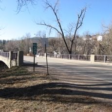
Carter Lake Dam, Embankment dam in Larimer County, Colorado, US

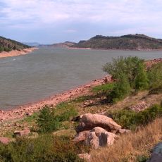
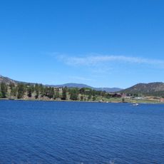
Carter Lake Dam is a major embankment dam in Colorado that creates a large reservoir for water storage across the landscape. The facility manages water for irrigation purposes and enables recreational activities such as fishing and boating in the area.

Planning and construction of this embankment dam began in the 1950s as part of regional water management initiatives. The dam was completed and has since supported water security and agricultural development across Colorado communities.

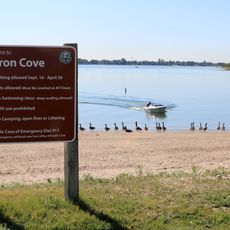
The dam holds significance for local communities as a centerpiece of water management in the Rocky Mountains region. Visitors and residents use the area for fishing and boating, making it a gathering place for outdoor recreation.

Visitors can explore the area on foot and will find multiple access points to the water and dam. The best time to visit depends on weather conditions, as the region sees peak activity during summer months.

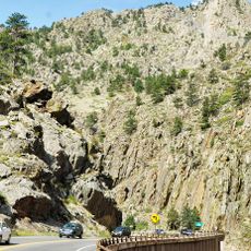
The dam is part of a larger water project that diverts water between different river valleys. This engineering accomplishment allows water to be transported to where it is needed for farming and communities.

The community of curious travelers

AroundUs brings together thousands of curated places, local tips, and hidden gems, enriched daily by 60,000 contributors worldwide.

Start exploring
Location
GPS coordinates
40.32550,-105.21200
Latest update
December 13, 2025 17:06
Around this place
Horsetooth Reservoir
United States of America

Horsetooth Reservoir

25.9 km
Boyd Lake State Park
United States of America

Boyd Lake State Park

19 km
Lake Estes
United States of America

Lake Estes

24.1 km
United States of America

Left Hand Canyon

25.2 km
Rialto Theater
United States of America

Rialto Theater

14.1 km
Chipper's Lanes
United States of America

Chipper's Lanes

26.1 km
Longmont Museum & Cultural Center
United States of America

Longmont Museum & Cultural Center

22.2 km
United Church of Christ of Highlandlake
United States of America

United Church of Christ of Highlandlake

18.9 km
St. Stephen's Episcopal Church
United States of America

St. Stephen's Episcopal Church

19.9 km
Downtown Loveland Historic District
United States of America

Downtown Loveland Historic District

14.1 km
First United Presbyterian Church
United States of America

First United Presbyterian Church

14.3 km
St. Vrain Church of the Brethren
United States of America

St. Vrain Church of the Brethren

15.6 km
Longmont College
United States of America

Longmont College

20 km
William H. McCreery House
United States of America

William H. McCreery House

14.6 km
Centennial Lanes
United States of America

Centennial Lanes

19.6 km
Little Thompson River Bridge
United States of America

Little Thompson River Bridge

19.9 km
Anderson Barn
United States of America

Anderson Barn

21.8 km
Downtown Longmont Historic District
United States of America

Downtown Longmont Historic District

20.1 km
Hoverhome and Hover Farmstead
United States of America

Hoverhome and Hover Farmstead

17.4 km
Devil's Backbone Open Space
United States of America

Devil's Backbone Open Space

10.8 km
Maude Stanfield Harter Borland House
United States of America

Maude Stanfield Harter Borland House

14.4 km
Henry K. and Mary E. Shaffer House
United States of America

Henry K. and Mary E. Shaffer House

14.4 km
Loveland Museum
United States of America

Loveland Museum

14.2 km
North St. Vrain Creek Bridge
United States of America

North St. Vrain Creek Bridge

12.5 km
Estes Park Museum
United States of America

Estes Park Museum

25.4 km
Big Thompson Canyon
United States of America

Big Thompson Canyon

22.7 km
Sonic
United States of America

Sonic

16.8 km
Sonic
United States of America

Sonic

16.6 km
Show the full map
Reviews
Share your experience

No review yet

Discussions
Start a discussion...

No discussion yet

« Carter Lake Dam - Embankment dam in Larimer County, Colorado, US » is provided by Around Us (aroundus.com). Images and texts are derived from Wikimedia project under a Creative Commons license. You are allowed to copy, distribute, and modify copies of this page, under the conditions set by the license, as long as this note is clearly visible.

Discover hidden gems everywhere you go!

From secret cafés to breathtaking viewpoints, skip the crowded tourist spots and find places that match your style. Our app makes it easy with voice search, smart filtering, route optimization, and insider tips from travelers worldwide. Download now for the complete mobile experience.

Around Us App Screenshot

A unique approach to discovering new places

Le Figaro

All the places worth exploring

France Info

A tailor-made excursion in just a few clicks

20 Minutes

Around Us
Travel Guide & Maps
Download

Send to your phone

QR Code
1

Open the camera app on your mobile.

2

Point at the QR code with your camera. A notification will appear.

3

Tap the notification to open the link.