Malheur National Wildlife Refuge
Malheur National Wildlife Refuge, National Wildlife Refuge in Harney County, Oregon.
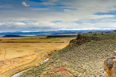
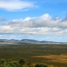
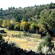
Malheur National Wildlife Refuge is a protected area in Oregon's high country that includes shallow lakes, wetlands, and dry plains. Water surfaces alternate with scrubland and low vegetation that stretches across gently rolling terrain under a wide sky.
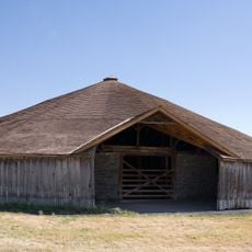
The government set aside the area in the early 20th century in response to intense bird hunting that had depleted many species. Later decades saw the construction of channels and dikes to maintain and shape habitats for migratory birds.
The name comes from the French word for misfortune and recalls early trappers who struggled in the harsh landscape. Locals watch birds along the water channels and use the gravel roads that run through open grassland, offering wide views.
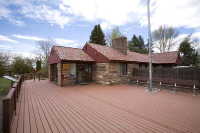
A visit works best in spring or fall when migratory birds populate the water surfaces. The center south of Burns offers maps and current sighting notes that help with orientation on the sprawling routes.
The area sits in a basin with no natural outlet, so water evaporates or seeps away rather than flowing to the sea. This closed hydrology creates shifting water levels that change the extent of wetlands from year to year.
Location: Harney County
Inception: August 18, 1908
Operator: United States Fish and Wildlife Service
Website: http://fws.gov/malheur
GPS coordinates: 43.26580,-118.84400
Latest update: December 5, 2025 22:23
Paisley Caves
149.9 km
Harney Basin
10.5 km
Fossil Lake
133.6 km
Lost Forest Research Natural Area
121 km
Hart Mountain National Antelope Refuge
103.7 km
Steens Mountain Wilderness
67.1 km
Strawberry Mountain Wilderness
115.5 km
Pete French Round Barn
22.1 km
Mickey Hot Springs
77.1 km
Abert Rim
149.8 km
David L. Shirk Ranch
127 km
Sod House Ranch
2.6 km
Frenchglen Hotel State Heritage Site
49.2 km
Greaser Petroglyph Site
144.1 km
P Ranch
48.9 km
Camp Warner
117.8 km
Chandler State Wayside
151.9 km
Riddle Ranch
30.3 km
Stone Bridge and the Oregon Central Military Wagon Road
130 km
Double-O Ranch Historic District
37.8 km
Chickahominy Reservoir
69.6 km
Deep Creek Falls
151.5 km
Allison Ranger Station
94.5 km
Sheep Ranch Fortified House
112.3 km
Desert Theatre
39.6 km
Owyhee Canyon
99 km
BLM Field Camp
128.2 km
BLM Field Camp
102.6 kmVisited this place? Tap the stars to rate it and share your experience / photos with the community! Try now! You can cancel it anytime.
Discover hidden gems everywhere you go!
From secret cafés to breathtaking viewpoints, skip the crowded tourist spots and find places that match your style. Our app makes it easy with voice search, smart filtering, route optimization, and insider tips from travelers worldwide. Download now for the complete mobile experience.
A unique approach to discovering new places❞
— Le Figaro
All the places worth exploring❞
— France Info
A tailor-made excursion in just a few clicks❞
— 20 Minutes