Enable Location

We need your location to show you interesting places around you

Discover nearby places

Find interesting locations and hidden gems around you

Precise directions

Get accurate directions and distances to places

Your location is never shared with other users. It's only used when you tap the location button.

Riddle Ranch

Log in to your account

Start exploring — it's free

Trusted by 61,910 travelers worldwide

Continue with Google
Continue with Apple
or

We will send you a code to connect

By continuing, you accept our Terms and Conditions and our Privacy Policy

Check your inbox

We've sent a pincode in your inbox. Please enter the code below.

Riddle Ranch, Pioneer ranch complex in Harney County, Oregon, United States

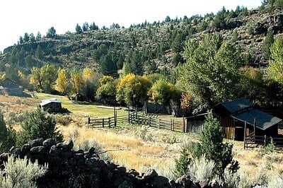
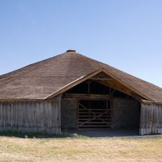
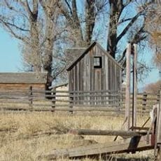
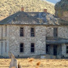
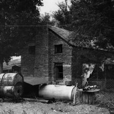
Riddle Ranch is a ranch complex of eight historical buildings constructed from logs, weatherboard, hand-cut shingles, and stone situated along the Little Blitzen River. The site preserves the original arrangement of residential buildings, barns, and working structures needed for daily cattle ranching operations.

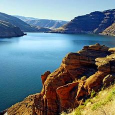
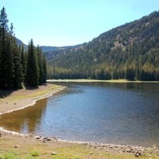
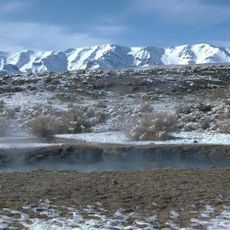
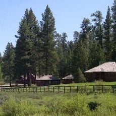
The Riddle brothers arrived in the area around 1900 and established their homes along the Little Blitzen River, building a cattle operation from the ground up. The ranch operated with managed water systems and irrigated pastures for decades until activities ceased in the late 1950s.

The site shows how ranchers in the American West lived and worked, with preserved tools and furnishings in the buildings that reflect their daily routines. Visitors see handcrafted details like hand-cut shingles and stone walls that reveal the practical skills of those who built and maintained this place.

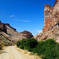
Access is permitted only Wednesday through Sunday between June and October, and visitors need a high-clearance four-wheel-drive vehicle to reach the site. Plan for unpaved roads and weather conditions that may limit or restrict your visit during the season.

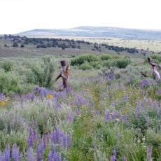
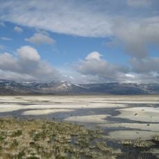
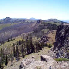
The site shows a rare example of water management on an early American ranch, with visible canals and irrigated fields that remain traceable today. This infrastructure was essential for the ranch to thrive in a dry mountain region.

The community of curious travelers

AroundUs brings together thousands of curated places, local tips, and hidden gems, enriched daily by 60,000 contributors worldwide.

Start exploring
Location
Architectural style
rustic architecture
GPS coordinates
43.07460,-118.57900
Latest update
December 13, 2025 12:23
Around this place
Malheur National Wildlife Refuge
United States of America

Malheur National Wildlife Refuge

30.3 km
Harney Basin
United States of America

Harney Basin

22.8 km
Jump Creek Falls
United States of America

Jump Creek Falls

141.3 km
Owyhee Reservoir
United States of America

Owyhee Reservoir

109.4 km
Hart Mountain National Antelope Refuge
United States of America

Hart Mountain National Antelope Refuge

105.6 km
Steens Mountain Wilderness
United States of America

Steens Mountain Wilderness

47.5 km
Strawberry Mountain Wilderness
United States of America

Strawberry Mountain Wilderness

137.8 km
Pete French Round Barn
United States of America

Pete French Round Barn

8.3 km
Northern Basin and Range ecoregion
United States of America

Northern Basin and Range ecoregion

128.7 km
Mickey Hot Springs
United States of America

Mickey Hot Springs

48.2 km
Lake Owyhee State Park
United States of America

Lake Owyhee State Park

124.4 km
David L. Shirk Ranch
United States of America

David L. Shirk Ranch

120.8 km
Sod House Ranch
United States of America

Sod House Ranch

31.1 km
Frenchglen Hotel State Heritage Site
United States of America

Frenchglen Hotel State Heritage Site

38.8 km
Greaser Petroglyph Site
United States of America

Greaser Petroglyph Site

141.4 km
P Ranch
United States of America

P Ranch

37.2 km
Camp Warner
United States of America

Camp Warner

118.3 km
Monument Rock Wilderness
United States of America

Monument Rock Wilderness

139.3 km
Succor Creek State Natural Area
United States of America

Succor Creek State Natural Area

125 km
Stone Bridge and the Oregon Central Military Wagon Road
United States of America

Stone Bridge and the Oregon Central Military Wagon Road

130.5 km
Double-O Ranch Historic District
United States of America

Double-O Ranch Historic District

63.5 km
Chickahominy Reservoir
United States of America

Chickahominy Reservoir

98.8 km
Moses and Mary Hart Stone House and Ranch Complex
United States of America

Moses and Mary Hart Stone House and Ranch Complex

122.4 km
Allison Ranger Station
United States of America

Allison Ranger Station

124.6 km
Sheep Ranch Fortified House
United States of America

Sheep Ranch Fortified House

85.9 km
Desert Theatre
United States of America

Desert Theatre

68.8 km
Owyhee Canyon
United States of America

Owyhee Canyon

78.8 km
BLM Field Camp
United States of America

BLM Field Camp

116.7 km
Show the full map
« Riddle Ranch - Pioneer ranch complex in Harney County, Oregon, United States » is provided by Around Us (aroundus.com). Images and texts are derived from Wikimedia project under a Creative Commons license. You are allowed to copy, distribute, and modify copies of this page, under the conditions set by the license, as long as this note is clearly visible.

Discover hidden gems everywhere you go!

From secret cafés to breathtaking viewpoints, skip the crowded tourist spots and find places that match your style. Our app makes it easy with voice search, smart filtering, route optimization, and insider tips from travelers worldwide. Download now for the complete mobile experience.

Around Us App Screenshot

A unique approach to discovering new places

Le Figaro

All the places worth exploring

France Info

A tailor-made excursion in just a few clicks

20 Minutes

Around Us
Travel Guide & Maps
Download

Send to your phone

QR Code
1

Open the camera app on your mobile.

2

Point at the QR code with your camera. A notification will appear.

3

Tap the notification to open the link.