Owyhee Canyon

Log in to your account

AroundUs is a community-driven map of interesting places, built by curious explorers like you. It grows with every review, story, and photo you share.
Connect to save your favorite spots, contribute locations, and create personalized routes.
By continuing, you accept our Terms and Conditions and our Privacy Policy
Add to collection
Map
Suggest a change
Share

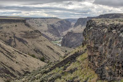
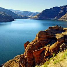
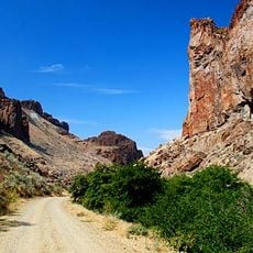
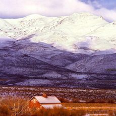
Owyhee Canyon, Protected canyon in Malheur County and Owyhee County, United States.

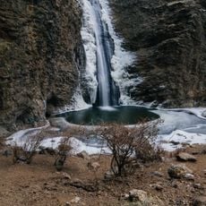
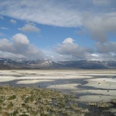
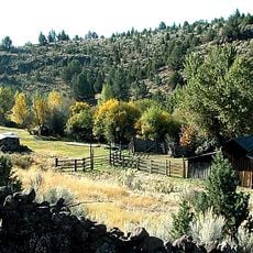
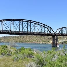
Owyhee Canyon is a deep gorge carved by multiple river systems that create steep rock walls and narrow passages throughout the terrain. The main river and its tributaries flow through this rugged landscape, forming a complex network of waterways and geological formations.

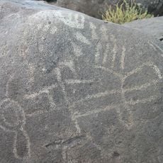
The canyon received its name from Hawaiian fur traders who explored this remote region during the early 1800s. This early interaction left a lasting mark on the geography and remains a distinctive part of the area's origin story.

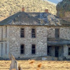
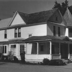
Native American peoples, particularly Shoshone and Paiute tribes, inhabited these canyon walls for centuries and shaped the landscape through their daily activities and resource use. Walking through the area, you can still sense the deep connection these communities had with this remote terrain.

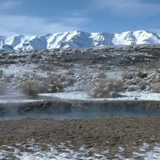
The area is extremely remote with few services available, so bring plenty of water and prepare your vehicle with spare tires and supplies before entering. Plan to be self-sufficient throughout your visit to this isolated landscape.

This remote location remains relatively unknown to many travelers, yet it contains an intricate web of interconnected waterways where multiple rivers and their branches flow through the same gorge system. This hidden complexity beneath the surface attracts visitors seeking genuine wilderness and solitude.

Location: Malheur County

Location: Owyhee County

Elevation above the sea: 2,884 ft

GPS coordinates: 43.20349,-117.62572

Latest update: December 6, 2025 19:08

Natural and historical sites across Oregon

Oregon offers a notable diversity of geological formations and natural landscapes ranging from the Pacific coastline to the volcanic plateaus of the eastern portion of the state. The Cascade Range dominates western Oregon with dense forests, waterfalls, and thermal springs, while the dry east features desert areas, deep canyons, and extinct volcanic cones. The rugged coastline extends for 363 miles (584 km) and displays rock arches, historic lighthouses, and protected coastal sections. The region's geological history includes volcanic activity, lava flows, and rock layers dating back millions of years. The collection includes natural hot springs such as Bagby Hot Springs, waterfalls like Abiqua Falls and Toketee Falls, and volcanic areas including Newberry National Volcanic Monument and Fort Rock. Coastal sites range from Cape Meares Lighthouse to Samuel H. Boardman State Scenic Corridor, while the interior presents locations such as the Painted Hills, the Alvord Desert, and the Owyhee Canyonlands. Lost Lake provides views of Mount Hood, Waldo Lake is known for its clarity, and Wizard Island rises from Crater Lake. The Steens Mountain Wilderness reaches elevations exceeding 9,000 feet (2,743 m), and Hells Canyon forms one of the deepest gorges in North America. These sites represent the geological processes and natural systems that have shaped Oregon across geological time.

Around this place
Show the full map
Fort Boise
United States of America

Fort Boise

84.6 km
Harney Basin
United States of America

Harney Basin

88.5 km
Jump Creek Falls
United States of America

Jump Creek Falls

64.4 km
Owyhee Reservoir
United States of America

Owyhee Reservoir

37 km
Deer Flat National Wildlife Refuge
United States of America

Deer Flat National Wildlife Refuge

86.6 km
Pete French Round Barn
United States of America

Pete French Round Barn

82.9 km
Northern Basin and Range ecoregion
United States of America

Northern Basin and Range ecoregion

55.7 km
Mickey Hot Springs
United States of America

Mickey Hot Springs

83 km
Lake Owyhee State Park
United States of America

Lake Owyhee State Park

56 km
Succor Creek State Natural Area
United States of America

Succor Creek State Natural Area

49.4 km
Riddle Ranch
United States of America

Riddle Ranch

78.8 km
Moses and Mary Hart Stone House and Ranch Complex
United States of America

Moses and Mary Hart Stone House and Ranch Complex

86.9 km
Map Rock Petroglyphs Historic District
United States of America

Map Rock Petroglyphs Historic District

78.5 km
Al Thompson and Son's Feed and Seed Company
United States of America

Al Thompson and Son's Feed and Seed Company

90.5 km
George Obendorf Gothic Arch Truss Barn
United States of America

George Obendorf Gothic Arch Truss Barn

80.8 km
Sheep Ranch Fortified House
United States of America

Sheep Ranch Fortified House

32.3 km
St. Mary's Catholic Church
United States of America

St. Mary's Catholic Church

91.3 km
Owyhee County Courthouse
United States of America

Owyhee County Courthouse

87.3 km
Henry W. and Ida Frost Dorman House
United States of America

Henry W. and Ida Frost Dorman House

90.4 km
Caldwell Carnegie Library
United States of America

Caldwell Carnegie Library

91.6 km
F. F. Beale House
United States of America

F. F. Beale House

91.7 km
John C. Rice House
United States of America

John C. Rice House

91.6 km
Guffey Butte–Black Butte Archaeological District
United States of America

Guffey Butte–Black Butte Archaeological District

90.1 km
Vinsonhaler Blacksmith Shop
United States of America

Vinsonhaler Blacksmith Shop

90.6 km
Noble Horse Barn
United States of America

Noble Horse Barn

70.8 km
Silver City Historic District
United States of America

Silver City Historic District

75.5 km
Guffey Railroad Bridge
United States of America

Guffey Railroad Bridge

89.5 km
Old Walters Ferry Bridge
United States of America

Old Walters Ferry Bridge

84.4 km
Show the full map

Reviews

Visited this place? Tap the stars to rate it and share your experience / photos with the community! Try now! You can cancel it anytime.

« Owyhee Canyon - Protected canyon in Malheur County and Owyhee County, United States » is provided by Around Us (aroundus.com). Images and texts are derived from Wikimedia project under a Creative Commons license. You are allowed to copy, distribute, and modify copies of this page, under the conditions set by the license, as long as this note is clearly visible.

Discover hidden gems everywhere you go!

From secret cafés to breathtaking viewpoints, skip the crowded tourist spots and find places that match your style. Our app makes it easy with voice search, smart filtering, route optimization, and insider tips from travelers worldwide. Download now for the complete mobile experience.

Around Us App Screenshot

A unique approach to discovering new places

Le Figaro

All the places worth exploring

France Info

A tailor-made excursion in just a few clicks

20 Minutes