Succor Creek State Natural Area

Log in to your account

AroundUs is a community-driven map of interesting places, built by curious explorers like you. It grows with every review, story, and photo you share.
Connect to save your favorite spots, contribute locations, and create personalized routes.
Continue with Google
Continue with Apple
Continue with X
Continue with Facebook
Continue with email
By continuing, you accept our Terms and Conditions and our Privacy Policy
Create an account

Succor Creek State Natural Area

Add to collection
Map
Suggest a change
Share

Succor Creek State Natural Area, Natural area in Malheur County, Oregon, United States.

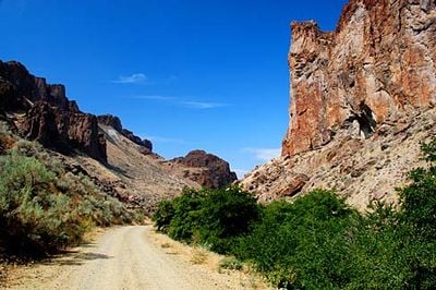
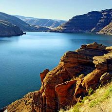
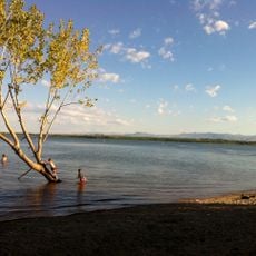
Succor Creek State Natural Area is a protected natural area featuring a deep canyon carved through volcanic rock formations. The landscape reveals layers of geology shaped over time, with the creek flowing through a dramatic ravine bordered by steep canyon walls.

The land entered protected status in the 1960s through a combination of government acquisition and private land purchases. These actions secured the area's natural and geological features for long-term preservation.

The name derives from the Spanish word socorro, as early Snake River Basin travelers found essential freshwater resources in this location.

Access to the area is by unpaved road that connects different sections of the canyon and surrounding terrain. Basic camping facilities are available on both sides of the creek for visitors with vehicles.

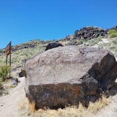
The area contains fossils and thundereggs, which are Oregon's official state rock. These geological specimens attract visitors interested in collecting and studying natural stone formations.

Location: Malheur County

Website: https://stateparks.oregon.gov/index.cfm?do=park.profile&parkId=9

GPS coordinates: 43.46650,-117.13400

Latest update: December 13, 2025 11:40

Photos
Around this place
Fort Boise
United States of America

Fort Boise

40.8 km
Jump Creek Falls
United States of America

Jump Creek Falls

16.9 km
Owyhee Reservoir
United States of America

Owyhee Reservoir

16.5 km
Deer Flat National Wildlife Refuge
United States of America

Deer Flat National Wildlife Refuge

38.8 km
Lake Owyhee State Park
United States of America

Lake Owyhee State Park

19 km
Simplot Stadium
United States of America

Simplot Stadium

42.8 km
Map Rock Petroglyphs Historic District
United States of America

Map Rock Petroglyphs Historic District

35.1 km
Boise River and Canal Bridge
United States of America

Boise River and Canal Bridge

43.7 km
Nampa Historic District
United States of America

Nampa Historic District

48.1 km
Caldwell Historic District
United States of America

Caldwell Historic District

42.3 km
Farmers and Merchants Bank
United States of America

Farmers and Merchants Bank

48 km
Al Thompson and Son's Feed and Seed Company
United States of America

Al Thompson and Son's Feed and Seed Company

46.9 km
A. K. Steunenberg House
United States of America

A. K. Steunenberg House

42.8 km
George Obendorf Gothic Arch Truss Barn
United States of America

George Obendorf Gothic Arch Truss Barn

33 km
St. Mary's Catholic Church
United States of America

St. Mary's Catholic Church

42 km
Blatchley Hall
United States of America

Blatchley Hall

42.5 km
Henry W. and Ida Frost Dorman House
United States of America

Henry W. and Ida Frost Dorman House

41.1 km
Caldwell Carnegie Library
United States of America

Caldwell Carnegie Library

42.2 km
F. F. Beale House
United States of America

F. F. Beale House

42.4 km
Nampa Presbyterian Church
United States of America

Nampa Presbyterian Church

48.1 km
Jacob P. Lockman House
United States of America

Jacob P. Lockman House

48.1 km
John C. Rice House
United States of America

John C. Rice House

42.3 km
Thomas K. Little House
United States of America

Thomas K. Little House

42.7 km
H. Orton Wiley House
United States of America

H. Orton Wiley House

47.1 km
Sterry Hall
United States of America

Sterry Hall

42.4 km
Vinsonhaler Blacksmith Shop
United States of America

Vinsonhaler Blacksmith Shop

47 km
Noble Horse Barn
United States of America

Noble Horse Barn

41.4 km
Nampa Train Depot
United States of America

Nampa Train Depot

48.1 km
Show the full map
Reviews

Visited this place? Tap the stars to rate it and share your experience / photos with the community! Try now! You can cancel it anytime.

« Succor Creek State Natural Area - Natural area in Malheur County, Oregon, United States » is provided by Around Us (aroundus.com). Images and texts are derived from Wikimedia project under a Creative Commons license. You are allowed to copy, distribute, and modify copies of this page, under the conditions set by the license, as long as this note is clearly visible.

Discover hidden gems everywhere you go!

From secret cafés to breathtaking viewpoints, skip the crowded tourist spots and find places that match your style. Our app makes it easy with voice search, smart filtering, route optimization, and insider tips from travelers worldwide. Download now for the complete mobile experience.

Around Us App Screenshot

A unique approach to discovering new places

Le Figaro

All the places worth exploring

France Info

A tailor-made excursion in just a few clicks

20 Minutes