Owyhee County

Log in to your account

AroundUs is a community-driven map of interesting places, built by curious explorers like you. It grows with every review, story, and photo you share.
Connect to save your favorite spots, contribute locations, and create personalized routes.
Continue with Google
Continue with Apple
Continue with X
Continue with Facebook
Continue with email
By continuing, you accept our Terms and Conditions and our Privacy Policy
Create an account
Add to collection
Map
Suggest a change
Share

Owyhee County, Administrative county in southwestern Idaho, United States

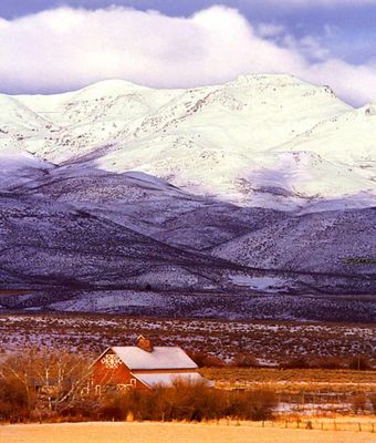
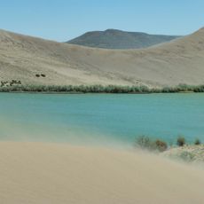
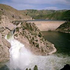
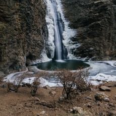
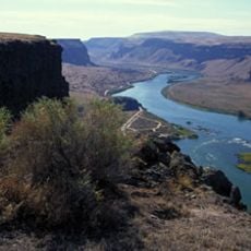
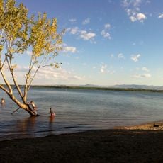
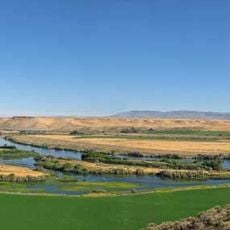
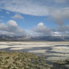
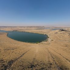
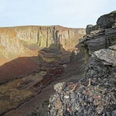
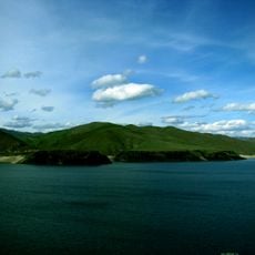
Owyhee County is an administrative region in southwestern Idaho that spans diverse terrain including mountains, desert areas, and deep river canyons. The landscape combines different geographic features with plateaus and rugged formations that shape how the county is physically organized.

The county was established in 1863 as the first county under Idaho Territory Legislature, officially organizing the region. Over time, the county seat moved from Ruby City to Silver City and eventually to Murphy, reflecting shifts in settlement patterns.

Western Shoshone, Northern Paiute, and Bannock peoples made this land their home for generations, and their presence still shows in place names and local stories today. When you travel through the river valleys and mountain passes, you can sense the deep connection these communities had with the landscape.

The region is connected by a network of highways to neighboring areas, making travel and navigation straightforward. Visitors should know that some parts are remote, so planning ahead is important if you want to explore outdoor areas like canyons and hiking trails.

The name comes from early Hawaiian fur trappers who explored this region during 19th-century trading expeditions. This surprising connection between the distant Pacific and this isolated mountain land remains embedded in the county's identity.

Location: Idaho

Inception: December 31, 1863

Capital city: Murphy

Shares border with: Canyon County, Ada County, Elmore County, Twin Falls County, Elko County, Humboldt County, Malheur County

Website: http://owyheecounty.net

GPS coordinates: 42.56000,-116.17000

Latest update: December 22, 2025 23:01

Photos
Around this place
Albertsons Stadium
United States of America

Albertsons Stadium

116.1 km
Idaho State Capitol
United States of America

Idaho State Capitol

117.8 km
Old Idaho State Penitentiary
United States of America

Old Idaho State Penitentiary

116.1 km
Bruneau Dunes State Park
United States of America

Bruneau Dunes State Park

54.9 km
Idaho Center
United States of America

Idaho Center

119.9 km
United States of America

Boise greenbelt

117.2 km
The Egyptian Theatre
United States of America

The Egyptian Theatre

117.5 km
United States of America

State of Idaho Executive Residence

121.6 km
Julia Davis Park
United States of America

Julia Davis Park

116.6 km
Arrowrock Dam
United States of America

Arrowrock Dam

117 km
Zions Bank Idaho Headquarters
United States of America

Zions Bank Idaho Headquarters

117.6 km
Jump Creek Falls
United States of America

Jump Creek Falls

119.2 km
Anne Frank Human Rights Memorial
United States of America

Anne Frank Human Rights Memorial

116.9 km
Meridian Idaho Temple
United States of America

Meridian Idaho Temple

125.3 km
Morley Nelson Snake River Birds of Prey National Conservation Area
United States of America

Morley Nelson Snake River Birds of Prey National Conservation Area

80.6 km
Deer Flat National Wildlife Refuge
United States of America

Deer Flat National Wildlife Refuge

117.4 km
Wahooz
United States of America

Wahooz

116.5 km
Three Island Crossing State Park
United States of America

Three Island Crossing State Park

81.5 km
Northern Basin and Range ecoregion
United States of America

Northern Basin and Range ecoregion

83.7 km
Roaring Springs Waterpark
United States of America

Roaring Springs Waterpark

116.4 km
Cathedral of St. John the Evangelist
United States of America

Cathedral of St. John the Evangelist

118.2 km
Boise Art Museum
United States of America

Boise Art Museum

116.9 km
United States of America

C. J. Strike Reservoir

46.5 km
Lucky Peak State Park
United States of America

Lucky Peak State Park

108.7 km
Owyhee River Wilderness
United States of America

Owyhee River Wilderness

43.2 km
Ahavath Beth Israel
United States of America

Ahavath Beth Israel

116.5 km
Lucky Peak Lake
United States of America

Lucky Peak Lake

108 km
United States of America

Hillcrest Country Club (Boise, Idaho)

114 km
Show the full map
Reviews

Visited this place? Tap the stars to rate it and share your experience / photos with the community! Try now! You can cancel it anytime.

Administrative divisions
« Owyhee County - Administrative county in southwestern Idaho, United States » is provided by Around Us (aroundus.com). Images and texts are derived from Wikimedia project under a Creative Commons license. You are allowed to copy, distribute, and modify copies of this page, under the conditions set by the license, as long as this note is clearly visible.

Discover hidden gems everywhere you go!

From secret cafés to breathtaking viewpoints, skip the crowded tourist spots and find places that match your style. Our app makes it easy with voice search, smart filtering, route optimization, and insider tips from travelers worldwide. Download now for the complete mobile experience.

Around Us App Screenshot

A unique approach to discovering new places

Le Figaro

All the places worth exploring

France Info

A tailor-made excursion in just a few clicks

20 Minutes