Enable Location

We need your location to show you interesting places around you

Discover nearby places

Find interesting locations and hidden gems around you

Precise directions

Get accurate directions and distances to places

Your location is never shared with other users. It's only used when you tap the location button.

Morley Nelson Snake River Birds of Prey National Conservation Area

Log in to your account

Start exploring — it's free

Trusted by 61,516 travelers worldwide

Continue with Google
Continue with Apple
or

We will send you a code to connect

By continuing, you accept our Terms and Conditions and our Privacy Policy

Check your inbox

We've sent a pincode in your inbox. Please enter the code below.

Morley Nelson Snake River Birds of Prey National Conservation Area

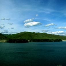
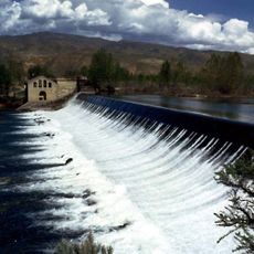
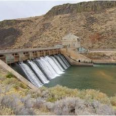
Morley Nelson Snake River Birds of Prey National Conservation Area, Nature reserve along Snake River Canyon, Idaho.

Description

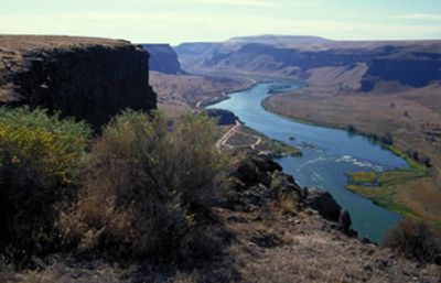
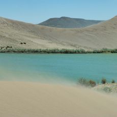
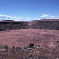
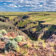
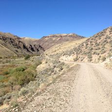
The Morley Nelson Snake River Birds of Prey National Conservation Area spans 485,000 acres of desert terrain with cliff walls rising up to 700 feet above the Snake River. These rock faces provide natural nesting sites as birds use the crevices and ledges carved into the canyon.

History

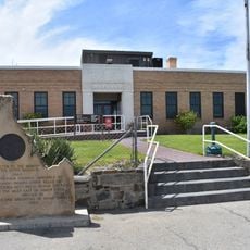
The canyon drew raptors for centuries, but scientific attention began in the 1970s when researchers documented its dense bird populations. Congress designated the area as a National Conservation Area in 1993, formally protecting what decades of study had shown to be one of North America's most important raptor habitats.

Culture

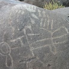
Petroglyphs in this area show human presence dating back thousands of years, and portions of the historic Oregon Trail run through the landscape. The place carries cultural weight as evidence of both ancient and more recent human journeys.

Practical

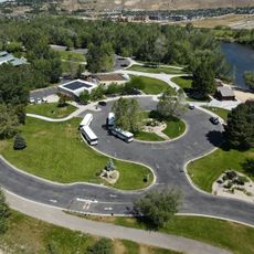
The area is open year-round, but watching nesting birds is best from March through June when pairs are actively breeding in the cliff walls. Multiple observation points like Dedication Point have informational signs and allow for easy viewing without special equipment.

Did you know?

The area hosts the world's largest concentration of Prairie Falcons, with over 700 breeding pairs of this species alone returning to the cliff walls each year. This singular status makes the conservation area globally important for protecting this particular raptor species.

Location
Inception
1993
Operator
BLM
GPS coordinates
43.28330,-116.20000
Latest update
December 10, 2025 20:01

AroundUs brings together thousands of curated places, local tips, and hidden gems, enriched daily by 60,000 contributors worldwide. Discover all places nearby (Idaho).

Around this place
Bruneau Dunes State Park
United States of America

Bruneau Dunes State Park

60.5 km
Lucky Peak Dam
United States of America

Lucky Peak Dam

29.8 km
Arrowrock Dam
United States of America

Arrowrock Dam

41.4 km
Lucky Peak State Park
United States of America

Lucky Peak State Park

30.1 km
Lucky Peak Lake
United States of America

Lucky Peak Lake

29.8 km
Crater Rings
United States of America

Crater Rings

29.4 km
Our Lady, Queen of Heaven Church
United States of America

Our Lady, Queen of Heaven Church

31.3 km
National Weather Service Boise, Idaho
United States of America

National Weather Service Boise, Idaho

31.6 km
Bengoechea Hotel
United States of America

Bengoechea Hotel

44.2 km
Little Jacks Creek Wilderness
United States of America

Little Jacks Creek Wilderness

65.6 km
Barber Dam
United States of America

Barber Dam

31.5 km
Diversion Dam and Deer Flat Embankments
United States of America

Diversion Dam and Deer Flat Embankments

29.6 km
Elmore County Courthouse
United States of America

Elmore County Courthouse

44.7 km
Barber Park
United States of America

Barber Park

32 km
Garfield School
United States of America

Garfield School

34.1 km
Owyhee County Courthouse
United States of America

Owyhee County Courthouse

29.3 km
Hopffgarten House
United States of America

Hopffgarten House

34.3 km
Guffey Butte–Black Butte Archaeological District
United States of America

Guffey Butte–Black Butte Archaeological District

26.1 km
Nathan Smith House
United States of America

Nathan Smith House

33.3 km
Rosedale Odd Fellows Temple
United States of America

Rosedale Odd Fellows Temple

34.3 km
Mountain Home Carnegie Library
United States of America

Mountain Home Carnegie Library

44.6 km
Bruneau Episcopal Church
United States of America

Bruneau Episcopal Church

55.5 km
Idaho Military History Museum
United States of America

Idaho Military History Museum

30.7 km
Black Cliffs Rock Climbing
United States of America

Black Cliffs Rock Climbing

29.8 km
Bruneau Canyon
United States of America

Bruneau Canyon

68.2 km
Sandy Point Beach
United States of America

Sandy Point Beach

29.9 km
Guffey Railroad Bridge
United States of America

Guffey Railroad Bridge

26.8 km
Old Walters Ferry Bridge
United States of America

Old Walters Ferry Bridge

33.2 km
Show the full map
« Morley Nelson Snake River Birds of Prey National Conservation Area - Nature reserve along Snake River Canyon, Idaho » is provided by Around Us (aroundus.com). Images and texts are derived from Wikimedia project under a Creative Commons license. You are allowed to copy, distribute, and modify copies of this page, under the conditions set by the license, as long as this note is clearly visible.

Discover hidden gems everywhere you go!

From secret cafés to breathtaking viewpoints, skip the crowded tourist spots and find places that match your style. Our app makes it easy with voice search, smart filtering, route optimization, and insider tips from travelers worldwide. Download now for the complete mobile experience.

Around Us App Screenshot

A unique approach to discovering new places

Le Figaro

All the places worth exploring

France Info

A tailor-made excursion in just a few clicks

20 Minutes

Around Us
Travel Guide & Maps
Download

Send to your phone

QR Code
1

Open the camera app on your mobile.

2

Point at the QR code with your camera. A notification will appear.

3

Tap the notification to open the link.