Enable Location

We need your location to show you interesting places around you

Discover nearby places

Find interesting locations and hidden gems around you

Precise directions

Get accurate directions and distances to places

Your location is never shared with other users. It's only used when you tap the location button.

Chickahominy Reservoir

Log in to your account

Start exploring — it's free

Trusted by 62,366 travelers worldwide

Continue with Google
Continue with Apple
or

We will send you a code to connect

By continuing, you accept our Terms and Conditions and our Privacy Policy

Check your inbox

We've sent a pincode in your inbox. Please enter the code below.

Chickahominy Reservoir

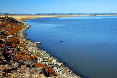
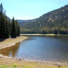
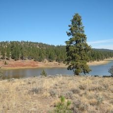
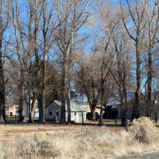
Chickahominy Reservoir, body of water

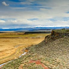
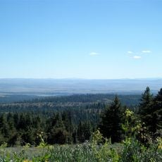
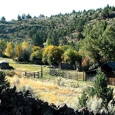
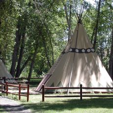
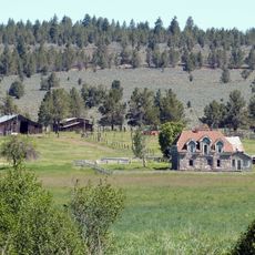
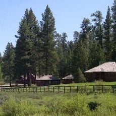
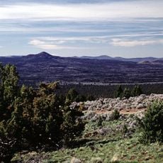
Chickahominy Reservoir is a man-made body of water in Harney County in eastern Oregon used primarily for fishing and outdoor recreation. The site features a boat ramp with dock facilities, 28 campsites, fish cleaning stations, and open landscape views of distant ridges and rolling terrain.

The reservoir was first filled with rainbow trout in the summer of 1967 and has since become a popular fishing destination in the region. Fish stocks have been maintained through regular restocking efforts by management to ensure ongoing angling opportunities.

The reservoir is a gathering place for anglers who have built traditions around fishing and sharing their catches with others. Visitors value the quiet way of life here, spending time with family or friends in a setting focused on nature without modern distractions.

The site is accessible via Highway 20 between Bend and Burns, about 32 miles west of Burns. Camping is affordable with first-come first-served availability, and the grounds offer drinking water, restrooms, and a boat launch for easy water access.

Water levels fluctuate based on spring runoff and rainfall, requiring anglers to adapt their techniques throughout the year and plan visits accordingly. Winter ice fishing is a notable activity here from December through late February, offering a different experience than summer months.

The community of curious travelers

AroundUs brings together thousands of curated places, local tips, and hidden gems, enriched daily by 60,000 contributors worldwide.

Start exploring
Location
GPS coordinates
43.54440,-119.61400
Latest update
February 9, 2026 08:20
Around this place
Malheur National Wildlife Refuge
United States of America

Malheur National Wildlife Refuge

69.6 km
Harney Basin
United States of America

Harney Basin

79.6 km
Crack in the Ground
United States of America

Crack in the Ground

88.4 km
Kam Wah Chung Company Building
United States of America

Kam Wah Chung Company Building

110.6 km
Fossil Lake
United States of America

Fossil Lake

75 km
Lost Forest Research Natural Area
United States of America

Lost Forest Research Natural Area

60.7 km
Strawberry Mountain Wilderness
United States of America

Strawberry Mountain Wilderness

107.1 km
Pete French Round Barn
United States of America

Pete French Round Barn

91 km
Pine Mountain Observatory
United States of America

Pine Mountain Observatory

110.3 km
Sod House Ranch
United States of America

Sod House Ranch

68.1 km
Frenchglen Hotel State Heritage Site
United States of America

Frenchglen Hotel State Heritage Site

97.9 km
P Ranch
United States of America

P Ranch

99.3 km
Black Canyon Wilderness
United States of America

Black Canyon Wilderness

88.3 km
Riddle Ranch
United States of America

Riddle Ranch

98.8 km
Clyde Holliday State Recreation Site
United States of America

Clyde Holliday State Recreation Site

105.8 km
United States of America

Old Camp Casino

42.4 km
Double-O Ranch Historic District
United States of America

Double-O Ranch Historic District

38.6 km
Roba Ranch
United States of America

Roba Ranch

82.1 km
Antelope Flat Reservoir
United States of America

Antelope Flat Reservoir

80.9 km
Advent Christian Church
United States of America

Advent Christian Church

110.5 km
Allison Ranger Station
United States of America

Allison Ranger Station

41.8 km
St. Thomas' Episcopal Church
United States of America

St. Thomas' Episcopal Church

107.8 km
Supervisor's House No. 1001
United States of America

Supervisor's House No. 1001

110.6 km
East Lava Field
United States of America

East Lava Field

92.5 km
John Day Compound
United States of America

John Day Compound

110.5 km
Ed Eskelin Ranch
United States of America

Ed Eskelin Ranch

109.9 km
Desert Theatre
United States of America

Desert Theatre

45.4 km
Kam Wah Chung Chinese Heritage Site
United States of America

Kam Wah Chung Chinese Heritage Site

110.6 km
Show the full map
« Chickahominy Reservoir - body of water » is provided by Around Us (aroundus.com). Images and texts are derived from Wikimedia project under a Creative Commons license. You are allowed to copy, distribute, and modify copies of this page, under the conditions set by the license, as long as this note is clearly visible.

Discover hidden gems everywhere you go!

From secret cafés to breathtaking viewpoints, skip the crowded tourist spots and find places that match your style. Our app makes it easy with voice search, smart filtering, route optimization, and insider tips from travelers worldwide. Download now for the complete mobile experience.

Around Us App Screenshot

A unique approach to discovering new places

Le Figaro

All the places worth exploring

France Info

A tailor-made excursion in just a few clicks

20 Minutes

Around Us
Travel Guide & Maps
Download

Send to your phone

QR Code
1

Open the camera app on your mobile.

2

Point at the QR code with your camera. A notification will appear.

3

Tap the notification to open the link.