Chest opened
+${chestReward.xp} XP
Explorer
NOUVEAU ×${chestReward.collectible.quantity}
tapez pour fermer

See the monuments around you in AR Open chests in the app

Around Us is built for your phone — point your camera at the streets and discover the monuments and places around you in augmented reality. Around Us is built for your phone — chests unlock when you walk, explore and capture nearby places.

Enable Location

We need your location to show you interesting places around you

Discover nearby places

Find interesting locations and hidden gems around you

Precise directions

Get accurate directions and distances to places

Your location is never shared with other users. It's only used when you tap the location button.

Celebration Park

Log in to your account

Start exploring — it's free

Trusted by 84,995 travelers worldwide

Continue with Google
Continue with Apple
or

We will send you a code to connect

By continuing, you accept our Terms and Conditions and our Privacy Policy

Check your inbox

We've sent a pincode in your inbox. Please enter the code below.

Discussion Reviews 1 Photos
2.3k Popularity

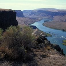
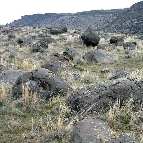
Celebration Park, Archaeological site along Snake River in Idaho, United States.

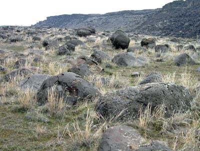
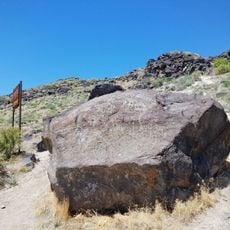
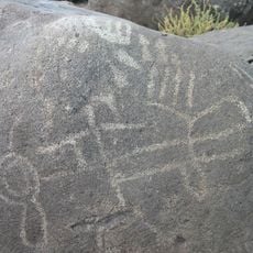
Celebration Park is an archaeological site along the Snake River where visitors can see ancient petroglyphs carved into basalt rocks. The rock formations were shaped by the massive Bonneville flood that occurred thousands of years ago and created the landscape visitors see today.

The park was established in 1989 as Idaho's first dedicated archaeological park to protect and preserve the petroglyphs for public access. The carvings were made by early indigenous peoples who lived in the region across many centuries.

The location served as a seasonal residence for Native American groups including Paiute, Shoshone, and Bannock people who used the land for sustenance.

The park provides picnic areas, restrooms, and drinking water at various spots for visitors to use while exploring. Guided tours are available to help visitors understand the petroglyphs and the site's archaeological importance.

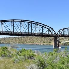
A historic railroad bridge from the 1800s crosses the valley with a distinctive engineering design that was rarely used elsewhere. This structure offers visitors an unusual link between modern times and the ancient past at the same location.

The community of curious travelers

AroundUs brings together thousands of curated places, local tips, and hidden gems, enriched daily by 60,000 contributors worldwide.
Start exploring
Location
GPS coordinates
43.30042,-116.52480
Latest update
August 30, 2026 13:03
Around this place
Morley Nelson Snake River Birds of Prey National Conservation Area
United States of America

Morley Nelson Snake River Birds of Prey National Conservation Area

19 mi
Deer Flat National Wildlife Refuge
United States of America

Deer Flat National Wildlife Refuge

18.7 mi
Our Lady, Queen of Heaven Church
United States of America

Our Lady, Queen of Heaven Church

19.2 mi
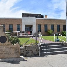
Map Rock Petroglyphs Historic District
United States of America

Map Rock Petroglyphs Historic District

12.3 mi
Nampa Historic District
United States of America

Nampa Historic District

19.3 mi
Farmers and Merchants Bank
United States of America

Farmers and Merchants Bank

19.4 mi
Lilyquist-Christianson Building
United States of America

Lilyquist-Christianson Building

14.2 mi
Owyhee County Courthouse
United States of America

Owyhee County Courthouse

5.9 mi
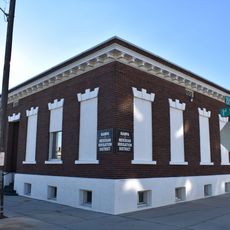
Nampa and Meridian Irrigation District Office
United States of America

Nampa and Meridian Irrigation District Office

19.2 mi
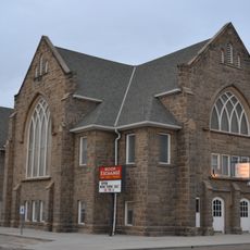
Nampa Presbyterian Church
United States of America

Nampa Presbyterian Church

19.1 mi
Guffey Butte–Black Butte Archaeological District
United States of America

Guffey Butte–Black Butte Archaeological District

0.2 mi
Nampa American Legion Chateau
United States of America

Nampa American Legion Chateau

19.1 mi
H. Orton Wiley House
United States of America

H. Orton Wiley House

18.3 mi
Noble Horse Barn
United States of America

Noble Horse Barn

12.9 mi
Nampa Train Depot
United States of America

Nampa Train Depot

19.4 mi
United States of America

Lake Lowell

19.3 mi
United States of America

Alum Bed Rapids

14 mi
United States of America

Murphy Rim

4.5 mi
Guffey Railroad Bridge
United States of America

Guffey Railroad Bridge

0.3 mi
United States of America

Wilson Bluff

12.2 mi
United States of America

Puhitempi Kuaikatete

18.3 mi
United States of America

Coal Bank

16.5 mi
United States of America

RedHawk Golf Course

18 mi
United States of America

Boise Ranch Golf Course

19.2 mi
United States of America

Falcon Crest Golf Club

17.3 mi
United States of America

Adelaide Theatre

19.1 mi
United States of America

Little Theatre

18.4 mi
United States of America

Scenic viewpoint

18.7 mi
Show the full map
Reviews
Share your experience

No review yet

Discussions
Start a discussion...

No discussion yet

« Celebration Park - Archaeological site along Snake River in Idaho, United States » is provided by Around Us (aroundus.com). Images and texts are derived from Wikimedia project under a Creative Commons license. You are allowed to copy, distribute, and modify copies of this page, under the conditions set by the license, as long as this note is clearly visible.

Discover hidden gems everywhere you go!

From secret cafés to breathtaking viewpoints, skip the crowded tourist spots and find places that match your style. Our app makes it easy with voice search, smart filtering, route optimization, and insider tips from travelers worldwide. Download now for the complete mobile experience.

Around Us App Screenshot

A unique approach to discovering new places

Le Figaro

All the places worth exploring

France Info

A tailor-made excursion in just a few clicks

20 Minutes

Around Us
Travel Guide & Maps
Download

Send to your phone

QR Code
1

Open the camera app on your mobile.

2

Point at the QR code with your camera. A notification will appear.

3

Tap the notification to open the link.