Chest opened
+${chestReward.xp} XP
Explorer
NOUVEAU ×${chestReward.collectible.quantity}
tapez pour fermer
Chest locked

Open chests in the app

Around Us is built for your phone — chests unlock when you walk, explore and capture nearby places.

Enable Location

We need your location to show you interesting places around you

Discover nearby places

Find interesting locations and hidden gems around you

Precise directions

Get accurate directions and distances to places

Your location is never shared with other users. It's only used when you tap the location button.

Interstate 84 in Idaho

Log in to your account

Start exploring — it's free

Trusted by 72,982 travelers worldwide

Continue with Google
Continue with Apple
or

We will send you a code to connect

By continuing, you accept our Terms and Conditions and our Privacy Policy

Check your inbox

We've sent a pincode in your inbox. Please enter the code below.

Interstate 84 in Idaho
Discussion Reviews 1 Photos
16k Popularity

Interstate 84 in Idaho, section of Interstate Highway in Idaho, United States

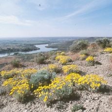
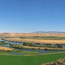
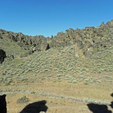
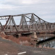
Interstate 84 is a major highway that runs across Idaho from the Oregon border to the Utah border, connecting cities like Boise and Twin Falls. The road largely follows the Snake River and passes through nine counties including Payette, Canyon, and Ada.

The first sections opened in the 1960s, replacing older roads that followed the Oregon Trail, and helped farms transport goods more efficiently. Starting in the 2000s, the state widened several sections around Boise and Nampa to handle increasing traffic.

The highway is named the Vietnam Veterans Memorial Highway in honor of soldiers who served in Vietnam. Local residents and travelers use this route daily as a vital connection between communities across the state.

Rest areas are spaced regularly along the route with restrooms, picnic tables, and drinking water available. Check road conditions before traveling in winter when snow and ice are common, and drive carefully during dust storms or when deer crossing signs appear.

The highway crosses Sweetzer Summit where trucks face speed restrictions on the steep grade. Deer migrations caused accidents in the past until wildlife crossings were built to allow animals safe passage while protecting drivers from collisions.

The community of curious travelers

AroundUs brings together thousands of curated places, local tips, and hidden gems, enriched daily by 60,000 contributors worldwide.

Start exploring
Location
Location
Location
Location
Location
Location
Location
Location
Location
Inception
1957
GPS coordinates
42.98054,-114.93439
Latest update
February 19, 2026 23:00
Around this place
Hagerman Fossil Beds National Monument
United States of America

Hagerman Fossil Beds National Monument

20.8 km
Thousand Springs State Park
United States of America

Thousand Springs State Park

14.5 km
Three Island Crossing State Park
United States of America

Three Island Crossing State Park

31.6 km
J. C. Penney Company Building
United States of America

J. C. Penney Company Building

43.3 km
Little City of Rocks Wilderness Study Area
United States of America

Little City of Rocks Wilderness Study Area

25.2 km
Owsley Bridge
United States of America

Owsley Bridge

24.3 km
Archie Webster House
United States of America

Archie Webster House

43.7 km
Schubert Theatre
United States of America

Schubert Theatre

18.6 km
Jack Oughton House
United States of America

Jack Oughton House

43.6 km
Greer and Jennie Quay House
United States of America

Greer and Jennie Quay House

42.8 km
American Legion Hall
United States of America

American Legion Hall

43.3 km
Our Lady of Limerick Catholic Church
United States of America

Our Lady of Limerick Catholic Church

29.8 km
Custer Slaughter House
United States of America

Custer Slaughter House

42.8 km
Jerome County Courthouse
United States of America

Jerome County Courthouse

44.3 km
Arnold Stevens House
United States of America

Arnold Stevens House

40.1 km
Jose and Gertrude Anasola House
United States of America

Jose and Gertrude Anasola House

43.6 km
Galo Arambarri Boarding House
United States of America

Galo Arambarri Boarding House

43.4 km
Thompson Mortuary Chapel
United States of America

Thompson Mortuary Chapel

18.7 km
E. C. Gleason House
United States of America

E. C. Gleason House

44.7 km
William Weigle House and Water Tank
United States of America

William Weigle House and Water Tank

37 km
Buhl IOOF Building
United States of America

Buhl IOOF Building

44.8 km
Gorby Opera Theater
United States of America

Gorby Opera Theater

29.7 km
Thomas J. Kehrer House
United States of America

Thomas J. Kehrer House

37.8 km
Joseph Mandl House
United States of America

Joseph Mandl House

44.5 km
George V. Doughty House and Garage
United States of America

George V. Doughty House and Garage

43.2 km
Wood River Center Grange No. 87
United States of America

Wood River Center Grange No. 87

37.2 km
Don Tooley House
United States of America

Don Tooley House

43.8 km
John F. Schmerschall House
United States of America

John F. Schmerschall House

44.6 km
Show the full map
Reviews
Share your experience

No review yet

Discussions
Start a discussion...

No discussion yet

« Interstate 84 in Idaho - section of Interstate Highway in Idaho, United States » is provided by Around Us (aroundus.com). Images and texts are derived from Wikimedia project under a Creative Commons license. You are allowed to copy, distribute, and modify copies of this page, under the conditions set by the license, as long as this note is clearly visible.

Discover hidden gems everywhere you go!

From secret cafés to breathtaking viewpoints, skip the crowded tourist spots and find places that match your style. Our app makes it easy with voice search, smart filtering, route optimization, and insider tips from travelers worldwide. Download now for the complete mobile experience.

Around Us App Screenshot

A unique approach to discovering new places

Le Figaro

All the places worth exploring

France Info

A tailor-made excursion in just a few clicks

20 Minutes

Around Us
Travel Guide & Maps
Download

Send to your phone

QR Code
1

Open the camera app on your mobile.

2

Point at the QR code with your camera. A notification will appear.

3

Tap the notification to open the link.