Chest opened
+${chestReward.xp} XP
Explorer
NOUVEAU ×${chestReward.collectible.quantity}
tapez pour fermer
Chest locked

Open chests in the app

Around Us is built for your phone — chests unlock when you walk, explore and capture nearby places.

Enable Location

We need your location to show you interesting places around you

Discover nearby places

Find interesting locations and hidden gems around you

Precise directions

Get accurate directions and distances to places

Your location is never shared with other users. It's only used when you tap the location button.

Log in to your account

Start exploring — it's free

Trusted by 72,968 travelers worldwide

Continue with Google
Continue with Apple
or

We will send you a code to connect

By continuing, you accept our Terms and Conditions and our Privacy Policy

Check your inbox

We've sent a pincode in your inbox. Please enter the code below.

Interstate 90 in Idaho
Discussion Reviews Photo
16.4k Popularity

Interstate 90 in Idaho, section of Interstate Highway in Kootenai and Shoshone counties in Idaho, United States

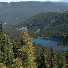
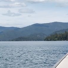
Interstate 90 in Idaho is a four-lane major highway that runs across the northern part of the state from the Washington border to the Montana border. It follows the Spokane River valley, passes along Lake Coeur d'Alene, crosses several mountain passes, and connects larger cities like Coeur d'Alene with smaller towns and historic mining communities.

Interstate 90 is based on the historic Mullan Road, built in the mid-19th century as one of the first engineered roads in the region. The federal highway project began in 1957 and took several decades to complete, with final sections opening in the early 1990s, creating a major east-west corridor for rapid travel.

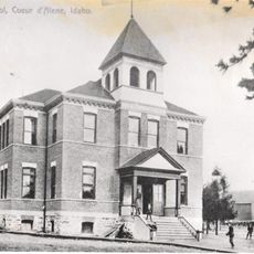
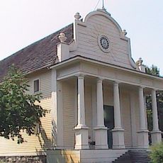
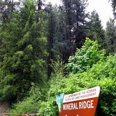
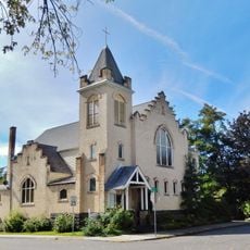
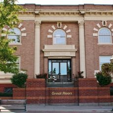
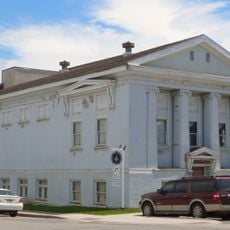
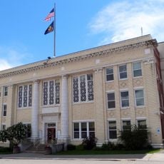
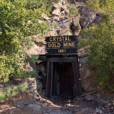
The highway connects various communities across northern Idaho, passing by historic mining towns and small settlements that maintain their local character and heritage. Travelers see signs of the region's mining past and encounter places like Wallace, where old architecture still defines the town's identity.

Drivers should watch for wildlife crossing the road, especially at dawn and dusk, and bring water and snacks for longer journeys. Rest areas and service stations are spaced along the route where travelers can stop to stretch and get basic supplies.

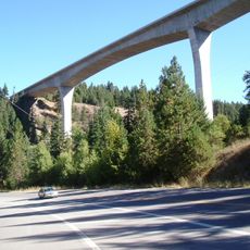
In Wallace, the highway was rerouted onto a tall viaduct along the town's edge during the 1980s to protect the historic downtown from through traffic. This diversion also eliminated the last traffic light on Interstate 90 in Idaho, the only such signal on the entire federal highway.

The community of curious travelers

AroundUs brings together thousands of curated places, local tips, and hidden gems, enriched daily by 60,000 contributors worldwide.

Start exploring
Location
Location
Inception
1957
GPS coordinates
47.59505,-116.39236
Latest update
February 17, 2026 02:00
Around this place
The Roosevelt Inn
United States of America

The Roosevelt Inn

30.8 km
Old Mission State Park
United States of America

Old Mission State Park

5.6 km
Idaho Panhandle National Forests
United States of America

Idaho Panhandle National Forests

18.9 km
Fort Sherman
United States of America

Fort Sherman

31.8 km
Veterans Memorial Centennial Bridge
United States of America

Veterans Memorial Centennial Bridge

24.9 km
Clark House
United States of America

Clark House

30.7 km
St. Thomas Catholic Church
United States of America

St. Thomas Catholic Church

29.9 km
Kootenai County Courthouse
United States of America

Kootenai County Courthouse

30.9 km
Mineral Ridge National Recreation Trail, Idaho
United States of America

Mineral Ridge National Recreation Trail, Idaho

19 km
First United Methodist Church
United States of America

First United Methodist Church

29.9 km
Coeur d'Alene Masonic Temple
United States of America

Coeur d'Alene Masonic Temple

30.2 km
Coeur d'Alene Federal Building
United States of America

Coeur d'Alene Federal Building

30.4 km
St. Maries Masonic Temple No. 63
United States of America

St. Maries Masonic Temple No. 63

33.8 km
Benewah County Courthouse
United States of America

Benewah County Courthouse

33.8 km
St. Maries 1910 Fire Memorial
United States of America

St. Maries 1910 Fire Memorial

34.4 km
John P. and Stella Gray House
United States of America

John P. and Stella Gray House

29.3 km
Silas W. and Elizabeth Crane House
United States of America

Silas W. and Elizabeth Crane House

33.5 km
Coeur d'Alene City Hall
United States of America

Coeur d'Alene City Hall

30.3 km
Crystal Gold Mine
United States of America

Crystal Gold Mine

23.6 km
John A. Finch Caretaker's House
United States of America

John A. Finch Caretaker's House

32.8 km
Harvey M. Davey House
United States of America

Harvey M. Davey House

30.5 km
Honeysuckle Beach
United States of America

Honeysuckle Beach

32.5 km
Chatcolet CCC Picnic and Camping Area
United States of America

Chatcolet CCC Picnic and Camping Area

37.1 km
Museum of North Idaho
United States of America

Museum of North Idaho

30.9 km
Sanders Beach
United States of America

Sanders Beach

29.5 km
Silver Beach
United States of America

Silver Beach

27.2 km
Coeur d'Alene Public Library
United States of America

Coeur d'Alene Public Library

30.1 km
Preston Beach
United States of America

Preston Beach

29 km
Show the full map
Reviews
Share your experience

No review yet

Discussions
Start a discussion...

No discussion yet

« Interstate 90 in Idaho - section of Interstate Highway in Kootenai and Shoshone counties in Idaho, United States » is provided by Around Us (aroundus.com). Images and texts are derived from Wikimedia project under a Creative Commons license. You are allowed to copy, distribute, and modify copies of this page, under the conditions set by the license, as long as this note is clearly visible.

Discover hidden gems everywhere you go!

From secret cafés to breathtaking viewpoints, skip the crowded tourist spots and find places that match your style. Our app makes it easy with voice search, smart filtering, route optimization, and insider tips from travelers worldwide. Download now for the complete mobile experience.

Around Us App Screenshot

A unique approach to discovering new places

Le Figaro

All the places worth exploring

France Info

A tailor-made excursion in just a few clicks

20 Minutes

Around Us
Travel Guide & Maps
Download

Send to your phone

QR Code
1

Open the camera app on your mobile.

2

Point at the QR code with your camera. A notification will appear.

3

Tap the notification to open the link.