Chest opened
+${chestReward.xp} XP
Explorer
NOUVEAU ×${chestReward.collectible.quantity}
tapez pour fermer
Chest locked

Open chests in the app

Around Us is built for your phone — chests unlock when you walk, explore and capture nearby places.

Enable Location

We need your location to show you interesting places around you

Discover nearby places

Find interesting locations and hidden gems around you

Precise directions

Get accurate directions and distances to places

Your location is never shared with other users. It's only used when you tap the location button.

Palisades Dam

Log in to your account

Start exploring — it's free

Trusted by 72,887 travelers worldwide

Continue with Google
Continue with Apple
or

We will send you a code to connect

By continuing, you accept our Terms and Conditions and our Privacy Policy

Check your inbox

We've sent a pincode in your inbox. Please enter the code below.

Discussion Reviews 1 Photos
9.3k Popularity

Palisades Dam, Hydroelectric dam in Bonneville County, US

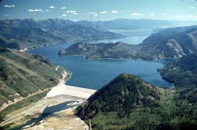
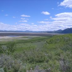
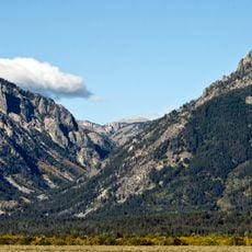
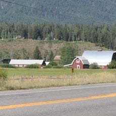
Palisades Dam is an embankment dam built across the upper Snake River in eastern Idaho to store water for hydroelectric power and irrigation purposes. The structure includes a power station with turbines that generate electricity to support farming operations across the region.

Construction began in 1951 under the United States Bureau of Reclamation and the dam was completed in 1957. It was built as part of a broader water management plan for agricultural development in the Snake River Valley.

The dam and power station received recognition for their engineering importance through inclusion in the National Register of Historic Places in 2018.

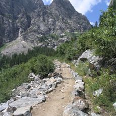
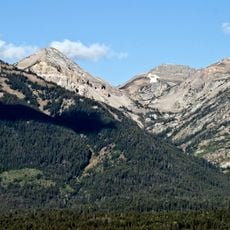
The site is accessible by road, with views available from public overlooks along and near the structure. Visitors should plan their visit considering weather conditions and daylight hours for safe exploration.

The structure was recognized in the National Register of Historic Places in 2018 for its engineering significance. This recognition highlights how the project represented important mid-century infrastructure development in the American West.

The community of curious travelers

AroundUs brings together thousands of curated places, local tips, and hidden gems, enriched daily by 60,000 contributors worldwide.

Start exploring
Inception
1951
Elevation above the sea
1,713 m
Length
640 m
GPS coordinates
43.33310,-111.20300
Latest update
December 10, 2025 15:58
Around this place
National Elk Refuge
United States of America

National Elk Refuge

40.3 km
Pierre's Hole
United States of America

Pierre's Hole

42.6 km
Snake River Canyon
United States of America

Snake River Canyon

24.1 km
National Museum of Wildlife Art of the United States
United States of America

National Museum of Wildlife Art of the United States

42.1 km
Rendezvous Mountain
United States of America

Rendezvous Mountain

39.8 km
Wort Hotel
United States of America

Wort Hotel

39.2 km
Grays Lake National Wildlife Refuge
United States of America

Grays Lake National Wildlife Refuge

35.1 km
Spud Drive-In Theater
United States of America

Spud Drive-In Theater

40.4 km
Granite Canyon
United States of America

Granite Canyon

44.5 km
Death Canyon Trail
United States of America

Death Canyon Trail

47.9 km
Death Canyon Barn
United States of America

Death Canyon Barn

47.7 km
Rendezvous Peak
United States of America

Rendezvous Peak

35.5 km
Miller Cabin
United States of America

Miller Cabin

41.4 km
Huff Memorial Library
United States of America

Huff Memorial Library

39.2 km
United States of America

Fossil Mountain

42.4 km
Grace and Robert Miller Ranch
United States of America

Grace and Robert Miller Ranch

41.5 km
St. John's Episcopal Church and Rectory
United States of America

St. John's Episcopal Church and Rectory

39.2 km
Mount Hunt
United States of America

Mount Hunt

43.1 km
Upper Granite Canyon Patrol Cabin
United States of America

Upper Granite Canyon Patrol Cabin

39.8 km
Prospectors Mountain
United States of America

Prospectors Mountain

45.3 km
Van Vleck House and Barn
United States of America

Van Vleck House and Barn

39.4 km
Jackson Hole American Legion Post No. 43
United States of America

Jackson Hole American Legion Post No. 43

39.4 km
Hardeman Barns
United States of America

Hardeman Barns

32.6 km
Teton County Courthouse
United States of America

Teton County Courthouse

44.2 km
Open Canyon
United States of America

Open Canyon

46 km
Laurance S. Rockefeller Preserve Center
United States of America

Laurance S. Rockefeller Preserve Center

47.5 km
Teton Theatre
United States of America

Teton Theatre

39.2 km
Jackson Hole Playhouse
United States of America

Jackson Hole Playhouse

39.1 km
Show the full map
Reviews
Share your experience

No review yet

Discussions
Start a discussion...

No discussion yet

« Palisades Dam - Hydroelectric dam in Bonneville County, US » is provided by Around Us (aroundus.com). Images and texts are derived from Wikimedia project under a Creative Commons license. You are allowed to copy, distribute, and modify copies of this page, under the conditions set by the license, as long as this note is clearly visible.

Discover hidden gems everywhere you go!

From secret cafés to breathtaking viewpoints, skip the crowded tourist spots and find places that match your style. Our app makes it easy with voice search, smart filtering, route optimization, and insider tips from travelers worldwide. Download now for the complete mobile experience.

Around Us App Screenshot

A unique approach to discovering new places

Le Figaro

All the places worth exploring

France Info

A tailor-made excursion in just a few clicks

20 Minutes

Around Us
Travel Guide & Maps
Download

Send to your phone

QR Code
1

Open the camera app on your mobile.

2

Point at the QR code with your camera. A notification will appear.

3

Tap the notification to open the link.