Wheatland County

Log in to your account

AroundUs is a community-driven map of interesting places, built by curious explorers like you. It grows with every review, story, and photo you share.
Connect to save your favorite spots, contribute locations, and create personalized routes.
By continuing, you accept our Terms and Conditions and our Privacy Policy
Add to collection
Map
Suggest a change
Share

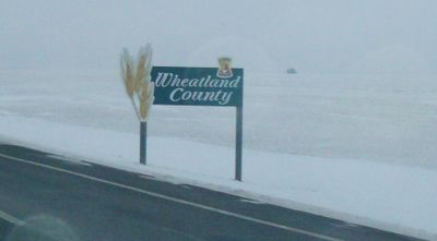
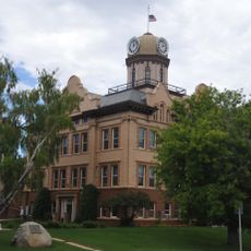
Wheatland County, municipal district in Alberta, Canada

GPS coordinates: 46.43353,-109.84980

Latest update: March 18, 2025 21:26

Around this place
Show the full map
Crazy Peak
United States of America

Crazy Peak

56.7 km
Big Baldy Mountain
United States of America

Big Baldy Mountain

83 km
Greycliff Prairie Dog Town State Park
United States of America

Greycliff Prairie Dog Town State Park

75.2 km
Byron R. Sherman House
United States of America

Byron R. Sherman House

81.5 km
Hailstone National Wildlife Refuge
United States of America

Hailstone National Wildlife Refuge

70.2 km
Fergus County High School
United States of America

Fergus County High School

76.9 km
Loco Mountain
United States of America

Loco Mountain

44 km
Milwaukee Road Historic District
United States of America

Milwaukee Road Historic District

1.8 km
Michael Jacobs House
United States of America

Michael Jacobs House

99.4 km
Judith River Ranger Station
United States of America

Judith River Ranger Station

57.1 km
Masonic Temple
United States of America

Masonic Temple

77.3 km
Parberry Block East
United States of America

Parberry Block East

81.7 km
Roundup Central School
United States of America

Roundup Central School

100.2 km
Lavina State Bank
United States of America

Lavina State Bank

71.8 km
St. Benedict's Catholic School
United States of America

St. Benedict's Catholic School

100.3 km
Lewistown Central Business Historic District
United States of America

Lewistown Central Business Historic District

77.3 km
Carnegie Public Library
United States of America

Carnegie Public Library

67.4 km
St. Joseph's Hospital
United States of America

St. Joseph's Hospital

78 km
Abraham and Mary Walton Hogeland House
United States of America

Abraham and Mary Walton Hogeland House

77.2 km
Lewistown Courthouse Historic District
United States of America

Lewistown Courthouse Historic District

76.9 km
Anderson House
United States of America

Anderson House

76.6 km
Lewistown Silk Stocking District
United States of America

Lewistown Silk Stocking District

77.5 km
Melville Lutheran Church
United States of America

Melville Lutheran Church

39 km
Huntoon Residence
United States of America

Huntoon Residence

76.5 km
Big Timber Lutheran Church
United States of America

Big Timber Lutheran Church

67.5 km
Charles M Bair Family Museum
United States of America

Charles M Bair Family Museum

36.1 km
St Mark's Episcopal Church (Big Timber)
United States of America

St Mark's Episcopal Church (Big Timber)

67.5 km
Smith River Valley Historical Marker
United States of America

Smith River Valley Historical Marker

80.9 km
Show the full map

Reviews

Visited this place? Tap the stars to rate it and share your experience / photos with the community! Try now! You can cancel it anytime.

« Wheatland County - municipal district in Alberta, Canada » is provided by Around Us (aroundus.com). Images and texts are derived from Wikimedia project under a Creative Commons license. You are allowed to copy, distribute, and modify copies of this page, under the conditions set by the license, as long as this note is clearly visible.

Discover hidden gems everywhere you go!

From secret cafés to breathtaking viewpoints, skip the crowded tourist spots and find places that match your style. Our app makes it easy with voice search, smart filtering, route optimization, and insider tips from travelers worldwide. Download now for the complete mobile experience.

Around Us App Screenshot

A unique approach to discovering new places

Le Figaro

All the places worth exploring

France Info

A tailor-made excursion in just a few clicks

20 Minutes