Enable Location

We need your location to show you interesting places around you

Discover nearby places

Find interesting locations and hidden gems around you

Precise directions

Get accurate directions and distances to places

Your location is never shared with other users. It's only used when you tap the location button.

Greycliff Prairie Dog Town State Park

Log in to your account

Start exploring — it's free

Trusted by 62,563 travelers worldwide

Continue with Google
Continue with Apple
or

We will send you a code to connect

By continuing, you accept our Terms and Conditions and our Privacy Policy

Check your inbox

We've sent a pincode in your inbox. Please enter the code below.

Greycliff Prairie Dog Town State Park

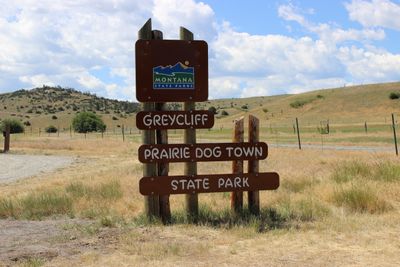
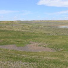
Greycliff Prairie Dog Town State Park, Prairie dog observation area in southeastern Montana, United States.

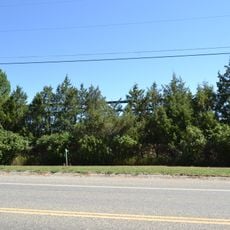
Greycliff Prairie Dog Town State Park is a protected area in southeastern Montana where black-tailed prairie dogs live in established colonies. The roughly 98-acre site contains multiple populations separated naturally by hills and valleys into distinct ward groups.

The park was established in 1974 through cooperation between Montana State Parks, the Nature Conservancy, and the Montana Department of Transportation to protect declining prairie dog populations. This effort marked an important recognition of the need to preserve these animals and their grassland habitats.

Interpretive signs throughout the park explain how prairie dogs organize themselves into social groups and support other wildlife in the grassland ecosystem. You can watch their interactions directly and learn why these animals matter for the health of the prairie.

The park is open year-round, but from November through April only walk-in access is available as vehicle parking closes during winter months. Parking areas and picnic tables are open during warmer seasons, making visits more comfortable outside the restricted period.

Unlike many other animals in the region that hibernate, the black-tailed prairie dogs here remain active and visible throughout the winter months. This makes the park an interesting observation spot even during the colder seasons.

The community of curious travelers

AroundUs brings together thousands of curated places, local tips, and hidden gems, enriched daily by 60,000 contributors worldwide.

Start exploring
Location
Inception
1974
GPS coordinates
45.75972,-109.77944
Latest update
December 13, 2025 12:20
Around this place
Granite Peak
United States of America

Granite Peak

66 km
The Murray Hotel
United States of America

The Murray Hotel

61.8 km
Grasshopper Glacier
United States of America

Grasshopper Glacier

70.1 km
Absaroka-Beartooth Wilderness
United States of America

Absaroka-Beartooth Wilderness

74.4 km
Crazy Peak
United States of America

Crazy Peak

48.1 km
Mount Wood
United States of America

Mount Wood

54 km
DePuy Spring Creek
United States of America

DePuy Spring Creek

66.8 km
Hailstone National Wildlife Refuge
United States of America

Hailstone National Wildlife Refuge

54 km
Loco Mountain
United States of America

Loco Mountain

67.3 km
Milwaukee Road Historic District
United States of America

Milwaukee Road Historic District

74.7 km
Michael Jacobs House
United States of America

Michael Jacobs House

42.6 km
Oliver H. Hovda House
United States of America

Oliver H. Hovda House

37.4 km
Carnegie Public Library
United States of America

Carnegie Public Library

15.6 km
Calvary Episcopal Church
United States of America

Calvary Episcopal Church

76 km
B Street District
United States of America

B Street District

61.3 km
Stoltz House
United States of America

Stoltz House

69 km
Joliet Bridge
United States of America

Joliet Bridge

70.4 km
Rolfson House
United States of America

Rolfson House

70.2 km
Melville Lutheran Church
United States of America

Melville Lutheran Church

42.6 km
Livingston Depot
United States of America

Livingston Depot

61.8 km
Big Timber Lutheran Church
United States of America

Big Timber Lutheran Church

15.7 km
Redeemer Lutheran Church (Livingston, Montana)
United States of America

Redeemer Lutheran Church (Livingston, Montana)

62 km
Immanuel Lutheran Church (Absarokee)
United States of America

Immanuel Lutheran Church (Absarokee)

37.6 km
St Mark's Episcopal Church (Big Timber)
United States of America

St Mark's Episcopal Church (Big Timber)

15.7 km
Empire Twin Theater
United States of America

Empire Twin Theater

61.8 km
Teslow Grain Elevator
United States of America

Teslow Grain Elevator

61.1 km
St. James Lutheran Church (Columbus, Montana)
United States of America

St. James Lutheran Church (Columbus, Montana)

42.8 km
Beartooth Mountain Baptist Church (Red Lodge)
United States of America

Beartooth Mountain Baptist Church (Red Lodge)

75.9 km
Show the full map
« Greycliff Prairie Dog Town State Park - Prairie dog observation area in southeastern Montana, United States » is provided by Around Us (aroundus.com). Images and texts are derived from Wikimedia project under a Creative Commons license. You are allowed to copy, distribute, and modify copies of this page, under the conditions set by the license, as long as this note is clearly visible.

Discover hidden gems everywhere you go!

From secret cafés to breathtaking viewpoints, skip the crowded tourist spots and find places that match your style. Our app makes it easy with voice search, smart filtering, route optimization, and insider tips from travelers worldwide. Download now for the complete mobile experience.

Around Us App Screenshot

A unique approach to discovering new places

Le Figaro

All the places worth exploring

France Info

A tailor-made excursion in just a few clicks

20 Minutes

Around Us
Travel Guide & Maps
Download

Send to your phone

QR Code
1

Open the camera app on your mobile.

2

Point at the QR code with your camera. A notification will appear.

3

Tap the notification to open the link.