Chest opened
+${chestReward.xp} XP
Explorer
NOUVEAU ×${chestReward.collectible.quantity}
tapez pour fermer
Chest locked

Open chests in the app

Around Us is built for your phone — chests unlock when you walk, explore and capture nearby places.

Enable Location

We need your location to show you interesting places around you

Discover nearby places

Find interesting locations and hidden gems around you

Precise directions

Get accurate directions and distances to places

Your location is never shared with other users. It's only used when you tap the location button.

Log in to your account

Start exploring — it's free

Trusted by 72,917 travelers worldwide

Continue with Google
Continue with Apple
or

We will send you a code to connect

By continuing, you accept our Terms and Conditions and our Privacy Policy

Check your inbox

We've sent a pincode in your inbox. Please enter the code below.

Hyalite Canyon
Discussion Reviews Photo
40+ Popularity

Hyalite Canyon, Valley in Gallatin County, Montana, US

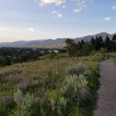
Hyalite Canyon is a valley in the Gallatin National Forest south of Bozeman characterized by rocky ridges, coniferous forests, and flowing mountain streams. The landscape consists of forested slopes leading to granite peaks and waterfalls fed by snowmelt and seasonal runoff.

Early settlers and miners came to the valley to access water and natural resources essential for survival in Montana's frontier days. The canyon's name derives from hyalite, a glassy mineral found in the surrounding rocks.

Multiple Native American tribes, including the Apsáalooke and Shoshone Bannock, maintain deep ties to this land through long-standing traditions and practices. The canyon represents an important part of their heritage and ongoing relationship with the natural world.

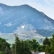
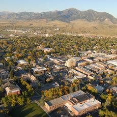
The valley is located a short drive south of Bozeman and features multiple camping areas and day-use facilities with parking throughout the canyon. Roads into the upper canyon can become snow-blocked during winter months, so visitors should check conditions before heading in.

The creek running through the canyon supplies drinking water for Bozeman's residents and has shaped how the city depends on this watershed for survival. Few visitors realize how central this valley is to the region's water needs.

The community of curious travelers

AroundUs brings together thousands of curated places, local tips, and hidden gems, enriched daily by 60,000 contributors worldwide.

Start exploring
Location
GPS coordinates
45.57972,-111.07917
Latest update
December 15, 2025 13:25
Around this place
Museum of the Rockies
United States of America

Museum of the Rockies

9.7 km
Bobcat Stadium
United States of America

Bobcat Stadium

9.2 km
Fort Ellis
United States of America

Fort Ellis

11.6 km
American Computer Museum
United States of America

American Computer Museum

9.1 km
Hotel Baxter
United States of America

Hotel Baxter

11.1 km
Gallatin Gateway Inn
United States of America

Gallatin Gateway Inn

9.4 km
First Presbyterian Church, Bozeman
United States of America

First Presbyterian Church, Bozeman

11.4 km
Samuel Lewis House
United States of America

Samuel Lewis House

11.3 km
Bozeman Public Library
United States of America

Bozeman Public Library

11.8 km
Gallatin County High School
United States of America

Gallatin County High School

11.4 km
Museum of the Rockies
United States of America

Museum of the Rockies

9.2 km
Bozeman Carnegie Library
United States of America

Bozeman Carnegie Library

11.7 km
Bon Ton Historic District
United States of America

Bon Ton Historic District

11.2 km
Holy Rosary Church Rectory
United States of America

Holy Rosary Church Rectory

11.5 km
St. James Episcopal Church and Rectory
United States of America

St. James Episcopal Church and Rectory

11.4 km
Gallatin County Courthouse
United States of America

Gallatin County Courthouse

11.5 km
Methodist Episcopal Church
United States of America

Methodist Episcopal Church

11.4 km
Brandenburg House
United States of America

Brandenburg House

11.7 km
Cooper Park Historic District
United States of America

Cooper Park Historic District

11 km
Peets Hill/Burke Park
United States of America

Peets Hill/Burke Park

11.1 km
Emerson Center for the Arts & Culture

Emerson Center for the Arts & Culture

11.3 km
Arboreto y Jardines de Montana
United States of America

Arboreto y Jardines de Montana

9.2 km
Montana Science Center
United States of America

Montana Science Center

10.3 km
Bogert Park
United States of America

Bogert Park

11.4 km
Gallatin History Museum
United States of America

Gallatin History Museum

11.5 km
Downtown Bozeman Partnership

Downtown Bozeman Partnership

11.6 km
Montana State University Historic District
United States of America

Montana State University Historic District

10 km
Ellen Theatre
United States of America

Ellen Theatre

11.6 km
Show the full map
Reviews
Share your experience

No review yet

Discussions
Start a discussion...

No discussion yet

« Hyalite Canyon - Valley in Gallatin County, Montana, US » is provided by Around Us (aroundus.com). Images and texts are derived from Wikimedia project under a Creative Commons license. You are allowed to copy, distribute, and modify copies of this page, under the conditions set by the license, as long as this note is clearly visible.

Discover hidden gems everywhere you go!

From secret cafés to breathtaking viewpoints, skip the crowded tourist spots and find places that match your style. Our app makes it easy with voice search, smart filtering, route optimization, and insider tips from travelers worldwide. Download now for the complete mobile experience.

Around Us App Screenshot

A unique approach to discovering new places

Le Figaro

All the places worth exploring

France Info

A tailor-made excursion in just a few clicks

20 Minutes

Around Us
Travel Guide & Maps
Download

Send to your phone

QR Code
1

Open the camera app on your mobile.

2

Point at the QR code with your camera. A notification will appear.

3

Tap the notification to open the link.