Enable Location

We need your location to show you interesting places around you

Discover nearby places

Find interesting locations and hidden gems around you

Precise directions

Get accurate directions and distances to places

Your location is never shared with other users. It's only used when you tap the location button.

Pompeys Pillar National Monument

Log in to your account

Start exploring — it's free

Trusted by 62,595 travelers worldwide

Continue with Google
Continue with Apple
or

We will send you a code to connect

By continuing, you accept our Terms and Conditions and our Privacy Policy

Check your inbox

We've sent a pincode in your inbox. Please enter the code below.

Pompeys Pillar National Monument, Natural sandstone monument in Yellowstone County, Montana, United States

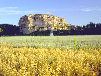
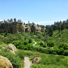
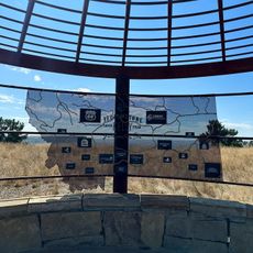
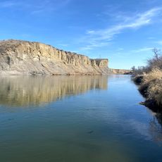
Pompeys Pillar is a sandstone formation rising roughly 150 feet above the Yellowstone River along a protected riverside area in south central Montana. The site features thousands of carved marks across its surface and includes a visitor center with trails and educational displays about the region.

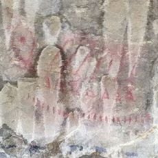
The site became known when William Clark carved his name into the stone in 1806 while exploring the region with the Lewis and Clark Expedition. This inscription remains one of the few tangible records of that historic journey.

The rock surface displays carvings from people across different eras: Native Americans left their marks, followed by fur traders, soldiers, and railroad workers who all added their own inscriptions. These overlapping marks tell the story of how this spot served as a gathering place for centuries.

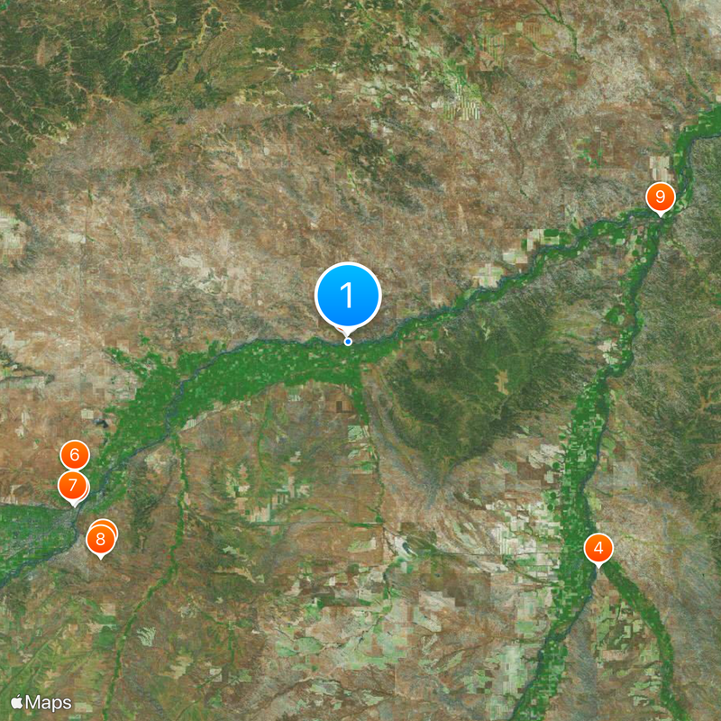
The rock is easily reached via marked trails that branch from the visitor center. The best time to visit is from May through September, when the center operates and trails are accessible.

The monument records a timeline of roughly eleven thousand years of human activity, as traces from Native Americans, traders, and later visitors layer across the entire surface. This layering creates a natural archive of visitor marks spanning many millennia.

The community of curious travelers

AroundUs brings together thousands of curated places, local tips, and hidden gems, enriched daily by 60,000 contributors worldwide.

Start exploring
Inception
2001
Operator
BLM
GPS coordinates
45.99530,-108.00600
Latest update
December 20, 2025 12:08
Unusual Montana: natural sites, historic landmarks, and craft distilleries

Montana hosts natural and historic sites ranging from the limestone gorges of Bighorn Canyon, where red cliffs rise over 300 meters, to the Makoshika badlands dotted with dinosaur fossils. Visitors explore the boiling River near Gardiner, where thermal springs blend with the cold waters of the...

Around this place
Lewis and Clark National Historic Trail
United States of America

Lewis and Clark National Historic Trail

953 m
Pictograph Cave
United States of America

Pictograph Cave

43.1 km
United States of America

Fort Custer

44.9 km
Rimrock Auto Arena at MetraPark
United States of America

Rimrock Auto Arena at MetraPark

42.5 km
Lake Elmo State Park
United States of America

Lake Elmo State Park

40.4 km
United States of America

Boothill Cemetery

42.5 km
Pictograph Cave State Park
United States of America

Pictograph Cave State Park

43.7 km
United States of America

Big Horn River Bridge

44.9 km
St. Joseph's Catholic Church
United States of America

St. Joseph's Catholic Church

42.3 km
First Baptist Church
United States of America

First Baptist Church

42.4 km
John Boyum House
United States of America

John Boyum House

42.3 km
James J. Sullivan House
United States of America

James J. Sullivan House

42.6 km
Yellowstone Kelly Interpretive Site
United States of America

Yellowstone Kelly Interpretive Site

43.4 km
United States of America

Arapooish Recreation Park

43.3 km
United States of America

Red Bluff

37.2 km
United States of America

Skeleton Cliff

43 km
United States of America

Sacrifice Cliff

43.7 km
United States of America

Rattlesnake Reservoir

34.4 km
United States of America

Eagle Rock Golf Course

33.3 km
United States of America

Huntley Golf Course

26.9 km
United States of America

Lake Hills Golf Club

42 km
United States of America

Billings Motorsports Park

36 km
United States of America

NOVA

44.9 km
United States of America

Nova Center for the Performing Arts

44.9 km
United States of America

Del Alma Gallery & Studio

45.1 km
United States of America

Scenic viewpoint

23 m
United States of America

Four Dances

43.8 km
United States of America

Scenic viewpoint

43.7 km
Show the full map
« Pompeys Pillar National Monument - Natural sandstone monument in Yellowstone County, Montana, United States » is provided by Around Us (aroundus.com). Images and texts are derived from Wikimedia project under a Creative Commons license. You are allowed to copy, distribute, and modify copies of this page, under the conditions set by the license, as long as this note is clearly visible.

Discover hidden gems everywhere you go!

From secret cafés to breathtaking viewpoints, skip the crowded tourist spots and find places that match your style. Our app makes it easy with voice search, smart filtering, route optimization, and insider tips from travelers worldwide. Download now for the complete mobile experience.

Around Us App Screenshot

A unique approach to discovering new places

Le Figaro

All the places worth exploring

France Info

A tailor-made excursion in just a few clicks

20 Minutes

Around Us
Travel Guide & Maps
Download

Send to your phone

QR Code
1

Open the camera app on your mobile.

2

Point at the QR code with your camera. A notification will appear.

3

Tap the notification to open the link.