Enable Location

We need your location to show you interesting places around you

Discover nearby places

Find interesting locations and hidden gems around you

Precise directions

Get accurate directions and distances to places

Your location is never shared with other users. It's only used when you tap the location button.

Lewis and Clark National Historic Trail

Log in to your account

Start exploring — it's free

Trusted by 61,509 travelers worldwide

Continue with Google
Continue with Apple
or

We will send you a code to connect

By continuing, you accept our Terms and Conditions and our Privacy Policy

Check your inbox

We've sent a pincode in your inbox. Please enter the code below.

Lewis and Clark National Historic Trail

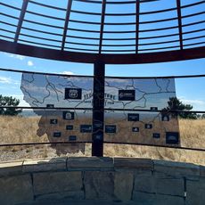
Lewis and Clark National Historic Trail, National historic trail from Pittsburgh to Pacific Ocean, United States

Description

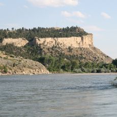
This route runs from Pittsburgh in Pennsylvania to the Pacific coast in Oregon and Washington, covering roughly 7,900 kilometers (4,900 miles) through sixteen states. The path follows the Missouri River upstream, crosses the Rocky Mountains, and then tracks the Columbia River downstream to the ocean.

History

A group led by Meriwether Lewis and William Clark left St. Louis in 1804 and reached the Pacific two years later, making contact with numerous indigenous nations along the way. The journey brought back detailed records of geography, plants, and animals that expanded knowledge of the western portion of the continent.

Culture

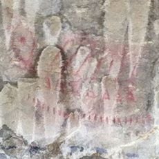
The rivers and mountain passes along this route carried names long before the Corps arrived, and many of those names remain in use by communities who still live here. Travelers encounter places where languages, trade, and ceremonies took place between different groups, and where these relationships continue today.

Practical

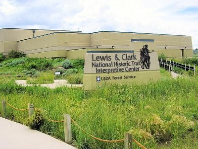
Several visitor centers along the way offer maps and information about nearby sections that can be explored on foot or by canoe. The headquarters in Omaha provides materials to help plan hikes and camping trips along selected segments.

Did you know?

In 2019 the route was expanded by an additional 1,900 kilometers (1,200 miles) running along the Ohio and Mississippi rivers, incorporating the original starting point. This expansion made it the longest route within the national system.

Location
Location
Location
Location
Location
Location
Location
Location
Location
Location
Location
Location
Location
Location
Location
Location
Inception
1978
GPS coordinates
46.00360,-108.00900
Latest update
December 14, 2025 19:49

AroundUs brings together thousands of curated places, local tips, and hidden gems, enriched daily by 60,000 contributors worldwide. Discover all places nearby (Iowa).

Around this place
Pictograph Cave
United States of America

Pictograph Cave

43.5 km
First Interstate Center
United States of America

First Interstate Center

46 km
Rimrocks
United States of America

Rimrocks

49.6 km
Moss Mansion
United States of America

Moss Mansion

46.5 km
ZooMontana
United States of America

ZooMontana

56.4 km
Little Bighorn Battlefield National Monument
United States of America

Little Bighorn Battlefield National Monument

66.1 km
Rimrock Auto Arena at MetraPark
United States of America

Rimrock Auto Arena at MetraPark

42.8 km
Lake Elmo State Park
United States of America

Lake Elmo State Park

40.6 km
Dude Rancher Lodge
United States of America

Dude Rancher Lodge

47.5 km
Northern Hotel
United States of America

Northern Hotel

45.7 km
Western Heritage Center
United States of America

Western Heritage Center

45.8 km
St. Patrick's Co-Cathedral
United States of America

St. Patrick's Co-Cathedral

46.1 km
Alberta Bair Theater
United States of America

Alberta Bair Theater

45.7 km
Pictograph Cave State Park
United States of America

Pictograph Cave State Park

44.2 km
Roundup Central School
United States of America

Roundup Central School

64.3 km
The Reef
United States of America

The Reef

54.9 km
St. Benedict's Catholic School
United States of America

St. Benedict's Catholic School

64.2 km
Prescott Commons
United States of America

Prescott Commons

47.9 km
St. Joseph's Catholic Church
United States of America

St. Joseph's Catholic Church

43.1 km
Masonic Temple
United States of America

Masonic Temple

45.7 km
First Baptist Church
United States of America

First Baptist Church

43.2 km
Austin North House
United States of America

Austin North House

45.8 km
John Boyum House
United States of America

John Boyum House

43.1 km
Billings Chamber of Commerce Building
United States of America

Billings Chamber of Commerce Building

45.5 km
Moss Mansion Museum
United States of America

Moss Mansion Museum

46.5 km
James J. Sullivan House
United States of America

James J. Sullivan House

43.4 km
Babcock Theatre
United States of America

Babcock Theatre

45.8 km
Yellowstone Kelly Interpretive Site
United States of America

Yellowstone Kelly Interpretive Site

43.6 km
Show the full map
« Lewis and Clark National Historic Trail - National historic trail from Pittsburgh to Pacific Ocean, United States » is provided by Around Us (aroundus.com). Images and texts are derived from Wikimedia project under a Creative Commons license. You are allowed to copy, distribute, and modify copies of this page, under the conditions set by the license, as long as this note is clearly visible.

Discover hidden gems everywhere you go!

From secret cafés to breathtaking viewpoints, skip the crowded tourist spots and find places that match your style. Our app makes it easy with voice search, smart filtering, route optimization, and insider tips from travelers worldwide. Download now for the complete mobile experience.

Around Us App Screenshot

A unique approach to discovering new places

Le Figaro

All the places worth exploring

France Info

A tailor-made excursion in just a few clicks

20 Minutes

Around Us
Travel Guide & Maps
Download

Send to your phone

QR Code
1

Open the camera app on your mobile.

2

Point at the QR code with your camera. A notification will appear.

3

Tap the notification to open the link.