Chest opened
+${chestReward.xp} XP
Explorer
NOUVEAU ×${chestReward.collectible.quantity}
tapez pour fermer
Chest locked

Open chests in the app

Around Us is built for your phone — chests unlock when you walk, explore and capture nearby places.

Enable Location

We need your location to show you interesting places around you

Discover nearby places

Find interesting locations and hidden gems around you

Precise directions

Get accurate directions and distances to places

Your location is never shared with other users. It's only used when you tap the location button.

Cheyenne River

Log in to your account

Start exploring — it's free

Trusted by 72,889 travelers worldwide

Continue with Google
Continue with Apple
or

We will send you a code to connect

By continuing, you accept our Terms and Conditions and our Privacy Policy

Check your inbox

We've sent a pincode in your inbox. Please enter the code below.

Cheyenne River
Discussion Reviews 1 Photos
13.1k Popularity

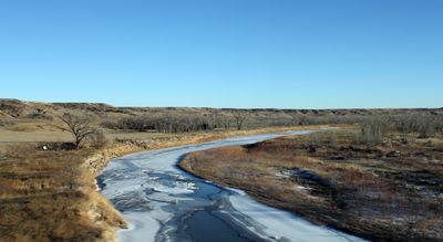
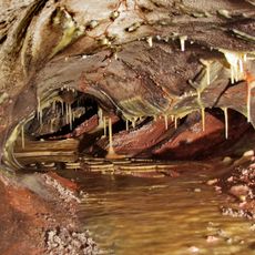
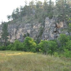
Cheyenne River, River system in Wyoming and South Dakota, US.

The Cheyenne River is a river system that flows across eastern Wyoming and western South Dakota before meeting the Missouri River at Lake Oahe. Its waters travel through diverse landscapes before reaching this major confluence point.

The river system was fundamentally altered by the construction of Angostura Dam in 1949. This dam transformed the waterway into a managed system for irrigation and flood control.

The river holds deep meaning for the Lakota people, who call it Wakpá Wašté in their language. This name reflects the long connection between the tribe and the flowing water.

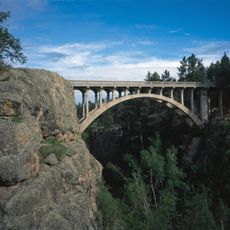
The river's water is used for agricultural irrigation and serves a large watershed area. Visitors can explore various points along the system to understand the landscape and water management infrastructure.

The river system feeds into multiple reservoirs as it travels through the region. These reservoirs play an important role in storing water for irrigation during drier times of the year.

The community of curious travelers

AroundUs brings together thousands of curated places, local tips, and hidden gems, enriched daily by 60,000 contributors worldwide.

Start exploring
GPS coordinates
43.67391,-102.91088
Latest update
December 7, 2025 20:41
Around this place
Mount Rushmore
United States of America

Mount Rushmore

49.6 km
Mount Rushmore National Memorial
United States of America

Mount Rushmore National Memorial

49.6 km
Custer State Park
United States of America

Custer State Park

41.6 km
United States of America

Stratobowl

48.5 km
Rapid City High School
United States of America

Rapid City High School

51.5 km
Keystone Wye
United States of America

Keystone Wye

51 km
Rushmore Cave
United States of America

Rushmore Cave

40.6 km
Black Hills Playhouse
United States of America

Black Hills Playhouse

44.1 km
Sitting Bull Crystal Cavern Dance Pavilion
United States of America

Sitting Bull Crystal Cavern Dance Pavilion

46.4 km
Rapid City Public Library
United States of America

Rapid City Public Library

51.8 km
Lincoln Borglum Museum
United States of America

Lincoln Borglum Museum

49.3 km
Cathedral of Our Lady of Perpetual Help
United States of America

Cathedral of Our Lady of Perpetual Help

49.9 km
O'Harra Stadium
United States of America

O'Harra Stadium

50.2 km
Church of the Immaculate Conception
United States of America

Church of the Immaculate Conception

51.4 km
Big Thunder Gold Mine
United States of America

Big Thunder Gold Mine

47.6 km
Pennington County Courthouse
United States of America

Pennington County Courthouse

51.6 km
Emmanuel Episcopal Church
United States of America

Emmanuel Episcopal Church

51.8 km
Hermosa Masonic Lodge
United States of America

Hermosa Masonic Lodge

29.3 km
The National Presidential Wax Museum
United States of America

The National Presidential Wax Museum

47.8 km
Keystone School
United States of America

Keystone School

47.7 km
Pig Tail Bridge
United States of America

Pig Tail Bridge

47.7 km
Wind Cave
United States of America

Wind Cave

47.6 km
Peter Norbeck Summer House
United States of America

Peter Norbeck Summer House

45.8 km
Wind Cave National Park Administrative and Utility Area Historic District
United States of America

Wind Cave National Park Administrative and Utility Area Historic District

47.2 km
Beaver Creek Rockshelter
United States of America

Beaver Creek Rockshelter

46.3 km
Beaver Creek Bridge
United States of America

Beaver Creek Bridge

47.6 km
Mount Coolidge Lookout Tower
United States of America

Mount Coolidge Lookout Tower

46.6 km
Peter Norbeck Outdoor Education Center
United States of America

Peter Norbeck Outdoor Education Center

39.5 km
Show the full map
Reviews
Share your experience

No review yet

Discussions
Start a discussion...

No discussion yet

« Cheyenne River - River system in Wyoming and South Dakota, US » is provided by Around Us (aroundus.com). Images and texts are derived from Wikimedia project under a Creative Commons license. You are allowed to copy, distribute, and modify copies of this page, under the conditions set by the license, as long as this note is clearly visible.

Discover hidden gems everywhere you go!

From secret cafés to breathtaking viewpoints, skip the crowded tourist spots and find places that match your style. Our app makes it easy with voice search, smart filtering, route optimization, and insider tips from travelers worldwide. Download now for the complete mobile experience.

Around Us App Screenshot

A unique approach to discovering new places

Le Figaro

All the places worth exploring

France Info

A tailor-made excursion in just a few clicks

20 Minutes

Around Us
Travel Guide & Maps
Download

Send to your phone

QR Code
1

Open the camera app on your mobile.

2

Point at the QR code with your camera. A notification will appear.

3

Tap the notification to open the link.