Enable Location

We need your location to show you interesting places around you

Discover nearby places

Find interesting locations and hidden gems around you

Precise directions

Get accurate directions and distances to places

Your location is never shared with other users. It's only used when you tap the location button.

Log in to your account

Start exploring — it's free

Trusted by 61,318 travelers worldwide

Continue with Google
Continue with Apple
or

We will send you a code to connect

By continuing, you accept our Terms and Conditions and our Privacy Policy

Check your inbox

We've sent a pincode in your inbox. Please enter the code below.

Stratobowl

Stratobowl, Natural depression launch site in Black Hills National Forest, South Dakota.

Description

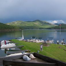
Stratobowl is a deep natural basin with limestone walls rising 400 feet on three sides, forming an enclosed valley southeast of Rapid City. The floor contains private vacation homes, while a public trail circles the rim above.

History

In 1935, Captains Stevens and Anderson launched Explorer II from this site, reaching an altitude of about 22 kilometers where they captured the first photograph of Earth's curvature. This scientific achievement made this location historic in aviation history.

Culture

The September hot air balloon event draws pilots who launch at sunrise to honor the historic Explorer mission. The natural basin creates special wind and warmth conditions that make balloon flights here particularly memorable for those who experience them.

Practical

The public area is accessible from the Rim Trailhead, where visitors can walk around the upper edge of the basin. Clear weather offers the best views, allowing you to see the entire valley floor from above.

Did you know?

The roads at the valley floor form a peace sign pattern visible from the rim trail above. This accidental design has become a quiet landmark of this former research site.

Location
GPS coordinates
43.97670,-103.34500
Latest update
December 10, 2025 16:22

AroundUs brings together thousands of curated places, local tips, and hidden gems, enriched daily by 60,000 contributors worldwide. Discover all places nearby (South Dakota).

Around this place
Mount Rushmore
United States of America

Mount Rushmore

14.2 km
Mount Rushmore National Memorial
United States of America

Mount Rushmore National Memorial

14.2 km
Dinosaur Park
United States of America

Dinosaur Park

13.7 km
Hotel Alex Johnson
United States of America

Hotel Alex Johnson

14.9 km
Rapid City High School
United States of America

Rapid City High School

14.5 km
Sheridan Lake
United States of America

Sheridan Lake

8.5 km
Keystone Wye
United States of America

Keystone Wye

9.7 km
Rushmore Cave
United States of America

Rushmore Cave

11.4 km
The Journey Museum and Gardens
United States of America

The Journey Museum and Gardens

15.9 km
Sitting Bull Crystal Cavern Dance Pavilion
United States of America

Sitting Bull Crystal Cavern Dance Pavilion

2.6 km
Rapid City Public Library
United States of America

Rapid City Public Library

14.6 km
Lincoln Borglum Museum
United States of America

Lincoln Borglum Museum

14.2 km
Cathedral of Our Lady of Perpetual Help
United States of America

Cathedral of Our Lady of Perpetual Help

13.2 km
O'Harra Stadium
United States of America

O'Harra Stadium

15.6 km
Church of the Immaculate Conception
United States of America

Church of the Immaculate Conception

14.6 km
Big Thunder Gold Mine
United States of America

Big Thunder Gold Mine

10.8 km
Pennington County Courthouse
United States of America

Pennington County Courthouse

15 km
Carnegie Public Library Building
United States of America

Carnegie Public Library Building

14.8 km
Emmanuel Episcopal Church
United States of America

Emmanuel Episcopal Church

14.5 km
Pap Madison Cabin
United States of America

Pap Madison Cabin

14.7 km
The National Presidential Wax Museum
United States of America

The National Presidential Wax Museum

11.8 km
Prairie Edge Trading Company and Galleries
United States of America

Prairie Edge Trading Company and Galleries

15 km
Keystone School
United States of America

Keystone School

10.9 km
Milwaukee Road Freight House
United States of America

Milwaukee Road Freight House

15.1 km
First Congregational Church
United States of America

First Congregational Church

14.7 km
Gambrill Storage Building
United States of America

Gambrill Storage Building

14.8 km
Rapid City Masonic Temple
United States of America

Rapid City Masonic Temple

14.7 km
Elks Theatre
United States of America

Elks Theatre

14.9 km
Show the full map
« Stratobowl - Natural depression launch site in Black Hills National Forest, South Dakota » is provided by Around Us (aroundus.com). Images and texts are derived from Wikimedia project under a Creative Commons license. You are allowed to copy, distribute, and modify copies of this page, under the conditions set by the license, as long as this note is clearly visible.

Discover hidden gems everywhere you go!

From secret cafés to breathtaking viewpoints, skip the crowded tourist spots and find places that match your style. Our app makes it easy with voice search, smart filtering, route optimization, and insider tips from travelers worldwide. Download now for the complete mobile experience.

Around Us App Screenshot

A unique approach to discovering new places

Le Figaro

All the places worth exploring

France Info

A tailor-made excursion in just a few clicks

20 Minutes

Around Us
Travel Guide & Maps
Download

Send to your phone

QR Code
1

Open the camera app on your mobile.

2

Point at the QR code with your camera. A notification will appear.

3

Tap the notification to open the link.