Keystone Wye

Log in to your account

AroundUs is a community-driven map of interesting places, built by curious explorers like you. It grows with every review, story, and photo you share.
Connect to save your favorite spots, contribute locations, and create personalized routes.
Continue with Google
Continue with Apple
Continue with X
Continue with Facebook
Continue with email
By continuing, you accept our Terms and Conditions and our Privacy Policy
Create an account
Add to collection
Map
Suggest a change
Share

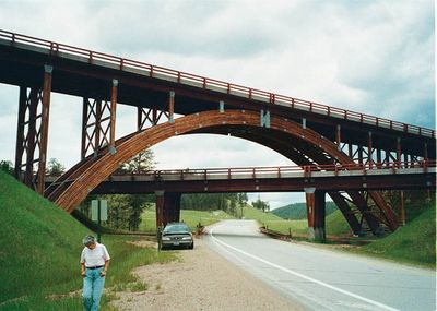
Keystone Wye, Road interchange in Black Hills, South Dakota

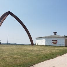
The Keystone Wye is a road interchange in the Black Hills that connects U.S. Route 16 and US 16A using two glued laminated timber arches spanning three levels. The structure uses wooden components to carry traffic across different elevations.

Engineers Clyde Jundt and Kenneth C. Wilson designed this infrastructure in 1967 using wooden arches as primary structural elements. It was built to support Norbeck's vision of a modern route through the Black Hills.

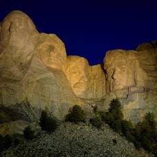
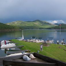
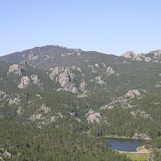
The interchange name comes from Senator Peter Norbeck's 1930s road system, which linked tourist destinations like Mount Rushmore and Black Elk Peak. This connection was part of a larger plan to open up the Black Hills to travelers.

When visiting, remember that this is a functional road interchange designed for through traffic. A 2021 renovation updated the wooden decks and asphalt surfaces, ensuring the structure remains safe and passable.

Three wooden arch pieces that failed quality inspections were repurposed into a pyramidal sculpture. The artwork was later relocated near the Sitting Bull Crystal Cavern Dance Pavilion.

Location: South Dakota

GPS coordinates: 43.92470,-103.44200

Latest update: December 11, 2025 18:07

Photos
Around this place
Mount Rushmore
United States of America

Mount Rushmore

5.3 km
Crazy Horse Memorial
United States of America

Crazy Horse Memorial

17.5 km
Mount Rushmore National Memorial
United States of America

Mount Rushmore National Memorial

5.2 km
Needles
United States of America

Needles

13 km
Black Elk Peak
United States of America

Black Elk Peak

9.7 km
Custer State Park
United States of America

Custer State Park

20 km
Pactola Lake
United States of America

Pactola Lake

17 km
United States of America

Stratobowl

9.7 km
Black Hills Institute of Geological Research, Inc.
United States of America

Black Hills Institute of Geological Research, Inc.

10.8 km
Sheridan Lake
United States of America

Sheridan Lake

5.6 km
Black Elk Wilderness
United States of America

Black Elk Wilderness

11.1 km
Rushmore Cave
United States of America

Rushmore Cave

10.4 km
Black Hills Playhouse
United States of America

Black Hills Playhouse

13.2 km
Sitting Bull Crystal Cavern Dance Pavilion
United States of America

Sitting Bull Crystal Cavern Dance Pavilion

11.6 km
Crazy Horse Memorial
United States of America

Crazy Horse Memorial

18.6 km
Lincoln Borglum Museum
United States of America

Lincoln Borglum Museum

5.4 km
Big Thunder Gold Mine
United States of America

Big Thunder Gold Mine

3.9 km
1881 Courthouse Museum
United States of America

1881 Courthouse Museum

21.8 km
Hermosa Masonic Lodge
United States of America

Hermosa Masonic Lodge

22.1 km
The National Presidential Wax Museum
United States of America

The National Presidential Wax Museum

4.2 km
Keystone School
United States of America

Keystone School

3.7 km
Peter Norbeck Summer House
United States of America

Peter Norbeck Summer House

13.7 km
Custer County Courthouse
United States of America

Custer County Courthouse

21.8 km
Black Elk Peak Lookout Tower
United States of America

Black Elk Peak Lookout Tower

9.7 km
Mount Coolidge Lookout Tower
United States of America

Mount Coolidge Lookout Tower

20.3 km
Sunday Gulch Trail
United States of America

Sunday Gulch Trail

13.3 km
Peter Norbeck Outdoor Education Center
United States of America

Peter Norbeck Outdoor Education Center

18.3 km
Civilian Conservation Corps Museum
United States of America

Civilian Conservation Corps Museum

9.7 km
Show the full map
Reviews

Visited this place? Tap the stars to rate it and share your experience / photos with the community! Try now! You can cancel it anytime.

« Keystone Wye - Road interchange in Black Hills, South Dakota » is provided by Around Us (aroundus.com). Images and texts are derived from Wikimedia project under a Creative Commons license. You are allowed to copy, distribute, and modify copies of this page, under the conditions set by the license, as long as this note is clearly visible.

Discover hidden gems everywhere you go!

From secret cafés to breathtaking viewpoints, skip the crowded tourist spots and find places that match your style. Our app makes it easy with voice search, smart filtering, route optimization, and insider tips from travelers worldwide. Download now for the complete mobile experience.

Around Us App Screenshot

A unique approach to discovering new places

Le Figaro

All the places worth exploring

France Info

A tailor-made excursion in just a few clicks

20 Minutes