Black Elk Wilderness

Log in to your account

AroundUs is a community-driven map of interesting places, built by curious explorers like you. It grows with every review, story, and photo you share.
Connect to save your favorite spots, contribute locations, and create personalized routes.
Continue with Google
Continue with Apple
Continue with X
Continue with Facebook
Continue with email
By continuing, you accept our Terms and Conditions and our Privacy Policy
Create an account
Add to collection
Map
Suggest a change
Share

Black Elk Wilderness, Protected wilderness area in Black Hills National Forest, South Dakota.

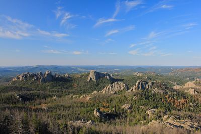
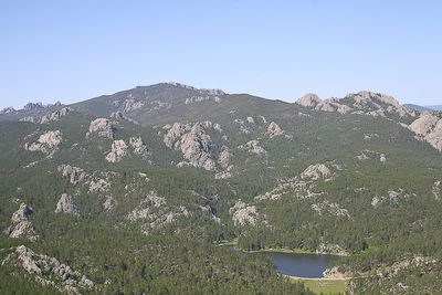
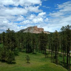
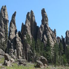
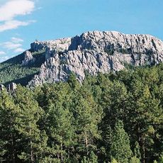
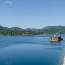
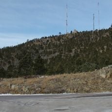
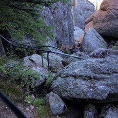
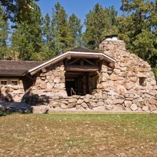
Black Elk Wilderness is a protected area within Black Hills National Forest in South Dakota, featuring dense forests, steep canyons, and granite peaks. The terrain varies from forested slopes to rocky outcrops higher up, creating diverse habitats across its expanse.

Congress designated this area in 1980 as a protected wilderness under the National Wilderness Preservation System. This action was taken to ensure that the natural landscape would remain relatively unchanged.

The land takes its name from Black Elk, an Oglala Lakota spiritual leader whose teachings and connection to this place remain deeply meaningful. For many visitors, these forests and peaks represent a space where people feel connected to something larger than themselves.

Motorized vehicles and mechanical equipment are not allowed anywhere in the wilderness, so travel is only on foot or horseback. You will need permits for camping and fishing, which should be arranged before your visit.

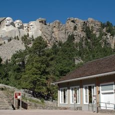
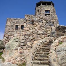
South Dakota's highest point is located within these boundaries, and from its summit you can see across four different states. This unique vantage point draws many hikers who want to experience this rare perspective.

Location: South Dakota

Inception: 1980

Operator: United States Forest Service

Part of: Black Hills National Forest, National Wilderness Preservation System

Shares border with: Custer State Park

Website: http://fs.usda.gov/recarea/blackhills/recarea/?recid=80906

GPS coordinates: 43.85000,-103.53300

Latest update: December 11, 2025 11:02

Photos
Around this place
Mount Rushmore
United States of America

Mount Rushmore

6.7 km
Crazy Horse Memorial
United States of America

Crazy Horse Memorial

7.4 km
Mount Rushmore National Memorial
United States of America

Mount Rushmore National Memorial

6.8 km
Needles
United States of America

Needles

1.9 km
Black Elk Peak
United States of America

Black Elk Peak

1.8 km
Custer State Park
United States of America

Custer State Park

14.8 km
Pactola Lake
United States of America

Pactola Lake

25 km
United States of America

Stratobowl

20.6 km
Black Hills Institute of Geological Research, Inc.
United States of America

Black Hills Institute of Geological Research, Inc.

9.9 km
Sheridan Lake
United States of America

Sheridan Lake

15.4 km
Keystone Wye
United States of America

Keystone Wye

11.1 km
Rushmore Cave
United States of America

Rushmore Cave

16.4 km
Black Hills Playhouse
United States of America

Black Hills Playhouse

9.7 km
Pactola Dam
United States of America

Pactola Dam

24.9 km
Sitting Bull Crystal Cavern Dance Pavilion
United States of America

Sitting Bull Crystal Cavern Dance Pavilion

22.3 km
Crazy Horse Memorial
United States of America

Crazy Horse Memorial

8.3 km
Lincoln Borglum Museum
United States of America

Lincoln Borglum Museum

6.9 km
Big Thunder Gold Mine
United States of America

Big Thunder Gold Mine

10.6 km
1881 Courthouse Museum
United States of America

1881 Courthouse Museum

10.8 km
The National Presidential Wax Museum
United States of America

The National Presidential Wax Museum

9.6 km
Keystone School
United States of America

Keystone School

10.4 km
Peter Norbeck Summer House
United States of America

Peter Norbeck Summer House

8.4 km
Garlock Building
United States of America

Garlock Building

10.5 km
Custer County Courthouse
United States of America

Custer County Courthouse

10.8 km
Black Elk Peak Lookout Tower
United States of America

Black Elk Peak Lookout Tower

1.8 km
Mount Coolidge Lookout Tower
United States of America

Mount Coolidge Lookout Tower

12.4 km
Sunday Gulch Trail
United States of America

Sunday Gulch Trail

3 km
Peter Norbeck Outdoor Education Center
United States of America

Peter Norbeck Outdoor Education Center

15.2 km
Show the full map
Reviews

Visited this place? Tap the stars to rate it and share your experience / photos with the community! Try now! You can cancel it anytime.

« Black Elk Wilderness - Protected wilderness area in Black Hills National Forest, South Dakota » is provided by Around Us (aroundus.com). Images and texts are derived from Wikimedia project under a Creative Commons license. You are allowed to copy, distribute, and modify copies of this page, under the conditions set by the license, as long as this note is clearly visible.

Discover hidden gems everywhere you go!

From secret cafés to breathtaking viewpoints, skip the crowded tourist spots and find places that match your style. Our app makes it easy with voice search, smart filtering, route optimization, and insider tips from travelers worldwide. Download now for the complete mobile experience.

Around Us App Screenshot

A unique approach to discovering new places

Le Figaro

All the places worth exploring

France Info

A tailor-made excursion in just a few clicks

20 Minutes