Enable Location

We need your location to show you interesting places around you

Discover nearby places

Find interesting locations and hidden gems around you

Precise directions

Get accurate directions and distances to places

Your location is never shared with other users. It's only used when you tap the location button.

Log in to your account

Start exploring — it's free

Trusted by 61,909 travelers worldwide

Continue with Google
Continue with Apple
or

We will send you a code to connect

By continuing, you accept our Terms and Conditions and our Privacy Policy

Check your inbox

We've sent a pincode in your inbox. Please enter the code below.

Sully Creek State Park

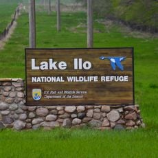
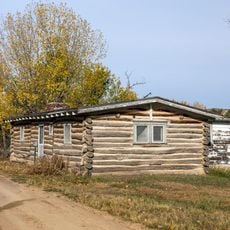
Sully Creek State Park, State park near Medora, US

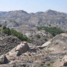
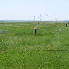
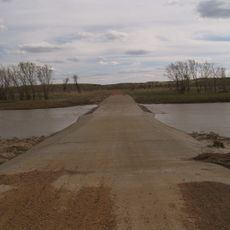
Sully Creek State Park is a 63-acre park situated along the eastern banks of the Little Missouri River in North Dakota's Badlands region. The grounds feature camping areas, equestrian corrals, shower facilities, and an RV dump station for visitors.

The park was established in 1970 and originally named after General Alfred Sully, a military figure from the region's past. In 2024, it was renamed Rough Rider State Park to reflect a new direction.

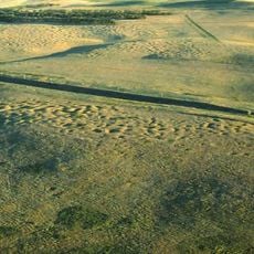
The park serves as a starting point for the Maah Daah Hey Trail, a popular hiking route that runs through the Badlands. This path connects visitors with the rugged grassland landscape and draws hikers and riders looking to experience the region's natural terrain.

The park is accessible by car or on foot and offers multiple overnight options to suit different needs. Plan enough time to explore the trails and fully experience the landscape.

Horseback riders are required to use certified weed-free feed to protect the ecological balance of the grassland areas. This requirement demonstrates how the park combines recreation with environmental stewardship.

The community of curious travelers

AroundUs brings together thousands of curated places, local tips, and hidden gems, enriched daily by 60,000 contributors worldwide.

Start exploring
Location
Inception
1970
GPS coordinates
46.89220,-103.53800
Latest update
December 14, 2025 14:26
Around this place
United States of America

Medora Musical

2.5 km
Elkhorn Ranch
United States of America

Elkhorn Ranch

38.5 km
Makoshika State Park
United States of America

Makoshika State Park

89.6 km
Theodore Roosevelt's Maltese Cross Cabin
United States of America

Theodore Roosevelt's Maltese Cross Cabin

2.9 km
Chateau de Mores
United States of America

Chateau de Mores

2.1 km
Lake Ilo National Wildlife Refuge
United States of America

Lake Ilo National Wildlife Refuge

81.2 km
Grassy Butte Post Office
United States of America

Grassy Butte Post Office

60.1 km
Fort Dilts
United States of America

Fort Dilts

70.7 km
De Mores Packing Plant Ruins
United States of America

De Mores Packing Plant Ruins

2.8 km
Peaceful Valley Ranch
United States of America

Peaceful Valley Ranch

7.9 km
Von Hoffman House
United States of America

Von Hoffman House

2.7 km
Dickinson Museum Center
United States of America

Dickinson Museum Center

57.4 km
Lynch Quarry Site
United States of America

Lynch Quarry Site

86.2 km
Saints Peter and Paul Church
United States of America

Saints Peter and Paul Church

51.2 km
St. Mary's Catholic Church
United States of America

St. Mary's Catholic Church

2.8 km
Billings County Courthouse
United States of America

Billings County Courthouse

2.6 km
Mystic Theatre
United States of America

Mystic Theatre

72.6 km
Initial Rock
United States of America

Initial Rock

13.5 km
St. Peter's Catholic Church
United States of America

St. Peter's Catholic Church

50.8 km
Dickinson Public Library
United States of America

Dickinson Public Library

57.1 km
Stark County Courthouse
United States of America

Stark County Courthouse

57.4 km
Original Slope County Courthouse
United States of America

Original Slope County Courthouse

48.6 km
Golden Valley County Courthouse
United States of America

Golden Valley County Courthouse

35.5 km
Wibaux Commercial Historic District
United States of America

Wibaux Commercial Historic District

50.5 km
Fallon County Jail
United States of America

Fallon County Jail

81.7 km
Glendive Dinosaur & Fossil Museum
United States of America

Glendive Dinosaur & Fossil Museum

91.3 km
Elkhorn Ranch State Historic Site
United States of America

Elkhorn Ranch State Historic Site

40.7 km
Three V Crossing
United States of America

Three V Crossing

42.1 km
Show the full map
« Sully Creek State Park - State park near Medora, US » is provided by Around Us (aroundus.com). Images and texts are derived from Wikimedia project under a Creative Commons license. You are allowed to copy, distribute, and modify copies of this page, under the conditions set by the license, as long as this note is clearly visible.

Discover hidden gems everywhere you go!

From secret cafés to breathtaking viewpoints, skip the crowded tourist spots and find places that match your style. Our app makes it easy with voice search, smart filtering, route optimization, and insider tips from travelers worldwide. Download now for the complete mobile experience.

Around Us App Screenshot

A unique approach to discovering new places

Le Figaro

All the places worth exploring

France Info

A tailor-made excursion in just a few clicks

20 Minutes

Around Us
Travel Guide & Maps
Download

Send to your phone

QR Code
1

Open the camera app on your mobile.

2

Point at the QR code with your camera. A notification will appear.

3

Tap the notification to open the link.