Interior Plains, Physiographic province in central North America.
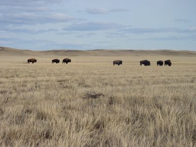
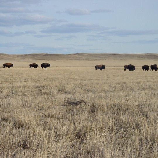
The Interior Plains is a physiographic region of eight provinces spanning the Laurentian craton of central North America, from the Gulf Coast to the Beaufort Sea along the east flank of the Rocky Mountains. In Canada it takes in the Canadian Prairies, the Boreal Plains and the Taiga Plains east of the Mackenzie and Richardson Mountains; in the United States, the Great Plains and the tallgrass prairie south of the Great Lakes. The photograph shows dry pale yellow grass running to a low horizon, with a band of rounded brown and gray hills beyond.
This province formed between 2000 and 1800 million years ago when several ancient rock plates merged together. During the late Cretaceous, a shallow inland sea divided the region and left marine deposits still visible in the soil today.
The open grasslands shaped how communities hunted and traded across the territory for centuries. Traces of old trails and settlements remain visible across the flat terrain today.
The plains run from the Gulf Coast to the Beaufort Sea along the east flank of the Rocky Mountains, crossing the Canadian Prairies and the U.S. Great Plains. The Laurentide Ice Sheet left kettle lakes and scoured sediment pockets across the northern section. Travel is easiest where rivers and roads follow the flat glacial terrain.
The Western Interior Seaway, which flooded almost all of the plains west of today's Mississippi River during the Cretaceous, left limestone-shale couplets and carbonate layers in the sedimentary record. The Sundance Sea had earlier covered parts of Wyoming, Montana and the Dakotas. The Black Hills of South Dakota are the only remaining outcrops of the Trans-Hudson Orogeny within the plains.
The community of curious travelers
AroundUs brings together thousands of curated places, local tips, and hidden gems, enriched daily by 92,657 contributors worldwide.