Chest opened
+${chestReward.xp} XP
Explorer
NOUVEAU ×${chestReward.collectible.quantity}
tapez pour fermer
Chest locked

Open chests in the app

Around Us is built for your phone — chests unlock when you walk, explore and capture nearby places.

Enable Location

We need your location to show you interesting places around you

Discover nearby places

Find interesting locations and hidden gems around you

Precise directions

Get accurate directions and distances to places

Your location is never shared with other users. It's only used when you tap the location button.

Log in to your account

Start exploring — it's free

Trusted by 72,987 travelers worldwide

Continue with Google
Continue with Apple
or

We will send you a code to connect

By continuing, you accept our Terms and Conditions and our Privacy Policy

Check your inbox

We've sent a pincode in your inbox. Please enter the code below.

Coronation Island Wilderness
Discussion Reviews Photo
1.2k Popularity

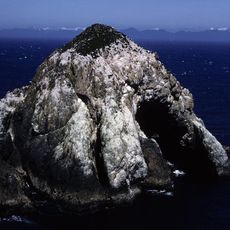
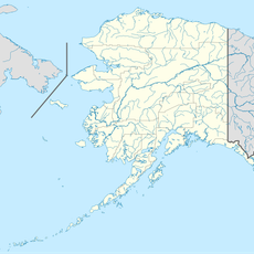
Coronation Island Wilderness, Protected wilderness area in southeastern Alaska, United States.

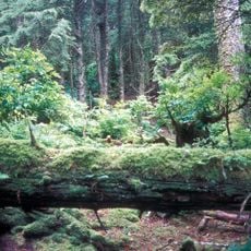
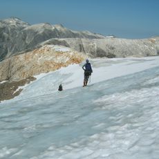
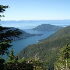
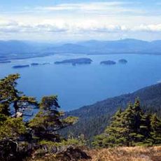
Coronation Island is a wilderness area of 19,232 acres covered in temperate rainforest, with Sitka spruce and western hemlock trees descending sharply to steep coastal cliffs. The remote location has preserved the forest and wildlife in their natural state.

The island received its name from British navigator George Vancouver in 1793, who chose it to commemorate an important royal anniversary. Since then it has remained a remote and largely undisturbed landscape.

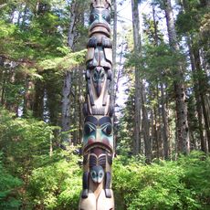
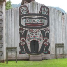
The Tlingit people relied on this area for seasonal food gathering, and their traditional use of the land remains visible in local place names and stories passed down through families.

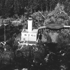
Visitors can only reach the island by floatplane or small boat when weather permits, as there are no developed facilities or amenities on site. Planning ahead and self-sufficiency are essential for any visit.

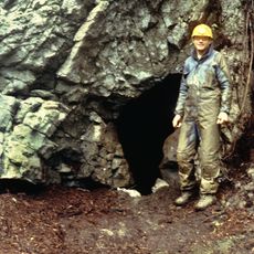
The Colander Cave holds brown bear fossils that are more than 11,000 years old, offering rare evidence of ancient animal life in the region. This cave discovery remains little known among most visitors to the area.

The community of curious travelers

AroundUs brings together thousands of curated places, local tips, and hidden gems, enriched daily by 60,000 contributors worldwide.

Start exploring
Location
GPS coordinates
55.86610,-134.22900
Latest update
December 14, 2025 18:46
Around this place
Sitka National Historical Park
United States of America

Sitka National Historical Park

147.4 km
On Your Knees Cave
United States of America

On Your Knees Cave

65.3 km
Blue Lake
United States of America

Blue Lake

146.1 km
Forrester Island Wilderness
United States of America

Forrester Island Wilderness

126.4 km
Baranof Cross-Island Trail
United States of America

Baranof Cross-Island Trail

140 km
Cape Decision Light
United States of America

Cape Decision Light

16.2 km
Kuiu Wilderness and Tebenkof Bay Wilderness
United States of America

Kuiu Wilderness and Tebenkof Bay Wilderness

47.9 km
Sitka National Cemetery
United States of America

Sitka National Cemetery

147.9 km
Kake Cannery
United States of America

Kake Cannery

123.6 km
Hazy Islands Wilderness
United States of America

Hazy Islands Wilderness

22.2 km
Sons of Norway Hall
United States of America

Sons of Norway Hall

131.2 km
Chief Shakes Historic Site
United States of America

Chief Shakes Historic Site

93.9 km
Lincoln Rock Light
United States of America

Lincoln Rock Light

97.7 km
United States of America

Mount Furuhelm

138.6 km
St. Philip's Episcopal Church
United States of America

St. Philip's Episcopal Church

133.1 km
Chief Son-I-Hat's Whale House and Totems Historic District
United States of America

Chief Son-I-Hat's Whale House and Totems Historic District

119.2 km
Duncan Canal
United States of America

Duncan Canal

99.4 km
W.P. Mills House
United States of America

W.P. Mills House

147.9 km
Etolin Canoe
United States of America

Etolin Canoe

116 km
M/V Chugach Ranger
United States of America

M/V Chugach Ranger

130.6 km
Helm Rock
United States of America

Helm Rock

66.6 km
United States of America

Beta Rock

47.5 km
United States of America

McHenry Ledge

120.9 km
United States of America

Simpson Rock

145.7 km
United States of America

Bibb Shoal

111.9 km
United States of America

Breakfast Rock

47.6 km
Tlevak Strait-Suemez Is.
United States of America

Tlevak Strait-Suemez Is.

90.1 km
United States of America

Balandra Shoal

76.4 km
Show the full map
Reviews
Share your experience

No review yet

Discussions
Start a discussion...

No discussion yet

« Coronation Island Wilderness - Protected wilderness area in southeastern Alaska, United States » is provided by Around Us (aroundus.com). Images and texts are derived from Wikimedia project under a Creative Commons license. You are allowed to copy, distribute, and modify copies of this page, under the conditions set by the license, as long as this note is clearly visible.

Discover hidden gems everywhere you go!

From secret cafés to breathtaking viewpoints, skip the crowded tourist spots and find places that match your style. Our app makes it easy with voice search, smart filtering, route optimization, and insider tips from travelers worldwide. Download now for the complete mobile experience.

Around Us App Screenshot

A unique approach to discovering new places

Le Figaro

All the places worth exploring

France Info

A tailor-made excursion in just a few clicks

20 Minutes

Around Us
Travel Guide & Maps
Download

Send to your phone

QR Code
1

Open the camera app on your mobile.

2

Point at the QR code with your camera. A notification will appear.

3

Tap the notification to open the link.