Juneau-Douglas Bridge, Two-lane bridge in Juneau, US
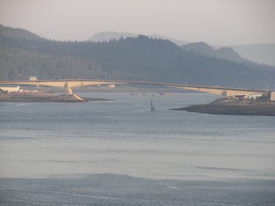
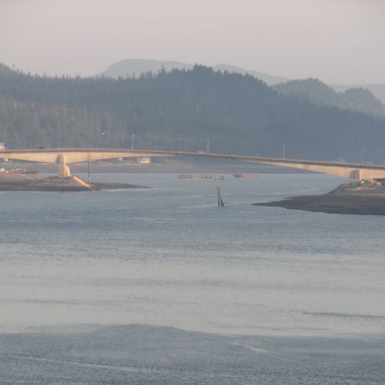
The Juneau-Douglas Bridge is a prestressed concrete girder bridge over the Gastineau Channel, linking mainland Juneau with Douglas Island. Its deck is 20.2 metres wide and its main span measures 189 metres. At zero tide the deck stands 66.4 feet (20.2 m) above the waterline, and the bridge carries a two-lane road with pedestrian and bicycle access.
The original bridge was built in 1935 using federal New Deal funding and served the community until 1980. It was then replaced with the current structure to handle growing traffic in the region.
Before the first bridge, Douglas Island residents rowed across the Gastineau Channel, where strong currents occur at times. The 1935 cantilever steel truss span was built outward from both banks, and its opening was celebrated on October 13, 1935. For a time the old and new bridges stood side by side until the 1935 structure was demolished in 1981.
The current bridge carries a two-lane road shared by vehicles and pedestrians, plus a bike path; there are no separate lanes. At zero tide the deck stands 66.4 feet (20.2 m) above the waterline. The bridge forms a no-wake zone on its north side, and strong currents can run beneath it.
The bridge deck sits 66.4 feet (20.2 m) above the waterline at zero tide. A spring Dolly Varden fishery lies directly beneath the span, and the bridge creates a no-wake zone on its north side.
The community of curious travelers
AroundUs brings together thousands of curated places, local tips, and hidden gems, enriched daily by 94,117 contributors worldwide.