Enable Location

We need your location to show you interesting places around you

Discover nearby places

Find interesting locations and hidden gems around you

Precise directions

Get accurate directions and distances to places

Your location is never shared with other users. It's only used when you tap the location button.

Panhandle

Log in to your account

Start exploring — it's free

Trusted by 63,440 travelers worldwide

Continue with Google
Continue with Apple
or

We will send you a code to connect

By continuing, you accept our Terms and Conditions and our Privacy Policy

Check your inbox

We've sent a pincode in your inbox. Please enter the code below.

Discussion Reviews 1 Photos
18.8k Popularity

Panhandle, town in Texas, United States

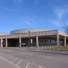
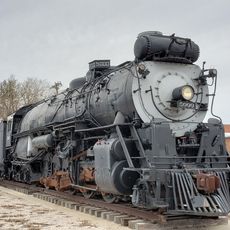
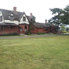
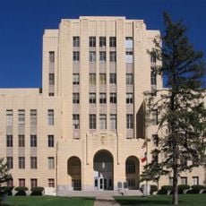
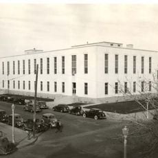
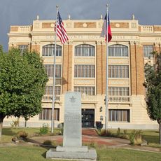
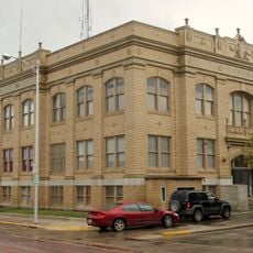
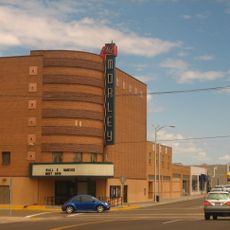
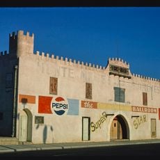
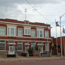
Panhandle is a small town in Carson County, Texas, located at the crossroads of US 60 and Highway 207. Downtown features red brick buildings from earlier periods, including the old 1928 train station that now serves as City Hall, and the 1950 courthouse with simple functional design.

The town began in the 1880s as Carson City when settlers arrived for farming and ranching, with the railroad reaching the area in 1887. In 1888, Carson County was established and the town became the county seat, taking the name Panhandle to match the region's nickname.

The name Panhandle comes from the shape of this Texas region and was officially chosen in 1888. The town keeps this identity alive through local buildings and the way people maintain stories of the settlers who built farms and communities here.

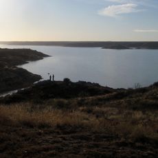
Panhandle is located roughly 29 miles northeast of Amarillo and is easily reached by highway. Most important sites lie in or near downtown and are walkable, or visitors can drive to see additional spots like the memorial sign along the highway outside town.

A man named Thomas Cree planted the town's first tree, a bois d'arc, in 1888, and it survived many droughts and storms. This modest event became a local story, and a new tree was planted in the 1990s as a memorial to this earliest planting.

The community of curious travelers

AroundUs brings together thousands of curated places, local tips, and hidden gems, enriched daily by 60,000 contributors worldwide.

Start exploring
Location
Elevation above the sea
1,054 m
GPS coordinates
35.34750,-101.38200
Latest update
February 16, 2026 23:20
Around this place
United States of America

American Quarter Horse Hall of Fame

42.3 km
Lake Meredith
United States of America

Lake Meredith

43.7 km
Amarillo Civic Center
United States of America

Amarillo Civic Center

43.7 km
Leaning Tower of Britten
United States of America

Leaning Tower of Britten

31.9 km
Atchison, Topeka and Santa Fe Railway 5000
United States of America

Atchison, Topeka and Santa Fe Railway 5000

43.5 km
Wonderland Park
United States of America

Wonderland Park

42.6 km
Chase Tower
United States of America

Chase Tower

44.4 km
Santa Fe Building
United States of America

Santa Fe Building

44.4 km
Amarillo National Bank Sox Stadium
United States of America

Amarillo National Bank Sox Stadium

41.1 km
McClellan Creek National Grassland
United States of America

McClellan Creek National Grassland

49 km
Texas Air & Space Museum
United States of America

Texas Air & Space Museum

32.4 km
Texas Tornado
United States of America

Texas Tornado

42.5 km
Amarillo Museum of Art
United States of America

Amarillo Museum of Art

45.6 km
Charles and Mary Ann Goodnight Ranch House
United States of America

Charles and Mary Ann Goodnight Ranch House

39.7 km
Potter County Courthouse
United States of America

Potter County Courthouse

44 km
Carson County Square House Museum
United States of America

Carson County Square House Museum

230 m
Sacred Heart Cathedral
United States of America

Sacred Heart Cathedral

44.2 km
J. Marvin Jones Federal Building and United States Courthouse
United States of America

J. Marvin Jones Federal Building and United States Courthouse

43.9 km
Cruz Gigante de Groom
United States of America

Cruz Gigante de Groom

28.1 km
Gray County Courthouse
United States of America

Gray County Courthouse

43.4 km
Courtyard by Marriott, Downtown Amarillo
United States of America

Courtyard by Marriott, Downtown Amarillo

44.3 km
Pampa City Hall
United States of America

Pampa City Hall

43.4 km
Freedom Museum USA
United States of America

Freedom Museum USA

42.8 km
Llano Cemetery
United States of America

Llano Cemetery

44.4 km
Morley Theatre
United States of America

Morley Theatre

36.2 km
Amarillo Natatorium
United States of America

Amarillo Natatorium

46.6 km
White Deer Land Company Building
United States of America

White Deer Land Company Building

43.5 km
Amarillo Globe Dream House
United States of America

Amarillo Globe Dream House

45.9 km
Show the full map
Reviews
Share your experience

No review yet

Discussions
Start a discussion...

No discussion yet

« Panhandle - town in Texas, United States » is provided by Around Us (aroundus.com). Images and texts are derived from Wikimedia project under a Creative Commons license. You are allowed to copy, distribute, and modify copies of this page, under the conditions set by the license, as long as this note is clearly visible.

Discover hidden gems everywhere you go!

From secret cafés to breathtaking viewpoints, skip the crowded tourist spots and find places that match your style. Our app makes it easy with voice search, smart filtering, route optimization, and insider tips from travelers worldwide. Download now for the complete mobile experience.

Around Us App Screenshot

A unique approach to discovering new places

Le Figaro

All the places worth exploring

France Info

A tailor-made excursion in just a few clicks

20 Minutes

Around Us
Travel Guide & Maps
Download

Send to your phone

QR Code
1

Open the camera app on your mobile.

2

Point at the QR code with your camera. A notification will appear.

3

Tap the notification to open the link.