Enable Location

We need your location to show you interesting places around you

Discover nearby places

Find interesting locations and hidden gems around you

Precise directions

Get accurate directions and distances to places

Your location is never shared with other users. It's only used when you tap the location button.

Log in to your account

Start exploring — it's free

Trusted by 63,418 travelers worldwide

Continue with Google
Continue with Apple
or

We will send you a code to connect

By continuing, you accept our Terms and Conditions and our Privacy Policy

Check your inbox

We've sent a pincode in your inbox. Please enter the code below.

Meade State Park
Discussion Reviews Photo
1.5k Popularity

Meade State Park, State park in Meade County, Kansas, US.

Meade State Park is a state-managed natural area covering about 800 acres in Meade County, with a lake of roughly 80 acres at its center. The lake is stocked with fish and surrounded by open grounds and trees that give the park its character.

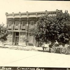
The park was established in 1927 from land that was once part of the Turkey Track Ranch to provide outdoor recreation for Kansas residents. This conversion marked an early effort to create public outdoor spaces in the state.

The park serves as a central gathering place for outdoor activities, with designated areas for hunting dove and quail, plus spaces for wildlife observation.

The park provides campsites with utility connections and primitive camping options distributed throughout the grounds. It is wise to check conditions and availability before visiting, especially if you have specific accommodation needs.

A fish hatchery facility sits west of the lake and operates from April through June, demonstrating fish breeding in controlled tanks. This breeding program reflects ongoing efforts to maintain fish populations in the area.

The community of curious travelers

AroundUs brings together thousands of curated places, local tips, and hidden gems, enriched daily by 60,000 contributors worldwide.

Start exploring
Location
GPS coordinates
37.17220,-100.45100
Latest update
December 14, 2025 14:40
Around this place
Long Branch Saloon
United States of America

Long Branch Saloon

74.8 km
Dalton Gang Hideout and Museum
United States of America

Dalton Gang Hideout and Museum

15.7 km
Big Basin Prairie Preserve
United States of America

Big Basin Prairie Preserve

40.9 km
Fort Dodge
United States of America

Fort Dodge

77.1 km
Lee Richardson Zoo
United States of America

Lee Richardson Zoo

95.3 km
Santa Fe Trail Remains
United States of America

Santa Fe Trail Remains

72.5 km
Cathedral of Our Lady of Guadalupe
United States of America

Cathedral of Our Lady of Guadalupe

78.3 km
Cimarron Hotel
United States of America

Cimarron Hotel

71.4 km
Fromme-Birney Round Barn
United States of America

Fromme-Birney Round Barn

92.3 km
Sacred Heart Cathedral
United States of America

Sacred Heart Cathedral

75.5 km
Dodge City Public Library
United States of America

Dodge City Public Library

75.2 km
Fowler Swimming Pool and Bathhouse
United States of America

Fowler Swimming Pool and Bathhouse

33 km
Protection High School
United States of America

Protection High School

86.1 km
Old Gray County Courthouse
United States of America

Old Gray County Courthouse

71.2 km
Dorothy's House and Land of Oz
United States of America

Dorothy's House and Land of Oz

43.6 km
Stockgrowers State Bank
United States of America

Stockgrowers State Bank

60.5 km
Buffalo Hotel
United States of America

Buffalo Hotel

96.1 km
Parrot Cove
United States of America

Parrot Cove

95.4 km
Stein House
United States of America

Stein House

61 km
Hooker Woodframe Grain Elevator
United States of America

Hooker Woodframe Grain Elevator

75.6 km
Hope House
United States of America

Hope House

95.9 km
Girl Scout Little House
United States of America

Girl Scout Little House

60.3 km
Welborn 'Doc' Barton House
United States of America

Welborn 'Doc' Barton House

73.3 km
Ashland Grade School
United States of America

Ashland Grade School

60.6 km
Finney County Point of Rocks
United States of America

Finney County Point of Rocks

84.7 km
Harper County Courthouse
United States of America

Harper County Courthouse

82.3 km
Grant County Courthouse District
United States of America

Grant County Courthouse District

92.1 km
Long Branch Lagoon
United States of America

Long Branch Lagoon

74.6 km
Show the full map
Reviews
Share your experience

No review yet

Discussions
Start a discussion...

No discussion yet

« Meade State Park - State park in Meade County, Kansas, US » is provided by Around Us (aroundus.com). Images and texts are derived from Wikimedia project under a Creative Commons license. You are allowed to copy, distribute, and modify copies of this page, under the conditions set by the license, as long as this note is clearly visible.

Discover hidden gems everywhere you go!

From secret cafés to breathtaking viewpoints, skip the crowded tourist spots and find places that match your style. Our app makes it easy with voice search, smart filtering, route optimization, and insider tips from travelers worldwide. Download now for the complete mobile experience.

Around Us App Screenshot

A unique approach to discovering new places

Le Figaro

All the places worth exploring

France Info

A tailor-made excursion in just a few clicks

20 Minutes

Around Us
Travel Guide & Maps
Download

Send to your phone

QR Code
1

Open the camera app on your mobile.

2

Point at the QR code with your camera. A notification will appear.

3

Tap the notification to open the link.