Enable Location

We need your location to show you interesting places around you

Discover nearby places

Find interesting locations and hidden gems around you

Precise directions

Get accurate directions and distances to places

Your location is never shared with other users. It's only used when you tap the location button.

Fort Dodge

Log in to your account

Start exploring — it's free

Trusted by 62,506 travelers worldwide

Continue with Google
Continue with Apple
or

We will send you a code to connect

By continuing, you accept our Terms and Conditions and our Privacy Policy

Check your inbox

We've sent a pincode in your inbox. Please enter the code below.

Fort Dodge

Fort Dodge, Military fort in Ford County, Kansas

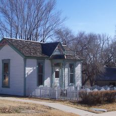
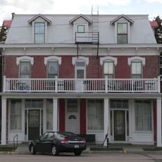
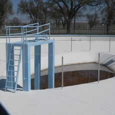
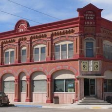
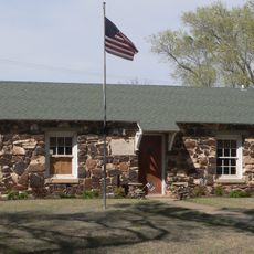
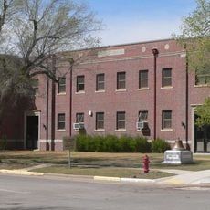
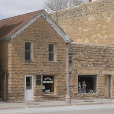
Fort Dodge is a historic military installation in Ford County, Kansas, featuring preserved buildings from the 19th century and modern facilities. The grounds include structures from different construction periods that document how the fort developed over many decades.

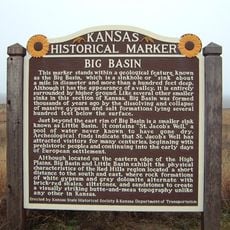
The fort was established in 1865 by the US Army to protect travelers and workers along the Santa Fe Trail. A major turning point came in 1890 when the installation was converted into a soldiers' home and ended its military operations.

The fort transformed from a military installation into the Kansas Soldiers' Home in 1890, continuing its connection to military service through veteran care.

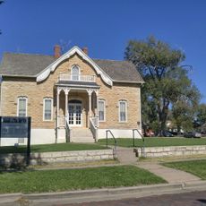
You can explore the grounds on your own and walk through the preserved buildings to see the history firsthand. The historic library on the site contains documents and information that help you learn more about the place's past.

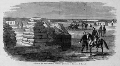
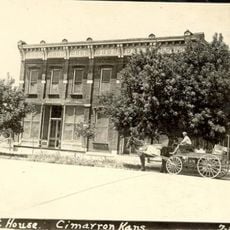
In its early years, the fort's structures were simple dugouts and sod houses before permanent wooden and stone buildings replaced them. These building phases show how settlers adapted to the challenges of life on the prairie.

The community of curious travelers

AroundUs brings together thousands of curated places, local tips, and hidden gems, enriched daily by 60,000 contributors worldwide.

Start exploring
Location
Inception
1865
GPS coordinates
37.73060,-99.93470
Latest update
December 10, 2025 20:03
Around this place
Long Branch Saloon
United States of America

Long Branch Saloon

8 km
Big Well
United States of America

Big Well

58.2 km
Brenham
United States of America

Brenham

69.9 km
Dalton Gang Hideout and Museum
United States of America

Dalton Gang Hideout and Museum

61.5 km
Big Basin Prairie Preserve
United States of America

Big Basin Prairie Preserve

54.9 km
Santa Fe Trail Remains
United States of America

Santa Fe Trail Remains

24.1 km
Cathedral of Our Lady of Guadalupe
United States of America

Cathedral of Our Lady of Guadalupe

11.2 km
Cimarron Hotel
United States of America

Cimarron Hotel

37.4 km
Fromme-Birney Round Barn
United States of America

Fromme-Birney Round Barn

43.9 km
Sacred Heart Cathedral
United States of America

Sacred Heart Cathedral

7.8 km
Dodge City Public Library
United States of America

Dodge City Public Library

7.9 km
Immaculate Heart of Mary Catholic Church
United States of America

Immaculate Heart of Mary Catholic Church

26.5 km
Hodgeman County Courthouse
United States of America

Hodgeman County Courthouse

39.5 km
Gano Grain Elevator and Scale House
United States of America

Gano Grain Elevator and Scale House

43 km
Fowler Swimming Pool and Bathhouse
United States of America

Fowler Swimming Pool and Bathhouse

44.7 km
Old Gray County Courthouse
United States of America

Old Gray County Courthouse

37.4 km
Stockgrowers State Bank
United States of America

Stockgrowers State Bank

62.1 km
Stein House
United States of America

Stein House

61.8 km
Girl Scout Little House
United States of America

Girl Scout Little House

61.8 km
Welborn 'Doc' Barton House
United States of America

Welborn 'Doc' Barton House

46.8 km
Ashland Grade School
United States of America

Ashland Grade School

62 km
Hackberry Creek Bridge
United States of America

Hackberry Creek Bridge

59.1 km
Finney County Point of Rocks
United States of America

Finney County Point of Rocks

72.1 km
T. S. Haun House
United States of America

T. S. Haun House

39.4 km
Comanche County Courthouse
United States of America

Comanche County Courthouse

74.4 km
Home of Stone
United States of America

Home of Stone

7.6 km
St. Mary's Catholic Church
United States of America

St. Mary's Catholic Church

38.3 km
Kiowa County Historical Museum and Soda Fountain
United States of America

Kiowa County Historical Museum and Soda Fountain

58.3 km
Show the full map
« Fort Dodge - Military fort in Ford County, Kansas » is provided by Around Us (aroundus.com). Images and texts are derived from Wikimedia project under a Creative Commons license. You are allowed to copy, distribute, and modify copies of this page, under the conditions set by the license, as long as this note is clearly visible.

Discover hidden gems everywhere you go!

From secret cafés to breathtaking viewpoints, skip the crowded tourist spots and find places that match your style. Our app makes it easy with voice search, smart filtering, route optimization, and insider tips from travelers worldwide. Download now for the complete mobile experience.

Around Us App Screenshot

A unique approach to discovering new places

Le Figaro

All the places worth exploring

France Info

A tailor-made excursion in just a few clicks

20 Minutes

Around Us
Travel Guide & Maps
Download

Send to your phone

QR Code
1

Open the camera app on your mobile.

2

Point at the QR code with your camera. A notification will appear.

3

Tap the notification to open the link.