Chest opened
+${chestReward.xp} XP
Explorer
NOUVEAU ×${chestReward.collectible.quantity}
tapez pour fermer
Chest locked

Open chests in the app

Around Us is built for your phone — chests unlock when you walk, explore and capture nearby places.

Enable Location

We need your location to show you interesting places around you

Discover nearby places

Find interesting locations and hidden gems around you

Precise directions

Get accurate directions and distances to places

Your location is never shared with other users. It's only used when you tap the location button.

Log in to your account

Start exploring — it's free

Trusted by 73,096 travelers worldwide

Continue with Google
Continue with Apple
or

We will send you a code to connect

By continuing, you accept our Terms and Conditions and our Privacy Policy

Check your inbox

We've sent a pincode in your inbox. Please enter the code below.

Honobia Creek Wildlife Management Area
Discussion Reviews Photo
1.3k Popularity

Honobia Creek Wildlife Management Area, Wildlife refuge in Pushmataha, LeFlore, and McCurtain Counties, Oklahoma, US.

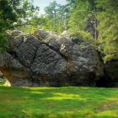
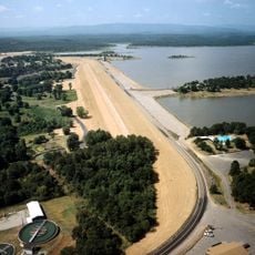
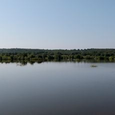
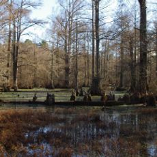
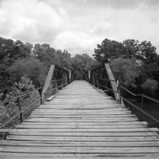
Honobia Creek Wildlife Management Area is a protected refuge spanning nearly 98,000 acres of pine forests, hardwood stands, and river systems across southeastern Oklahoma. The landscape combines different forest types with wetlands and natural waterways into one connected area.

The area was established in 2010 when three forest investment companies partnered with the Oklahoma Department of Wildlife Conservation. This collaboration created a privately owned refuge with public access rights for outdoor recreation.

The management area supports traditional hunting for white-tailed deer, wild turkey, and quail alongside fishing in its waters. These activities shape how visitors connect with the land and reflect long-standing outdoor practices in the region.

Visitors need to obtain a Land Access Permit before entering the refuge. While designated campsites do not exist, primitive camping is allowed throughout the area.

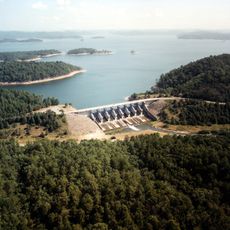
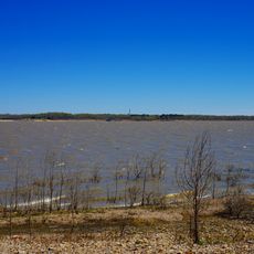
The Little River flows through the refuge for about 21 miles, creating varied habitats across the landscape. Its waters are home to several fish species, including smallmouth bass that draw anglers to specific spots.

The community of curious travelers

AroundUs brings together thousands of curated places, local tips, and hidden gems, enriched daily by 60,000 contributors worldwide.

Start exploring
GPS coordinates
34.37583,-95.24667
Latest update
December 14, 2025 18:16
Around this place
Robbers Cave State Park
United States of America

Robbers Cave State Park

70.3 km
Broken Bow Lake
United States of America

Broken Bow Lake

55.7 km
Beavers Bend Resort Park
United States of America

Beavers Bend Resort Park

58 km
Hugo Lake
United States of America

Hugo Lake

37.7 km
Lake Wister
United States of America

Lake Wister

78.2 km
Choctaw Capitol Building
United States of America

Choctaw Capitol Building

29.7 km
Peter Conser House
United States of America

Peter Conser House

72.6 km
International Temple, Supreme Assembly, Order of the Rainbow for Girls
United States of America

International Temple, Supreme Assembly, Order of the Rainbow for Girls

78 km
Lake Wister State Park
United States of America

Lake Wister State Park

74.5 km
AT6 Monument
United States of America

AT6 Monument

34.1 km
Little River National Wildlife Refuge
United States of America

Little River National Wildlife Refuge

64.8 km
Aldridge Hotel
United States of America

Aldridge Hotel

78.1 km
St. Joseph's Catholic Church
United States of America

St. Joseph's Catholic Church

75.5 km
McAlester House
United States of America

McAlester House

79.9 km
McAlester Scottish Rite Temple
United States of America

McAlester Scottish Rite Temple

78.3 km
Sacred Heart Catholic Church and Rectory
United States of America

Sacred Heart Catholic Church and Rectory

60.5 km
Cole Chapel School
United States of America

Cole Chapel School

64.9 km
Mountain Fork Bridge
United States of America

Mountain Fork Bridge

79.5 km
Cupco Church
United States of America

Cupco Church

36.1 km
Snow School
United States of America

Snow School

15.4 km
First Presbyterian Church
United States of America

First Presbyterian Church

78.9 km
Clayton High School Auditorium
United States of America

Clayton High School Auditorium

25.8 km
Idabel Armory
United States of America

Idabel Armory

66.3 km
Hugo Historic District
United States of America

Hugo Historic District

47.4 km
Beaver's Bend Mining Company
United States of America

Beaver's Bend Mining Company

51.9 km
Erie Theatre
United States of America

Erie Theatre

47.4 km
Okla Theatre
United States of America

Okla Theatre

78.3 km
Carter Mountain Lookout
United States of America

Carter Mountain Lookout

45.4 km
Show the full map
Reviews
Share your experience

No review yet

Discussions
Start a discussion...

No discussion yet

« Honobia Creek Wildlife Management Area - Wildlife refuge in Pushmataha, LeFlore, and McCurtain Counties, Oklahoma, US » is provided by Around Us (aroundus.com). Images and texts are derived from Wikimedia project under a Creative Commons license. You are allowed to copy, distribute, and modify copies of this page, under the conditions set by the license, as long as this note is clearly visible.

Discover hidden gems everywhere you go!

From secret cafés to breathtaking viewpoints, skip the crowded tourist spots and find places that match your style. Our app makes it easy with voice search, smart filtering, route optimization, and insider tips from travelers worldwide. Download now for the complete mobile experience.

Around Us App Screenshot

A unique approach to discovering new places

Le Figaro

All the places worth exploring

France Info

A tailor-made excursion in just a few clicks

20 Minutes

Around Us
Travel Guide & Maps
Download

Send to your phone

QR Code
1

Open the camera app on your mobile.

2

Point at the QR code with your camera. A notification will appear.

3

Tap the notification to open the link.