Mount Barrow, Mountain peak in northeastern Tasmania, Australia
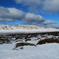
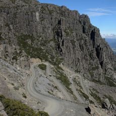
Mount Barrow is a Jurassic dolerite-capped plateau in northeastern Tasmania, 22 km east-north-east of Launceston, with a sharp summit ridge at its north-eastern end reaching 1,406 m. The plateau runs about 3 km and holds block fields, temperate old-growth rainforest, subalpine and alpine vegetation. A narrow gravel road near the top leads to a parking area beside an old stone hut.
Mount Barrow formed a barrier to settlers well into the 19th century. George Robinson and botanist Robert William Lawrence explored the steep, rainforested country in the 1830s, and Paul Strzelecki led scientific exploration in 1846. From the late 1870s, timber cutting and clearing opened the surrounding valleys for settlements such as Nunamara, Patersonia and Diddleum Plains.
The mountain lies where the lands of the Ben Lomond Nation, the Letteremairener clan of the Tamar Valley and the Pyemmairrenerpairrener clan met. Its Aboriginal name, pialermeliggener, was transcribed by G.A. Robinson while searching the upper Pipers River; its suffix refers to cliffs or scree near the summit, matching the exposed rock faces.
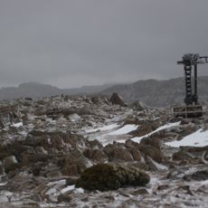
The summit road is periodically closed in winter because of snow; near the top it narrows to a gravel track ending at a parking area beside an old stone hut. The snow line sits around 1,100 metres, and mountain streams across the escarpment can swell into waterfalls after heavy snowfall.
The summit is the main television and FM radio transmission site for north-east Tasmania. Because ice builds up on the towers, the structures carry shields to deflect falling ice, and the programmes reach them by microwave link rather than fibre-optic cable. Power arrives by an overhead line running up the eastern side of the mountain.
The community of curious travelers
AroundUs brings together thousands of curated places, local tips, and hidden gems, enriched daily by 94,418 contributors worldwide.