Enable Location

We need your location to show you interesting places around you

Discover nearby places

Find interesting locations and hidden gems around you

Precise directions

Get accurate directions and distances to places

Your location is never shared with other users. It's only used when you tap the location button.

Frau Hitt

Log in to your account

Start exploring — it's free

Trusted by 62,071 travelers worldwide

Continue with Google
Continue with Apple
or

We will send you a code to connect

By continuing, you accept our Terms and Conditions and our Privacy Policy

Check your inbox

We've sent a pincode in your inbox. Please enter the code below.

Frau Hitt

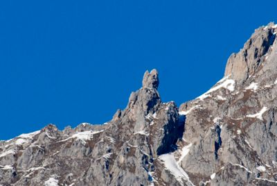
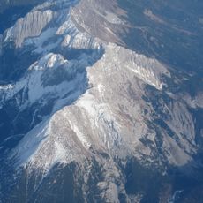
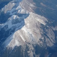
Frau Hitt, Mountain summit in Nordkette, Austria

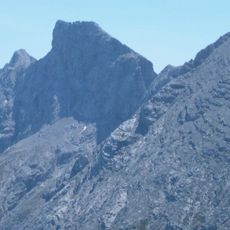
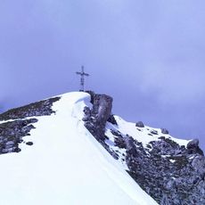
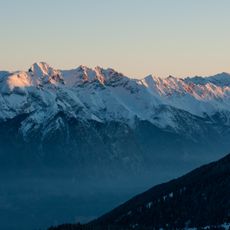
Frau Hitt is a summit in the Nordkette range standing at around 2,270 meters with a distinctive rock formation visible from Innsbruck. The peak features steep faces and is part of the larger Karwendel mountain system.

The first documented ascent occurred in 1580 when Johann Georg Ernstinger reached the summit, marking the start of recorded mountaineering on this peak. Since then the mountain has become a known climbing destination in the Innsbruck region.

The mountain takes its name from a local legend about a wealthy queen who turned to stone after offering a hungry beggar a piece of rock. This tale shapes how locals and visitors perceive and speak about the peak today.

Access to the summit is gained via the west shoulder route, with certain sections requiring technical climbing at Class III level. Visitors need proper alpine equipment, climbing experience, and favorable weather conditions for a safe attempt on this route.

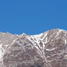
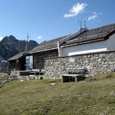
The Frau Hitt Saddle at around 2,235 meters connects the Oetz Valley with Gleirsch Valley and serves as a junction point for multiple alpine hiking paths. This location is less visited than the summit itself yet offers unique views into both valleys.

The community of curious travelers

AroundUs brings together thousands of curated places, local tips, and hidden gems, enriched daily by 60,000 contributors worldwide.

Start exploring
Location
Elevation above the sea
2,270 m
GPS coordinates
47.30518,11.35047
Latest update
December 10, 2025 15:48
« Frau Hitt - Mountain summit in Nordkette, Austria » is provided by Around Us (aroundus.com). Images and texts are derived from Wikimedia project under a Creative Commons license. You are allowed to copy, distribute, and modify copies of this page, under the conditions set by the license, as long as this note is clearly visible.

Discover hidden gems everywhere you go!

From secret cafés to breathtaking viewpoints, skip the crowded tourist spots and find places that match your style. Our app makes it easy with voice search, smart filtering, route optimization, and insider tips from travelers worldwide. Download now for the complete mobile experience.

Around Us App Screenshot

A unique approach to discovering new places

Le Figaro

All the places worth exploring

France Info

A tailor-made excursion in just a few clicks

20 Minutes

Around Us
Travel Guide & Maps
Download

Send to your phone

QR Code
1

Open the camera app on your mobile.

2

Point at the QR code with your camera. A notification will appear.

3

Tap the notification to open the link.