·

Enable Location

We need your location to show you interesting places around you

Discover nearby places

Find interesting locations and hidden gems around you

Precise directions

Get accurate directions and distances to places

Your location is never shared with other users. It's only used when you tap the location button.

Hochwildstelle

Log in to your account

Start exploring — it's free

Trusted by 62,647 travelers worldwide

Continue with Google
Continue with Apple
or

We will send you a code to connect

By continuing, you accept our Terms and Conditions and our Privacy Policy

Check your inbox

We've sent a pincode in your inbox. Please enter the code below.

Hochwildstelle

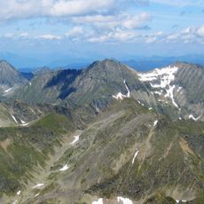
Hochwildstelle, Mountain summit in Schladming Tauern, Austria.

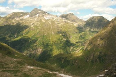
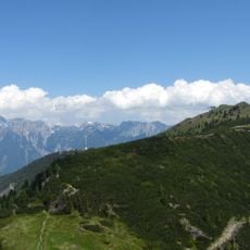
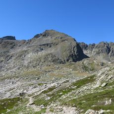
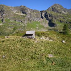
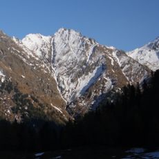
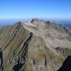
Hochwildstelle is a summit in the Schladming Tauern range, rising with steep rocky walls on its flanks. The peak features a sharp ridgeline running from north to south, creating a prominent silhouette when viewed from surrounding valleys.

The first recorded ascent took place in 1801 when M. Reiter and his climbing group reached the summit. This early climb marked the start of documented mountaineering activity on this peak.

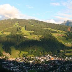
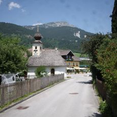
The summit holds meaning for people from the surrounding region as a marker of local mountain identity. It represents the highest point that lies entirely within Styrian borders.

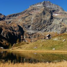
Two main climbing routes lead to the summit, both starting from passes and taking roughly an hour of climbing time. You will need to approach the starting passes beforehand, and rock scrambling skills are useful for the steeper sections near the top.

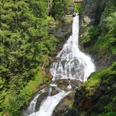
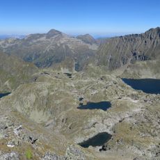
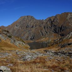
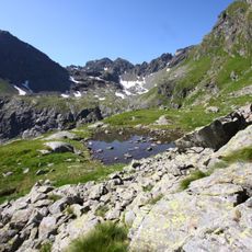
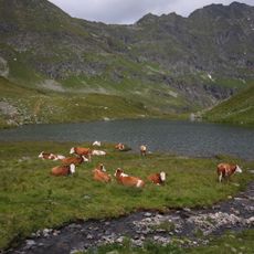
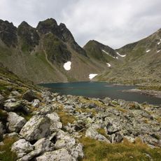
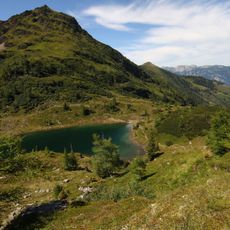
The area around the summit contains multiple mountain lakes and two major waterfalls that form an unusual network of water features at high elevation. These waterfalls are fed by snowmelt and create a landscape uncommon for peaks at this height.

The community of curious travelers

AroundUs brings together thousands of curated places, local tips, and hidden gems, enriched daily by 60,000 contributors worldwide.

Start exploring
Location
Location
Elevation above the sea
2,747 m
GPS coordinates
47.33497,13.83022
Latest update
December 11, 2025 18:01
« Hochwildstelle - Mountain summit in Schladming Tauern, Austria » is provided by Around Us (aroundus.com). Images and texts are derived from Wikimedia project under a Creative Commons license. You are allowed to copy, distribute, and modify copies of this page, under the conditions set by the license, as long as this note is clearly visible.

Discover hidden gems everywhere you go!

From secret cafés to breathtaking viewpoints, skip the crowded tourist spots and find places that match your style. Our app makes it easy with voice search, smart filtering, route optimization, and insider tips from travelers worldwide. Download now for the complete mobile experience.

Around Us App Screenshot

A unique approach to discovering new places

Le Figaro

All the places worth exploring

France Info

A tailor-made excursion in just a few clicks

20 Minutes

Around Us
Travel Guide & Maps
Download

Send to your phone

QR Code
1

Open the camera app on your mobile.

2

Point at the QR code with your camera. A notification will appear.

3

Tap the notification to open the link.