Hinteres Freieck, Mountain summit in Salzburg, Austria
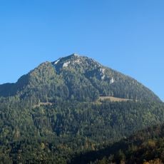
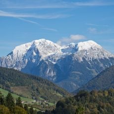
Hinteres Freieck is a 2,309 m mountain in the Göllstock of the Berchtesgaden Alps, standing on the Kuchler Kamm ridge. The Bluntautal valley lies to its south, separating it from the Hagengebirge. It is one of several summits on the long, difficult ridge route from Golling via the Kleiner Göll, Vorderes Freieck, Gründwandkopf and Taderer to the Hoher Göll.
The Kuchler Kamm ridge route, which crosses the Hinteres Freieck, has long linked Golling an der Salzach with the Hoher Göll. The sources record no mining history on the mountain itself; the peak is documented as a station on this long and difficult mountain hike over the Kleiner Göll, Vorderes Freieck, Gründwandkopf and Taderer.
The Kuchler Kamm route from Golling an der Salzach to the Hoher Göll crosses the Kleiner Göll, Vorderes and Hinteres Freieck, Gründwandkopf and Taderer; the sources describe it as a long and difficult mountain hike. South of the summit, the Bluntautal separates the Göllstock from the Hagengebirge.
The mountain can be reached via established hiking trails from the lower valleys, with summer months offering the most favorable conditions for climbing. Visitors should be comfortable with mountain terrain and bring appropriate gear for high-altitude conditions.
The Kuchl ridge route from Golling an der Salzach to the Hoher Göll crosses the Hinteres Freieck between the Vorderes Freieck and the Gründwandkopf; the German article gives the summit as 2309 m, the French one as 2308 m. South of the summit the Bluntautal separates the Göllstock from the Hagengebirge.
The community of curious travelers
AroundUs brings together thousands of curated places, local tips, and hidden gems, enriched daily by 93,875 contributors worldwide.