Enable Location

We need your location to show you interesting places around you

Discover nearby places

Find interesting locations and hidden gems around you

Precise directions

Get accurate directions and distances to places

Your location is never shared with other users. It's only used when you tap the location button.

Kupres

Log in to your account

Start exploring — it's free

Trusted by 63,232 travelers worldwide

Continue with Google
Continue with Apple
or

We will send you a code to connect

By continuing, you accept our Terms and Conditions and our Privacy Policy

Check your inbox

We've sent a pincode in your inbox. Please enter the code below.

Kupres
Discussion Reviews 2 Photos
27.3k Popularity

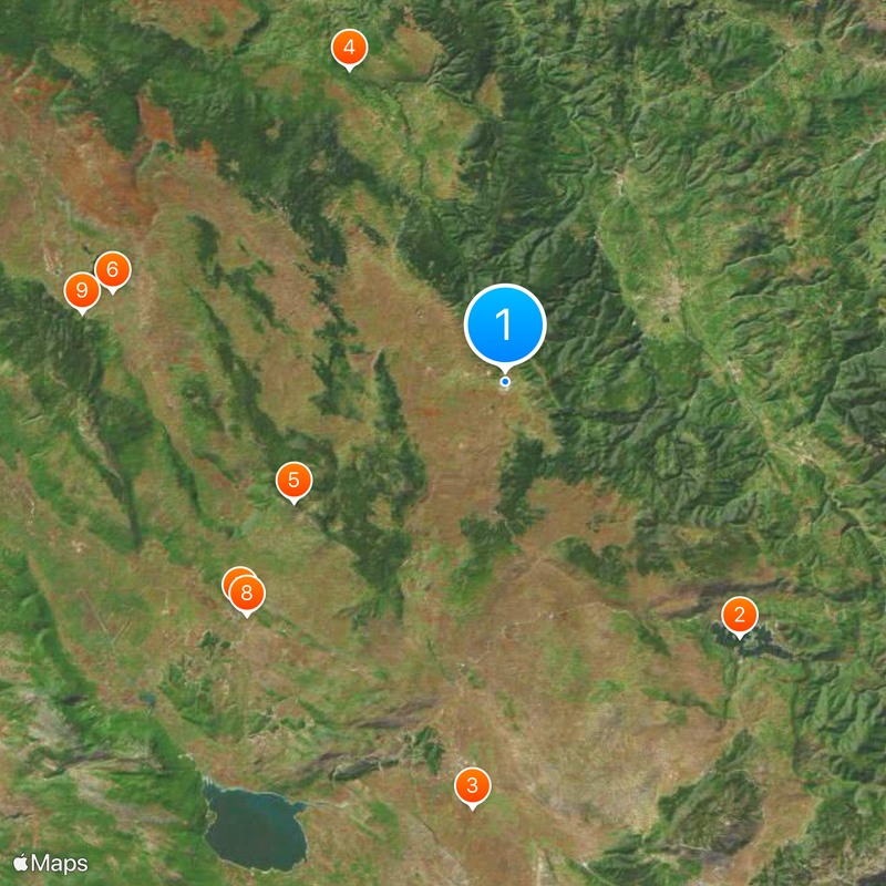
Kupres, Mountain locality in Kupres Municipality, Bosnia and Herzegovina.

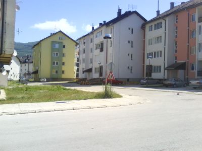
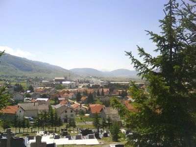
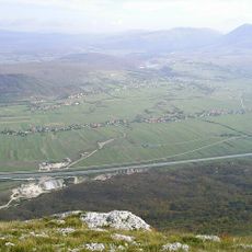
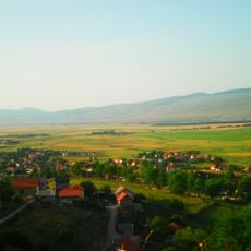
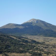
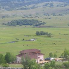
Kupres is a mountain town situated at 1,276 meters elevation on a broad highland plateau surrounded by the Dinaric Alps. The open terrain creates expansive meadows that roll toward distant mountain ridges on all sides.

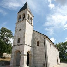
The settlement grew over centuries as a strategic crossroads where mountain passes linked different regions across Bosnia and Herzegovina. This position along trade routes shaped how the community developed and connected to surrounding areas.

Kupres centers on its expansive meadows, where farming remains central to how people live and work. The local connection to the land shows in how the community gathers to celebrate harvests and maintain their grasslands.

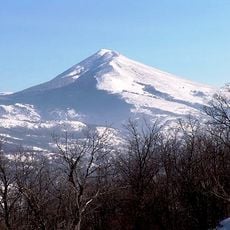
Winter visitors can use the Adria Ski Resort, which offers equipment rentals and day passes for skiing down the slopes. Strong footwear is recommended year-round, as the elevation and changing weather make hiking on the hillsides demanding at any time.

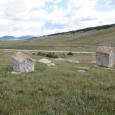
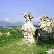
Near the town sits the Ravanjska Vrata necropolis, where around 70 medieval stećci tombstones stand as markers of ancient burials. These carved stones reveal burial practices that people followed in the region centuries ago.

The community of curious travelers

AroundUs brings together thousands of curated places, local tips, and hidden gems, enriched daily by 60,000 contributors worldwide.

Start exploring
Elevation above the sea
1,276 m
GPS coordinates
43.99056,17.27944
Latest update
December 20, 2025 13:52
Around this place
Rama Lake
Bosnia and Herzegovina

Rama Lake

28.3 km
Duvno field
Bosnia and Herzegovina

Duvno field

35 km
Janjske Otoke
Bosnia and Herzegovina

Janjske Otoke

28.5 km
Cincar
Bosnia and Herzegovina

Cincar

19.9 km
Glamoč field
Bosnia and Herzegovina

Glamoč field

33 km
All Saints Church, Livno
Bosnia and Herzegovina

All Saints Church, Livno

28.5 km
Gorica Monastery
Bosnia and Herzegovina

Gorica Monastery

28.5 km
Church of Saint Elias, Glamoč
Bosnia and Herzegovina

Church of Saint Elias, Glamoč

35 km
Hadzi Ahmeta Dukatar's Mosque
Bosnia and Herzegovina

Hadzi Ahmeta Dukatar's Mosque

28.4 km
Malovan
Bosnia and Herzegovina

Malovan

11.7 km
Church of the Assumption of the Blessed Virgin Mary, Uskoplje
Bosnia and Herzegovina

Church of the Assumption of the Blessed Virgin Mary, Uskoplje

25.2 km
Saint Anthony of Padua church in Bugojno
Bosnia and Herzegovina

Saint Anthony of Padua church in Bugojno

15.1 km
Džudža Džafer-bey Kopčić mosque in Tomislavgrad
Bosnia and Herzegovina

Džudža Džafer-bey Kopčić mosque in Tomislavgrad

30.9 km
Saints Peter and Paul Church, Livno
Bosnia and Herzegovina

Saints Peter and Paul Church, Livno

28.5 km
Immaculate Conception Church
Bosnia and Herzegovina

Immaculate Conception Church

31.6 km
Clock Tower of Livno
Bosnia and Herzegovina

Clock Tower of Livno

29 km
Galečka Ćuprija
Bosnia and Herzegovina

Galečka Ćuprija

20.2 km
Beglek Mosque
Bosnia and Herzegovina

Beglek Mosque

28.3 km
Balaguša Mosque
Bosnia and Herzegovina

Balaguša Mosque

28.2 km
Šćit
Bosnia and Herzegovina

Šćit

29 km
Necropolis of Ravanjska Vrata
Bosnia and Herzegovina

Necropolis of Ravanjska Vrata

14.4 km
Clock Tower of Donji Vakuf
Bosnia and Herzegovina

Clock Tower of Donji Vakuf

19.5 km
Fortress of Livno
Bosnia and Herzegovina

Fortress of Livno

29 km
Pont sur le Duman
Bosnia and Herzegovina

Pont sur le Duman

29 km
Immaculate Conception church
Bosnia and Herzegovina

Immaculate Conception church

31.6 km
Église de la Dormition-de-la-Mère-de-Dieu de Livno
Bosnia and Herzegovina

Église de la Dormition-de-la-Mère-de-Dieu de Livno

28.8 km
Fortress of Prusac
Bosnia and Herzegovina

Fortress of Prusac

14.1 km
St. Nikola Tavelić church
Bosnia and Herzegovina

St. Nikola Tavelić church

30.7 km
Show the full map
Reviews
Share your experience

No review yet

Discussions
Start a discussion...

No discussion yet

« Kupres - Mountain locality in Kupres Municipality, Bosnia and Herzegovina » is provided by Around Us (aroundus.com). Images and texts are derived from Wikimedia project under a Creative Commons license. You are allowed to copy, distribute, and modify copies of this page, under the conditions set by the license, as long as this note is clearly visible.

Discover hidden gems everywhere you go!

From secret cafés to breathtaking viewpoints, skip the crowded tourist spots and find places that match your style. Our app makes it easy with voice search, smart filtering, route optimization, and insider tips from travelers worldwide. Download now for the complete mobile experience.

Around Us App Screenshot

A unique approach to discovering new places

Le Figaro

All the places worth exploring

France Info

A tailor-made excursion in just a few clicks

20 Minutes

Around Us
Travel Guide & Maps
Download

Send to your phone

QR Code
1

Open the camera app on your mobile.

2

Point at the QR code with your camera. A notification will appear.

3

Tap the notification to open the link.