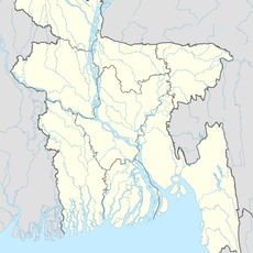
Kuakata Beach, Beach in Patuakhali District, Bangladesh
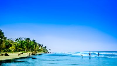
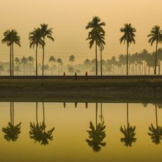
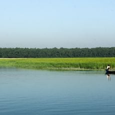
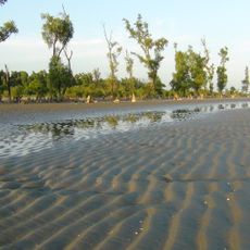
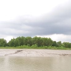
Kuakata Beach is a sandy shore in Patuakhali District that extends for many kilometers along the Bay of Bengal. The wide beach offers open spaces with a gentle shoreline that meets the water.
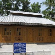
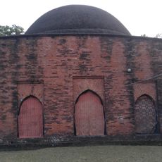
Rakhine settlers arrived from Myanmar during the 18th century and established themselves along this coast. They dug wells to secure drinking water and build a permanent community.
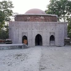
Hindu and Buddhist communities gather for religious festivals, performing traditional rituals and participating in local fairs that mark important moments in their calendar.
The best weather occurs from November to February when temperatures are comfortable and skies are clear. Visitors should plan their trip during these months to experience the area in ideal conditions.
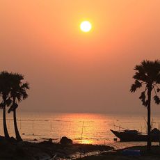
The location offers views of both sunrise and sunset over the Bay of Bengal from the same beach. This rare position allows visitors to witness two different moments of the day in one place.
GPS coordinates: 21.80320,90.18370
Latest update: December 6, 2025 17:40
Bangladesh extends from the Brahmaputra delta to the hills near the Myanmar border. The country combines historical structures with natural settings that suit photography. In Dhaka, mosques from the 17th century stand near buildings from the 20th century. The coast shows long sandy beaches and small islands in the Bay of Bengal. In the northeast, tea plantations sit on gentle hills, while wetlands and swamps become water-covered landscapes during the monsoon season. Places like Lalbagh Fort and Ahsan Manzil document the Mughal era and colonial influences in the capital. The Sixty Dome Mosque in Bagerhat dates from the 15th century and shows early Islamic architecture in the region. Jatiyo Sangsad Bhaban, the parliament building by Louis Kahn, represents modern design. Natural areas like Ratargul Swamp Forest or the tea gardens near Srimangal offer different subjects. Cox's Bazar beach stretches for many miles (kilometers) along the coast. Saint Martin Island lies farther south in the sea. Sajek Valley in the Chittagong Hill Tracts shows mountainous terrain with views over forested slopes.
Jakob Tower
73.1 km
Payra Bridge
75.5 km
BNS Sher-e-Bangla
23.5 km
Barisal Polytechnic Institute
101.2 km
Sundarbans South Wildlife Sanctuary
81.8 km
Oxford Mission Church
102 km
Karapur Miah Bari Mosque
103.1 km
Nijhum Dwip National Park
89.2 km
Char Kukri-Mukri Wildlife Sanctuary
49.7 km
Barguna Polytechnic Institute
40.5 km
Momin Mosque
69.2 km
Majidbaria Shahi Mosque
52 km
Bibi Chini Mosque
74.6 km
Bagerhat Stadium
102.8 km
Nasrat Gazi Mosque
87.5 km
Kuakata National Park
11.1 km
Bihanga Island
37.6 km
Sonarchar Wildlife Sanctuary
33.3 km
Collectorate Bhaban, Barishal
102 km
Dhangmari Wildlife Sanctuary
95 km
Chadpai Wildlife Sanctuary
84.3 km
Barisal Divisional Museum
101.9 km
Galua Paka Mosque
79.4 km
স্বাধীনতা জাদুঘর ভোলা
100.1 km
Bijoy Bihongo Sculpture
100 km
Sundarbans Reserved Forest
73.5 km
Dashina
66.1 km
Khanbari Old Jami Mosque Complex
89.5 kmReviews
Visited this place? Tap the stars to rate it and share your experience / photos with the community! Try now! You can cancel it anytime.
Discover hidden gems everywhere you go!
From secret cafés to breathtaking viewpoints, skip the crowded tourist spots and find places that match your style. Our app makes it easy with voice search, smart filtering, route optimization, and insider tips from travelers worldwide. Download now for the complete mobile experience.
A unique approach to discovering new places❞
— Le Figaro
All the places worth exploring❞
— France Info
A tailor-made excursion in just a few clicks❞
— 20 Minutes