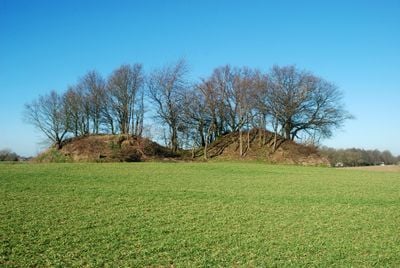
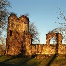
Tumuli of Noirmont, Archaeological burial site in Cortil-Noirmont, Belgium.
The Tumuli of Noirmont are two ancient burial mounds rising from agricultural fields in Cortil-Noirmont, Belgium, reaching heights of about 6 meters and 4.5 meters respectively. They occupy land bounded by street names that still reference their archaeological character: Tombes Romaines Street and Tumulus Street form part of their perimeter.
These mounds developed as burial sites for affluent individuals during antiquity and served as markers along important travel routes. Excavations carried out in 1874 and 1875 uncovered four wooden burial chambers containing calcined remains and high-status objects from the 2nd century.
The burial mounds are situated in an area known locally as 'Les Tombes' or 'Champ des Tombes', names that directly reflect the funerary purpose of the place. This linguistic connection shows how the landscape's ancient function remains embedded in village memory.
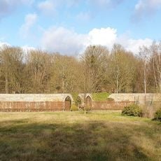
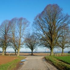
The mounds are easily accessible on foot and visible from nearby streets that define the archaeological site. The area has good visibility from surrounding paths, making it simple to locate and explore without special equipment or preparation.
The mounds form part of a broader network of tumuli marking the Brunehaut route, a first-century Roman road that ran from Bavai in the south to Cologne in the north. This connection to a major trade corridor explains why wealthy individuals chose to be buried along this particular stretch of landscape.
The community of curious travelers
AroundUs brings together thousands of curated places, local tips, and hidden gems, enriched daily by 60,000 contributors worldwide.