Ishpatina Ridge, Mountain peak in northern Ontario, Canada
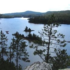
Ishpatina Ridge is the highest point in Ontario, at 693 m above sea level, rising about 300 m above the surrounding land in Lady Evelyn-Smoothwater Provincial Park. Between Tower Peak and North Peak lies Ishpatina Canyon, whose bottom sits at 533 m, nearly twice as deep as Ouimet Canyon. A 30 m steel lattice fire tower, the Ellis Tower, stands on the highest section, its small enclosed cabin topped by a white band.
Survey work in the 1970s confirmed this ridge as Ontario's highest point, taking this distinction from a previously recognized peak elsewhere. This finding reshaped regional mapping knowledge.
The name comes from the Ojibwe word ishpadinaa, meaning "high place" or "ridge". The same root gives Toronto's Spadina Avenue and the city of Ishpeming, Michigan, their names.
The usual approach is a canoe-and-portage route via a logging road south of Capreol, north of Sudbury; the northern route from Gowganda involves numerous portages and is used in winter by ski or snowshoe. Highway 560 lies more than 30 km north, and local logging roads and trails become hard to travel in poor weather. From a cabin on Scarecrow Lake, the summit trail runs 3.5 km, about two hours up and a little over one hour down.
An abandoned fire lookout tower sits at the summit, once staffed by forest workers who arrived by seaplane. This structure is a remnant of how aerial surveillance was used to monitor forest conditions.
The community of curious travelers
AroundUs brings together thousands of curated places, local tips, and hidden gems, enriched daily by 94,079 contributors worldwide.