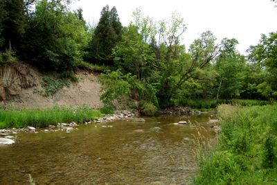
Rouge River, River system in Richmond Hill, Canada
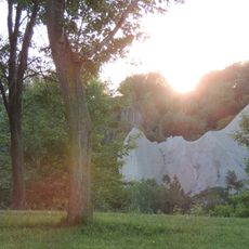
The Rouge River is a river system flowing through Richmond Hill toward Lake Ontario, beginning its journey from the Oak Ridges Moraine to the north. Along its course, it passes through forests, meadows, and wetland areas that together form a connected natural corridor.
The river was named by French explorer Louis Jolliet during his explorations, though Indigenous Mississauga people called it Gichi-ziibiins, meaning large creek. Over time, urban development altered much of its landscape, prompting recent restoration efforts to revive the waterway.
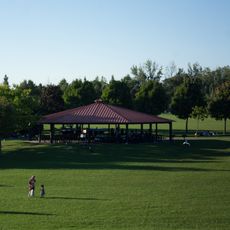
The river serves as a gathering place where visitors observe wildlife and connect directly with nature throughout the seasons. Local communities use the waterway and its banks regularly for outdoor activities and environmental learning.
Several parks along the waterway offer access points for hiking, wildlife viewing, and exploring natural areas throughout the year. Wear sturdy footwear and watch your footing on trails, especially after rain when ground conditions become slippery.
It forms part of Canada's first national park located entirely within a city boundary, bridging two provinces in an unusual arrangement. This distinction makes the waterway a testing ground for urban conservation approaches at the national level.
The community of curious travelers
AroundUs brings together thousands of curated places, local tips, and hidden gems, enriched daily by 60,000 contributors worldwide.