Etobicoke Creek, Waterway in Greater Toronto Area, Canada.
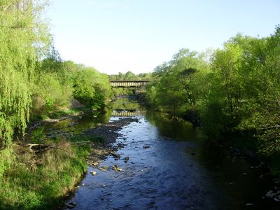
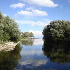
Etobicoke Creek is a waterway that flows approximately 61 kilometers through the Greater Toronto region, connecting several municipalities. It runs from Caledon to Lake Ontario and passes through diverse landscapes and natural habitats.
The name comes from a Mississauga word meaning wah-do-be-kang, documented by surveyor Augustus Jones before the official establishment in 1795. The name reflects the early indigenous presence in the area.
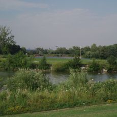
The creek serves as a gathering place for residents who walk its banks and observe local wildlife in their daily routines. Along the shores, people use the paths to connect with the natural landscape near their homes.
The creek has several walking trails and viewpoints along its course that allow visitors to explore different parts of the region. Access is good in most sections, though some trails vary depending on the season.
In March 2020, around 400 liters of red ink spilled into the creek, temporarily discoloring its waters. This unusual event brought unexpected attention to this often-overlooked waterway.
The community of curious travelers
AroundUs brings together thousands of curated places, local tips, and hidden gems, enriched daily by 60,000 contributors worldwide.