Labatt Park, Baseball venue in London, Canada
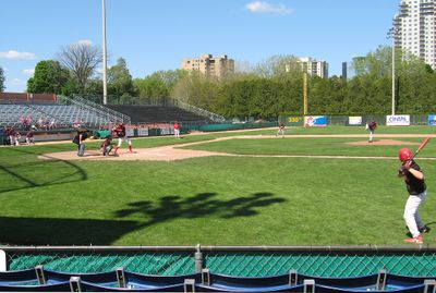
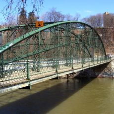
Labatt Park is a baseball ground in London, Ontario, featuring a grass playing surface and traditional ballpark infrastructure built to serve the local community. The facility maintains the classic layout of an older stadium with standard diamond dimensions and spectator seating.
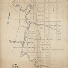
The grounds opened in 1877 and gained its current name from a brewing company that supported local sports in the early 1900s. Since then it has operated continuously through changing eras, making it one of the longest-running sports venues in North America.
The park served as a gathering place where baseball brought communities together across generations, creating memories that families still share today. People in London consider it a symbol of their sports heritage and local pride.
The grounds are easy to access by car and provide parking nearby for visitors, with clear signage directing you to the main entrance. The facility has shaded seating areas and is generally comfortable for spending an afternoon watching a game.
The venue holds a distinction as the oldest continuously operating baseball ground in North America, with games played there generation after generation without a pause. This unbroken span of play makes it a rare example of a sports space that has endured through dramatic social and cultural shifts.
Location: London
Inception: 1877
Official opening: May 3, 1877
Capacity: 5200
Part of: Blackfriars/Petersville Heritage Conservation District
Address: 25, Wilson Avenue
GPS coordinates: 42.98361,-81.25867
Latest update: December 7, 2025 20:47
Victoria Park
975 m
One London Place
1 km
Blackfriars Street Bridge
602 m
Grand Theatre
667 m
Eldon House
295 m
City Centre Towers
1 km
Middlesex County Court House
390 m
London Regional Children's Museum
609 m
London Hydro Substation No. 4
574 m
First Christian Reformed Church
491 m
London, Canada West, 1840-1841
1.1 km
Map of the city of London, surveyed and drawn by Sam'l Peters, P.L.S., published by Geo. Railton, for the London Directory, 1856
1.1 km
Sketch of part of the London Township
1.1 km
Plan of London shewing the gas lamps
1.1 km
Ridout Street Complex
311 m
1 Dundas Street
304 m
350 Talbot Street
688 m
37 Ridout Street South
1.1 km
330 Clarence Street
1 km
Map of the Township of London, Canada West, 1863
1.1 km
Plan of the Town of London, CW, Published by The Craig, London, 1846
1.1 km
King Street Bridge
391 m
London and Western Trusts Building
796 m
London Mechanics' Institute
967 m
Blackfriars Bridge
608 m
The Site of London
1.1 km
85 Albion Street
548 m
Former Toronto Dominion Bank Building
1.1 kmVisited this place? Tap the stars to rate it and share your experience / photos with the community! Try now! You can cancel it anytime.
Discover hidden gems everywhere you go!
From secret cafés to breathtaking viewpoints, skip the crowded tourist spots and find places that match your style. Our app makes it easy with voice search, smart filtering, route optimization, and insider tips from travelers worldwide. Download now for the complete mobile experience.
A unique approach to discovering new places❞
— Le Figaro
All the places worth exploring❞
— France Info
A tailor-made excursion in just a few clicks❞
— 20 Minutes