Enable Location

We need your location to show you interesting places around you

Discover nearby places

Find interesting locations and hidden gems around you

Precise directions

Get accurate directions and distances to places

Your location is never shared with other users. It's only used when you tap the location button.

Log in to your account

Start exploring — it's free

Trusted by 63,422 travelers worldwide

Continue with Google
Continue with Apple
or

We will send you a code to connect

By continuing, you accept our Terms and Conditions and our Privacy Policy

Check your inbox

We've sent a pincode in your inbox. Please enter the code below.

Rouge River Bridge
Discussion Reviews Photo
1.2k Popularity

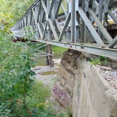
Rouge River Bridge, Highway bridge in Toronto, Canada

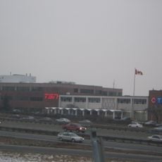
The Rouge River Bridge is a highway structure that carries the 401 over the Rouge River, linking Toronto with the Durham Region to the east. It consists of multiple parallel sections totaling fourteen lanes across its entire width.

The structure was originally built in 1941 and later significantly expanded to meet growing traffic demands. Inner spans were reconstructed in 1971 and outer spans were completed in 1994 during major highway development.

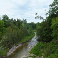
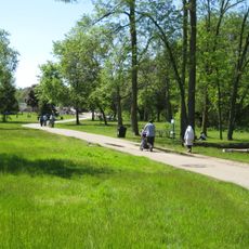
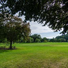
The Rouge River Bridge forms part of the transportation network near Glen Rouge Park, where visitors experience the transition between urban and natural environments.

This is one of the busiest highway crossings in the region, carrying heavy traffic daily, so visitors should plan to avoid peak hours. Approach the area during off-peak times to experience shorter travel delays.

This is not a single bridge but rather a system of multiple parallel structures with different construction types. Some sections use truss designs while others use girder designs, creating an unusual staggered appearance from certain viewpoints.

The community of curious travelers

AroundUs brings together thousands of curated places, local tips, and hidden gems, enriched daily by 60,000 contributors worldwide.

Start exploring
Location
Inception
1994
Official opening
1994
GPS coordinates
43.80400,-79.13500
Latest update
December 14, 2025 18:43
Reviews
Share your experience

No review yet

Discussions
Start a discussion...

No discussion yet

« Rouge River Bridge - Highway bridge in Toronto, Canada » is provided by Around Us (aroundus.com). Images and texts are derived from Wikimedia project under a Creative Commons license. You are allowed to copy, distribute, and modify copies of this page, under the conditions set by the license, as long as this note is clearly visible.

Discover hidden gems everywhere you go!

From secret cafés to breathtaking viewpoints, skip the crowded tourist spots and find places that match your style. Our app makes it easy with voice search, smart filtering, route optimization, and insider tips from travelers worldwide. Download now for the complete mobile experience.

Around Us App Screenshot

A unique approach to discovering new places

Le Figaro

All the places worth exploring

France Info

A tailor-made excursion in just a few clicks

20 Minutes

Around Us
Travel Guide & Maps
Download

Send to your phone

QR Code
1

Open the camera app on your mobile.

2

Point at the QR code with your camera. A notification will appear.

3

Tap the notification to open the link.