Walter Bean Grand River Trail, trail in the Regional Municipality of Waterloo, Ontario, Canada
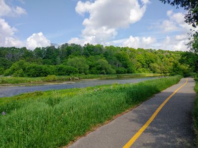
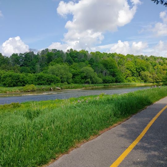
The Walter Bean Grand River Trail is a 76-kilometre multi-use route along the Grand River through Cambridge, Kitchener and Waterloo. It mostly follows the river's eastern edge, using 2-metre-wide gravel paths on the banks or residential roads to bypass private land. A 6.2-kilometre section in Cambridge is part of the Trans Canada Trail.
The trail is named after Walter Bean, who proposed a continuous route through the Waterloo Region. The project was announced in 1999, built in phases, and was 70 percent complete by 2004. The basic construction cost was set at $6.4 million, and 99 percent had been fundraised by September 2006. Ownership and management were later transferred to Cambridge, Kitchener and Waterloo.
The trail is named after Walter Bean, who proposed a continuous route through the Waterloo Region. Since 2020 the Trail Mix initiative has placed signs with QR codes along the route that link to songs and poems, so walkers can listen or read while moving between Cambridge, Kitchener and Waterloo.
The trail is open year-round and suitable for walking, cycling, cross-country skiing, and snowshoeing depending on the season. Parking areas are available at multiple access points including Kuntz Park, Schneider Park, and Kolb Park.
The trail is considered part of the larger Grand Valley Trail, a 250-kilometre route running along much of the Grand River. A 6.2-kilometre section in Cambridge is also part of the Trans Canada Trail, linking the route to the national network.
The community of curious travelers
AroundUs brings together thousands of curated places, local tips, and hidden gems, enriched daily by 94,623 contributors worldwide.