Stätzerhorn, mountain summit in Grisons, Switzerland
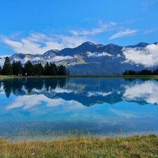
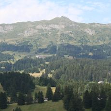
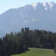
Stätzerhorn is a mountain in the Plessur Alps standing at 2574 meters with steep slopes and limestone formations that shape its appearance. The summit offers views across the surrounding Alpine valleys, and the rock faces vary in character from weathered to relatively fresh exposures.
The Stätzerhorn is the culminating point of the range west of the Lenzerheide Pass, and the border between the municipalities of Churwalden and Domleschg runs over its summit. The sources record no founding date or early climbing history; its documented use is as a hiking and ski-touring mountain, reached on foot by marked trails of grade T2 from several sides.
The mountain is also called Piz Raschil in Romansh, the local language of the Surselva side. In winter it forms part of a ski area: a six-seat chairlift runs from Alp Stätz at 1820 m to a station at 2420 m, just below the summit, covering about 600 metres of height in eight minutes.
Multiple hiking routes begin from different starting points, with the most direct path taking about four hours and offering varying difficulty levels. Visitors should prepare for changeable mountain conditions and bring appropriate gear for their chosen route.
The Stätzerhorn is also called Piz Raschil in Romansh, and its summit ridge marks the boundary between the municipalities of Churwalden and Domleschg. A six-seat chairlift from Alp Stätz at 1,820 metres climbs roughly 600 metres in eight minutes to a station at 2,420 metres, just below the top.
The community of curious travelers
AroundUs brings together thousands of curated places, local tips, and hidden gems, enriched daily by 93,608 contributors worldwide.