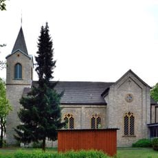
Ölbachtal mit Augustdorfer Dünenfeld, Nature reserve in Augustdorf, Germany.
Description
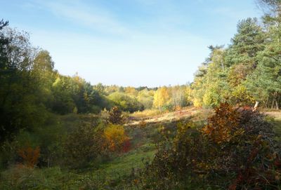
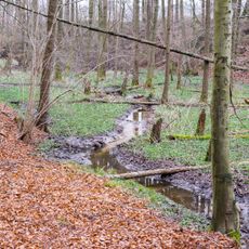
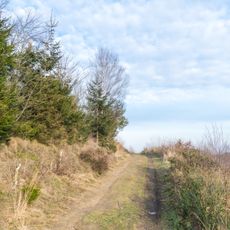
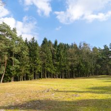
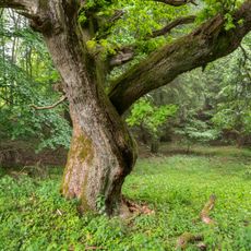
This nature reserve spans about 169 hectares across Oerlinghausen and Augustdorf, combining pine forests, heathlands, and sand dunes into one landscape. The terrain shifts between different habitats that support various plants and animals across the protected area.
History
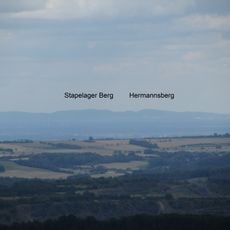
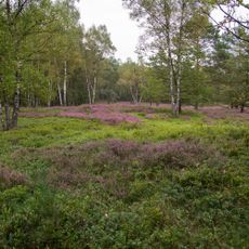
Protected since 1956, this area contains some of Northwestern Germany's oldest inland dunes, formed thousands of years ago during the last ice age through wind action on sand. These dunes show how past climate shaped the land.
Culture
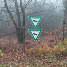
Information panels along the trails explain how plants and animals live together in this landscape and why protection matters here. Visitors can see how people use this space to learn about nature and understand its workings.
Practical
The reserve has marked hiking paths suitable for different fitness levels and easy to follow throughout the area. Visitors can download GPS tracks to navigate the trails independently if they prefer.
Did you know?
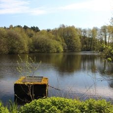
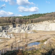
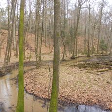
A former sand quarry operated here until 1975 and was later transformed into shallow water bodies that now shelter amphibians and insects. This transformation shows how past industrial use can become valuable wildlife habitat.
AroundUs brings together thousands of curated places, local tips, and hidden gems, enriched daily by 60,000 contributors worldwide. Discover all places nearby (Augustdorf).
Safariland Stukenbrock
3.6 km
Archäologisches Freilichtmuseum Oerlinghausen
3.9 km
Tönsberg
3.6 km
Hünenkapelle
3.1 km
Kirche Stapelage
4.5 km
Hermannsberg
3.6 km
Bauernburg Stapelage
4.6 km
Kipshagener Teiche
4.2 km
Bienenschmidt
3.5 km
Bartholdskrug
4.6 km
Steinbruch am Barkhauser Berg
3.6 km
Detmolder Straße 6-10
4.7 km
Wehrbachtal
3.5 km
Steinbruchstraße 12 (Oerlinghausen)
4.6 km
Detmolder Straße 24
4.7 km
Robert-Koch-Straße 17
4.6 km
Detmolder Straße 20 (Oerlinghausen)
4.6 km
Robert-Koch-Straße 19
4.6 km
St. Johannes Baptist
2.4 km
Evangelische Kirche
3.8 km
Tönsberg
3.3 km
LSG-Stuckenbrocker Lehmplatten, Holter Wald und obere Senne und Neuenkirchener Sandebene
4 km
Trockentäler, Kastentäler und Dünen des oberen Westerholter Baches
1.2 km
LSG-Teutoburger Wald mit Lippischem Wald, Osning Kamm und oestlichem Osning-Vorland
2.7 km
Schluchten und Moore am oberem Furlbach
3.1 km
Schluchten und Moore am oberem Furlbach
4 km
LSG-Teutoburger Wald mit Brackweder Osning und Obere Senne mit Wistinghauser-, Haustenbecker- und Augustdorfer Senne und Ausläufern der Stukenbroker Lehmplatten
1.5 km
Hermannsberg
3.7 kmDiscover hidden gems everywhere you go!
From secret cafés to breathtaking viewpoints, skip the crowded tourist spots and find places that match your style. Our app makes it easy with voice search, smart filtering, route optimization, and insider tips from travelers worldwide. Download now for the complete mobile experience.
A unique approach to discovering new places❞
— Le Figaro
All the places worth exploring❞
— France Info
A tailor-made excursion in just a few clicks❞
— 20 Minutes