Chest opened
+${chestReward.xp} XP
Explorer
NOUVEAU ×${chestReward.collectible.quantity}
tapez pour fermer

See the monuments around you in AR Open chests in the app

Around Us is built for your phone — point your camera at the streets and discover the monuments and places around you in augmented reality. Around Us is built for your phone — chests unlock when you walk, explore and capture nearby places.

•

Enable Location

We need your location to show you interesting places around you

Discover nearby places

Find interesting locations and hidden gems around you

Precise directions

Get accurate directions and distances to places

Your location is never shared with other users. It's only used when you tap the location button.

Roßkopf

Log in to your account

Start exploring — it's free

Trusted by 94,018 travelers worldwide

Continue with Google
Continue with Apple
or

We will send you a code to connect

By continuing, you accept our Terms and Conditions and our Privacy Policy

Check your inbox

We've sent a pincode in your inbox. Please enter the code below.

Roßkopf

Roßkopf, Mountain summit in Black Forest, Germany

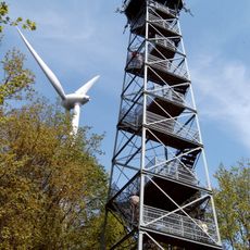
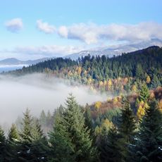
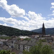
Roßkopf is a 736.9 m summit in the Middle Black Forest, 4 km east-northeast of Freiburg Minster, where the boundaries of Gundelfingen, Freiburg and former Ebnet meet. It is a peak on the ridge running from the Freiburg Schlossberg to St. Peter, with the Hornbühl, Flaunser and Langeck nearby. A steel-frame lookout tower, the Friedrichsturm, stands on the knoll beside a small shelter hut.

The steel-framed Friedrichsturm observation tower was erected on the summit in 1889 and stands just under 35 metres tall. In the late 1970s, plans for an A86 motorway tunnel through the Roßkopf from Gundelfingen to Kirchzarten were abandoned on cost grounds and replaced by the B31 Ost scheme with the Freiburg city tunnel.

Boundary markers scattered across the summit document how municipal borders between Freiburg, Gundelfingen, and former Ebnet evolved over time. These stones reflect the administrative changes that shaped the communities below.

The summit is accessible via the Kandel trail, which welcomes both hikers and cyclists with varying difficulty options. Bring weather-appropriate clothing as the paths can be slippery after rain.

The four 2003 turbines were replaced in a repowering: two were blown up in March 2025, the last two in May 2026. Two Enercon E-138 turbines about 229 m tall went online in mid-February 2026 and were inaugurated on 6 May 2026, producing roughly 18 to 20 million kWh a year.

The community of curious travelers

AroundUs brings together thousands of curated places, local tips, and hidden gems, enriched daily by 94,018 contributors worldwide.

Start exploring
GPS coordinates
48.01020,7.90254
Latest update
October 26, 2026 02:17
Reviews
Share your experience

No review yet

Discussions
Start a discussion...

No discussion yet

« Roßkopf - Mountain summit in Black Forest, Germany » is provided by Around Us (aroundus.com). Images and texts are derived from Wikimedia project under a Creative Commons license. You are allowed to copy, distribute, and modify copies of this page, under the conditions set by the license, as long as this note is clearly visible.

Discover hidden gems everywhere you go!

From secret cafés to breathtaking viewpoints, skip the crowded tourist spots and find places that match your style. Our app makes it easy with voice search, smart filtering, route optimization, and insider tips from travelers worldwide. Download now for the complete mobile experience.

Around Us App Screenshot
❝

A unique approach to discovering new places❞

— Le Figaro

❝

All the places worth exploring❞

— France Info

❝

A tailor-made excursion in just a few clicks❞

— 20 Minutes

Around Us
Travel Guide & Maps
Download

Send to your phone

QR Code
1

Open the camera app on your mobile.

2

Point at the QR code with your camera. A notification will appear.

3

Tap the notification to open the link.