Chest opened
+${chestReward.xp} XP
Explorer
NOUVEAU ×${chestReward.collectible.quantity}
tapez pour fermer

See the monuments around you in AR Open chests in the app

Around Us is built for your phone — point your camera at the streets and discover the monuments and places around you in augmented reality. Around Us is built for your phone — chests unlock when you walk, explore and capture nearby places.

•

Enable Location

We need your location to show you interesting places around you

Discover nearby places

Find interesting locations and hidden gems around you

Precise directions

Get accurate directions and distances to places

Your location is never shared with other users. It's only used when you tap the location button.

Müggelberge

Log in to your account

Start exploring — it's free

Trusted by 93,819 travelers worldwide

Continue with Google
Continue with Apple
or

We will send you a code to connect

By continuing, you accept our Terms and Conditions and our Privacy Policy

Check your inbox

We've sent a pincode in your inbox. Please enter the code below.

Müggelberge

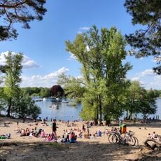
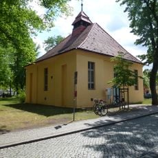
Müggelberge, Wooded hill ridge in Treptow-Köpenick, Berlin, Germany

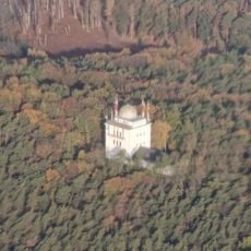
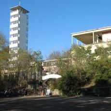
The Müggelberge are a wooded ridge of glacial sand and till in Berlin's Treptow-Köpenick district, covering about seven square kilometres. They are dominated by the Großer Müggelberg at 114.7 m and the Kleiner Müggelberg at 88.3 m. The Großer Müggelberg holds the stump of an unfinished TV tower and a transmission mast; the Kleiner Müggelberg has the Müggelturm viewing tower.

The ridge was shaped during the ice age by glaciers advancing from Scandinavia, and its deposits come from both the Saale and the Weichsel glaciations. Because it lies isolated like an island in the Berlin glacial valley and has no outwash plain, it is not classified as a terminal moraine. In September 1846 Johann Jacob Baeyer made the first height measurement on the Großer Müggelberg, giving 114.51 m; the official figure since a 2006 survey is 114.7 m above sea level.

The name Müggelberge was formerly also written Müggelsberge. The Kanonenberge, a 70.1 m spur in the northwest, take their name from 18th-century artillery practice there, not from the AEG cartridge firing of World War I that locals heard as far as Köpenick. The Todesbahn, a built sledging run from the ridge between the two main hills down to the Teufelssee, closed in 1992 and is now used by a Köpenick downhill club.

The Müggelturm on the Kleiner Müggelberg offers a panorama reaching up to 50 km. The sand pit of the Kanonenberge lies less than 300 m from the road to the Müggelturm, its slopes now densely wooded while the floor stays largely free of trees. The former Todesbahn toboggan run, closed in 1992, is now ridden by a Köpenick downhill club.

The Großer Müggelberg, Berlin's highest natural point at 114.7 m, carries the stump of an unfinished television tower plus a transmitting mast. Johann Jacob Baeyer first measured the hill in September 1846 by trigonometric levelling, obtaining 114.51 m. A 2006 resurvey by the Treptow-Köpenick survey office confirmed 114.7 m above sea level.

The community of curious travelers

AroundUs brings together thousands of curated places, local tips, and hidden gems, enriched daily by 93,819 contributors worldwide.

Start exploring
Elevation above the sea
114.7 m
Made from material
till
GPS coordinates
52.41677,13.64265
Latest update
October 26, 2026 04:00
Reviews
Share your experience

No review yet

Discussions
Start a discussion...

No discussion yet

« Müggelberge - Wooded hill ridge in Treptow-Köpenick, Berlin, Germany » is provided by Around Us (aroundus.com). Images and texts are derived from Wikimedia project under a Creative Commons license. You are allowed to copy, distribute, and modify copies of this page, under the conditions set by the license, as long as this note is clearly visible.

Discover hidden gems everywhere you go!

From secret cafés to breathtaking viewpoints, skip the crowded tourist spots and find places that match your style. Our app makes it easy with voice search, smart filtering, route optimization, and insider tips from travelers worldwide. Download now for the complete mobile experience.

Around Us App Screenshot
❝

A unique approach to discovering new places❞

— Le Figaro

❝

All the places worth exploring❞

— France Info

❝

A tailor-made excursion in just a few clicks❞

— 20 Minutes

Around Us
Travel Guide & Maps
Download

Send to your phone

QR Code
1

Open the camera app on your mobile.

2

Point at the QR code with your camera. A notification will appear.

3

Tap the notification to open the link.