Eyach, Brook in Baden-Württemberg, Germany
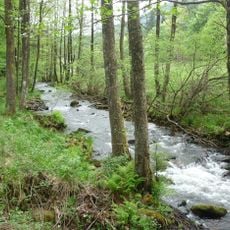
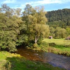
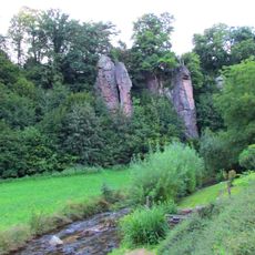
The Eyach is formed at the Große Wiese in the Eyach- und Rotenbachtal nature reserve, where the Brotenaubach and the Dürreychbach join at 567.8 m above sea level. From there it runs 11.3 km northeast through a wooded valley in the Middle and Lower Buntsandstein, past the Lehensägmühle and Eyachmühle mills, and enters the Enz from the left at Eyachbrücke near Neuenbürg at 359.9 m. Including its longer upper course it is 18.5 km long.
The name Yach first appears in the 1148 founding charter of Herrenalb Abbey. For over 500 years, timber was floated down the Eyach; this ended in 1889 after the Eyachtal road was built. In the 1980s the state considered the valley as a cooling-water reservoir for Neckarwestheim nuclear plant, and plans for a drinking-water dam were blocked by a citizens' group, leading to protection in 2002.
The name Eyach derives from Old High German Ib or Iw (yew) and aha (water), meaning "yew water"; in the local dialect the A drops and it is pronounced like "Eich". The Dürreychbach's name is a contraction of Dürre Eyach. Until well into the 20th century the valley meadows were mown for hay, and the irrigation channels dug for this are still visible today.
A gravel road runs along the entire left bank of the Eyach, from the confluence of Brotenaubach and Dürreychbach down to the mouth at Eyachbrücke. The valley lies in a protected area, and the meadows are kept open only through constant mowing, so walkers should stay on the tracks. The upper valley around the Wildseemoor is boggy high moorland.
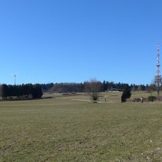
Since 1992 a power line of Anlage 615 crosses the lower Eyach valley, suspended from two 70-metre anchor masts on the Heuberg and Eiberg. The span between the masts is 1,444 metres, the longest between two pylons in Germany.
The community of curious travelers
AroundUs brings together thousands of curated places, local tips, and hidden gems, enriched daily by 92,885 contributors worldwide.